File:Baist's 1910 Real Estate Map Plate 3 with some post-1920 street alignments shown.jpg
Jump to navigation
Jump to search

Size of this preview: 416 × 599 pixels. Other resolutions: 167 × 240 pixels | 333 × 480 pixels | 533 × 768 pixels | 711 × 1,024 pixels | 1,439 × 2,072 pixels.
Original file (1,439 × 2,072 pixels, file size: 1.45 MB, MIME type: image/jpeg)
Captions
Captions
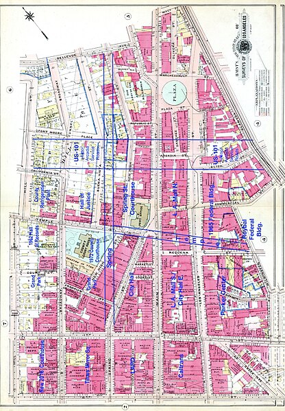
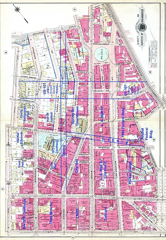
Baist's 1910 Real Estate Map Plate 3 with some post-1920 street alignments shown
Summary
[edit]
| Description |
English: Baist's 1910 Real Estate Map Plate 3 with some post-1920 street alignments shown |
| Date | |
| Source | Baists Real estate maps via LOC |
| Author | Baist |
Licensing
[edit]
This work is in the public domain in the United States because it was published (or registered with the U.S. Copyright Office) before January 1, 1929.
Public domain works must be out of copyright in both the United States and in the source country of the work in order to be hosted on the Commons. If the work is not a U.S. work, the file must have an additional copyright tag indicating the copyright status in the source country.
Note: This tag should not be used for sound recordings. |
File history
Click on a date/time to view the file as it appeared at that time.
| Date/Time | Thumbnail | Dimensions | User | Comment | |
|---|---|---|---|---|---|
| current | 17:00, 27 November 2020 | | 1,439 × 2,072 (1.45 MB) | Keizers (talk | contribs) | Uploaded a work by Baist from Baists Real estate maps via LOC with UploadWizard |
You cannot overwrite this file.
File usage on Commons
The following page uses this file:
File usage on other wikis
The following other wikis use this file:
- Usage on en.wikipedia.org