File:Bair Greco mosquito map.png
Jump to navigation
Jump to search

Size of this preview: 800 × 517 pixels. Other resolutions: 320 × 207 pixels | 640 × 414 pixels | 1,024 × 662 pixels | 1,222 × 790 pixels.
Original file (1,222 × 790 pixels, file size: 1.09 MB, MIME type: image/png)
Captions
Captions
Add a one-line explanation of what this file represents
Summary
[edit]
| Description |
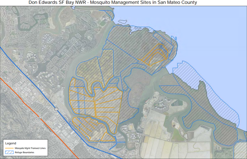
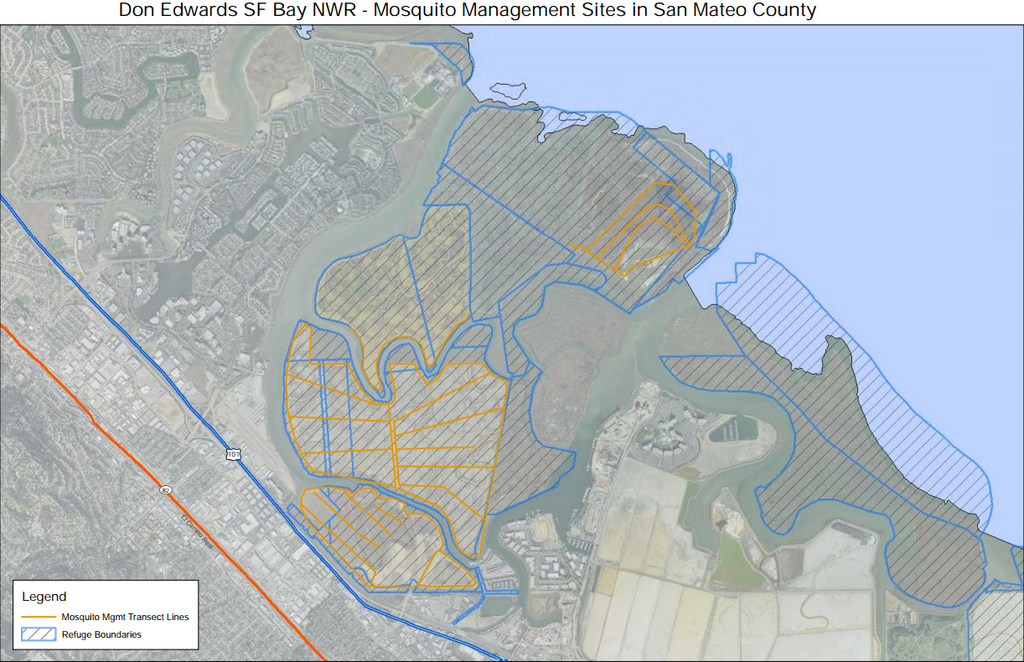
English: Area showing sections of Bair and Greco Islands that are contained within the Don Edwards San Francisco Bay National Wildlife Refuge |
| Date | |
| Source | https://www.fws.gov/refuge/Don_Edwards_San_Francisco_Bay/map.html |
| Author | U.S. Fish & Wildlife Service |
Licensing
[edit]
This image or recording is the work of a U.S. Fish and Wildlife Service employee, taken or made as part of that person's official duties. As a work of the U.S. federal government, the image is in the public domain. For more information, see the Fish and Wildlife Service copyright policy.
|
 |
File history
Click on a date/time to view the file as it appeared at that time.
| Date/Time | Thumbnail | Dimensions | User | Comment | |
|---|---|---|---|---|---|
| current | 22:21, 4 January 2017 | | 1,222 × 790 (1.09 MB) | Jeanjung212 (talk | contribs) | User created page with UploadWizard |
You cannot overwrite this file.
File usage on Commons
There are no pages that use this file.