File:Bahnstrecke Husum-St Peter Ording map.png
Jump to navigation
Jump to search

Size of this preview: 800 × 596 pixels. Other resolutions: 320 × 239 pixels | 640 × 477 pixels | 1,024 × 764 pixels | 1,280 × 954 pixels | 1,993 × 1,486 pixels.
Original file (1,993 × 1,486 pixels, file size: 350 KB, MIME type: image/png)
Captions
Captions
Add a one-line explanation of what this file represents
| Description |
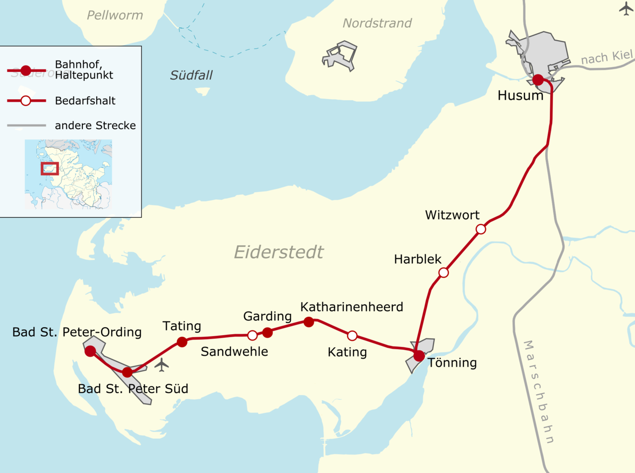
Deutsch: Karte der Bahnstrecke Husum–Bad St. Peter-Ording (Eiderstedtquerbahn) mit Haltepunkten
English: Map of the Husum–Bad St. Peter-Ording railway (Eiderstedtquerbahn) |
||||||||||||
| Date | |||||||||||||
| Source |
Own work, using
|
||||||||||||
| Author | Carport | ||||||||||||
| Permission (Reusing this file) |
|
File history
Click on a date/time to view the file as it appeared at that time.
| Date/Time | Thumbnail | Dimensions | User | Comment | |
|---|---|---|---|---|---|
| current | 15:08, 3 February 2010 | | 1,993 × 1,486 (350 KB) | Carport (talk | contribs) | {{Information |Description={{de|Karte der {{w|Bahnstrecke Husum–Bad St. Peter-Ording|3=de}} (Eiderstedtquerbahn) mit Haltepunkten}} {{en|Map of the Husum–Bad St. Peter-Ording railway (Eiderstedtquerbahn)}} |Source={{own}}, using * [[OpenStreetMap] |
You cannot overwrite this file.
File usage on Commons
The following page uses this file:
File usage on other wikis
The following other wikis use this file:
- Usage on de.wikipedia.org
- Usage on de.wikivoyage.org
- Usage on en.wikipedia.org
- Usage on www.wikidata.org