File:Badavanich eastward on Loch a'Chroisg geograph-3192115-by-Ben-Brooksbank.jpg
Jump to navigation
Jump to search
Size of this preview: 800 × 477 pixels. Other resolutions: 320 × 191 pixels | 640 × 382 pixels | 1,050 × 626 pixels.
Original file (1,050 × 626 pixels, file size: 133 KB, MIME type: image/jpeg)
Captions
Captions
Add a one-line explanation of what this file represents
Summary
[edit]
| Description |
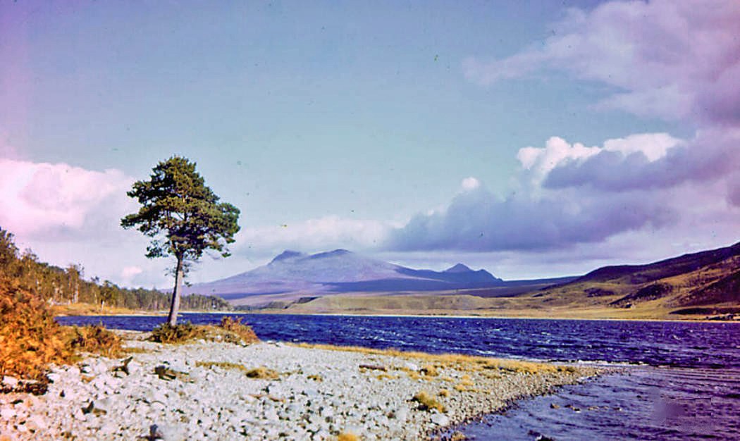
English: Eastward on Loch a'Chroisg to mountains south of Strath Bran, 1957. View from A832 on north shore of the Loch, to Sgurr a Ghias Leathaid (2,776 ft.) and Sgurr Mhuillin (2,845 ft.). [Don't speak with your mouth full!] |
| Date | Taken on 23 September 1957 |
| Source | From geograph.org.uk |
| Author | Ben Brooksbank |
| Permission (Reusing this file) |
Creative Commons Attribution Share-alike license 2.0 |
| Camera location | | View this and other nearby images on: OpenStreetMap |
|---|
Licensing
[edit]

|
This image was taken from the Geograph project collection. See this photograph's page on the Geograph website for the photographer's contact details. The copyright on this image is owned by Ben Brooksbank and is licensed for reuse under the Creative Commons Attribution-ShareAlike 2.0 license.
|
This file is licensed under the Creative Commons Attribution-Share Alike 2.0 Generic license.
Attribution: Ben Brooksbank
- You are free:
- to share – to copy, distribute and transmit the work
- to remix – to adapt the work
- Under the following conditions:
- attribution – You must give appropriate credit, provide a link to the license, and indicate if changes were made. You may do so in any reasonable manner, but not in any way that suggests the licensor endorses you or your use.
- share alike – If you remix, transform, or build upon the material, you must distribute your contributions under the same or compatible license as the original.
File history
Click on a date/time to view the file as it appeared at that time.
| Date/Time | Thumbnail | Dimensions | User | Comment | |
|---|---|---|---|---|---|
| current | 12:50, 28 October 2012 | | 1,050 × 626 (133 KB) | Chevin (talk | contribs) | == {{int:filedesc}} == {{Information |Description={{en|1='''Eastward on Loch a'Chroisg to mountains south of Strath Bran, 1957.'''<br/> View from A832 on north shore of the Loch, to Sgurr a Ghias Leathaid (2,776 ft.) and Sgurr Mhuillin (2,845 ft.). [Do... |
You cannot overwrite this file.
File usage on Commons
There are no pages that use this file.