File:Bad Gleichenberg - kath. Kirche (a).JPG
Jump to navigation
Jump to search

Size of this preview: 800 × 600 pixels. Other resolutions: 320 × 240 pixels | 640 × 480 pixels | 1,024 × 768 pixels | 1,280 × 960 pixels | 2,560 × 1,920 pixels | 4,920 × 3,690 pixels.
Original file (4,920 × 3,690 pixels, file size: 9.09 MB, MIME type: image/jpeg)
Captions
Captions
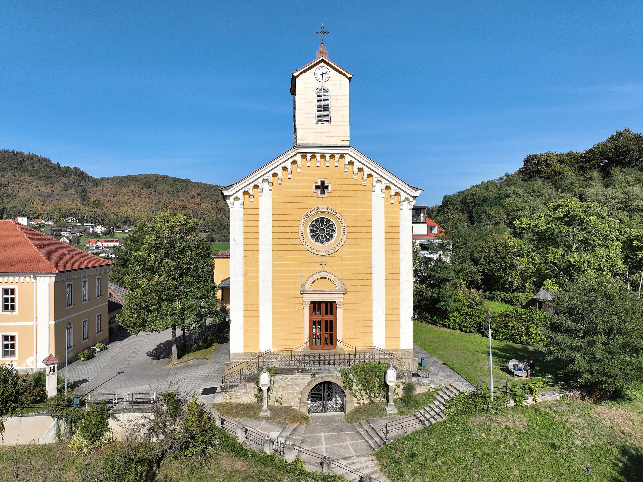
South-southwest view of the parish church of Bad Gleichenberg.
Summary
[edit]| Description |
Deutsch: Südsüdwestansicht der röm.-kath. Pfarrkirche hl. Matthias in der steiermärkischen Gemeinde Bad Gleichenberg.
Die Kirche wurde ab 1841 errichtet und am 29 Juni 1845 zu Ehren des hl. Apostels Matthias und der hl. Emmerentia feierlich eingeweiht. Gestiftet wurde sie vom Matthias Constantin Graf von Wickenburg, der Gouverneur von der Steiermark war. Die Kirche mit einem einfachen Saalraum mit Kassettendecke sowie einem eingezogenen Chor wurde von 1960 bis 1962 umgebaut und erweitert. Seit 1. Jänner 1940 ist sie eine Pfarrkirche, nachdem Gleichenberg aus dem Pfarrbereich Trautmannsdorf herausgelöst und zur selbständigen Pfarre erhoben wurdeː [1]. English: South-southwest view of the parish church of Bad Gleichenberg.
|
| Date | |
| Source | Own work |
| Author | C.Stadler/Bwag |
| Permission (Reusing this file) |
Deutsch: Hallo, du darfst mein Foto kostenlos nutzen, aber nenne mich bitte als Fotograf, beispielsweise „Foto: C.Stadler/Bwag“ oder © C.Stadler/Bwag; CC-BY-SA-4.0. Auf mehr Angaben bestehe ich nicht - im Gegensatz zu manch anderen, die die Vorgaben der unten angeführten Lizenzierung auf Punkt und Beistrich einfordern. English: Feel free to use my photos, but please mention me as the author like © C.Stadler/Bwag or © C.Stadler/Bwag; CC-BY-SA-4.0 (that's good enough) and if you want send me a message: bwag@gmx.net. |
| Other versions |
|
.JPG)
.JPG)
.JPG&action=edit§ion=1)
| Object location | | View this and other nearby images on: OpenStreetMap |
|---|
.JPG¶ms=046.876760_N_0015.910570_E_globe:Earth_class:object_type:object__&language=en)
| Camera location | | View this and other nearby images on: OpenStreetMap |
|---|
.JPG¶ms=046.876420_N_0015.910250_E_globe:Earth_type:camera_heading:35.00&language=en)
Licensing
[edit].JPG&action=edit§ion=2)
I, the copyright holder of this work, hereby publish it under the following license:
This file is licensed under the Creative Commons Attribution-Share Alike 3.0 Unported license.
- You are free:
- to share – to copy, distribute and transmit the work
- to remix – to adapt the work
- Under the following conditions:
- attribution – You must give appropriate credit, provide a link to the license, and indicate if changes were made. You may do so in any reasonable manner, but not in any way that suggests the licensor endorses you or your use.
- share alike – If you remix, transform, or build upon the material, you must distribute your contributions under the same or compatible license as the original.
File history
Click on a date/time to view the file as it appeared at that time.
| Date/Time | Thumbnail | Dimensions | User | Comment | |
|---|---|---|---|---|---|
| current | 20:34, 14 October 2023 | | 4,920 × 3,690 (9.09 MB) | Bwag (talk | contribs) | == {{int:filedesc}} == {{Information |Description= {{de|1= Südsüdwestansicht der röm.-kath. Pfarrkirche hl. Matthias in der steiermärkischen Gemeinde Bad Gleichenberg.<br/>Die Kirche wurde ab 1841 errichtet und am 29 Juni 1845 zu Ehren des hl. Apostels Matthias und der hl. Emmerentia feierlich eingeweiht. Gestiftet wurde sie vom Matthias Constantin Graf von Wickenburg, der Gouverneur von der Steiermark war. Die Kirche mit einem einfachen Saalraum mit Kassettendecke sowie einem eingezogenen C... |
You cannot overwrite this file.
File usage on Commons
The following 2 pages use this file:
File usage on other wikis
The following other wikis use this file:
.JPG&oldid=814808533)