File:BOB 02 2023-05-10 0930Z.jpg
Jump to navigation
Jump to search
Size of this preview: 488 × 599 pixels. Other resolutions: 195 × 240 pixels | 391 × 480 pixels | 626 × 768 pixels | 1,100 × 1,350 pixels.
Original file (1,100 × 1,350 pixels, file size: 1.41 MB, MIME type: image/jpeg)
Captions
Captions
Add a one-line explanation of what this file represents
Summary
[edit]| Description |
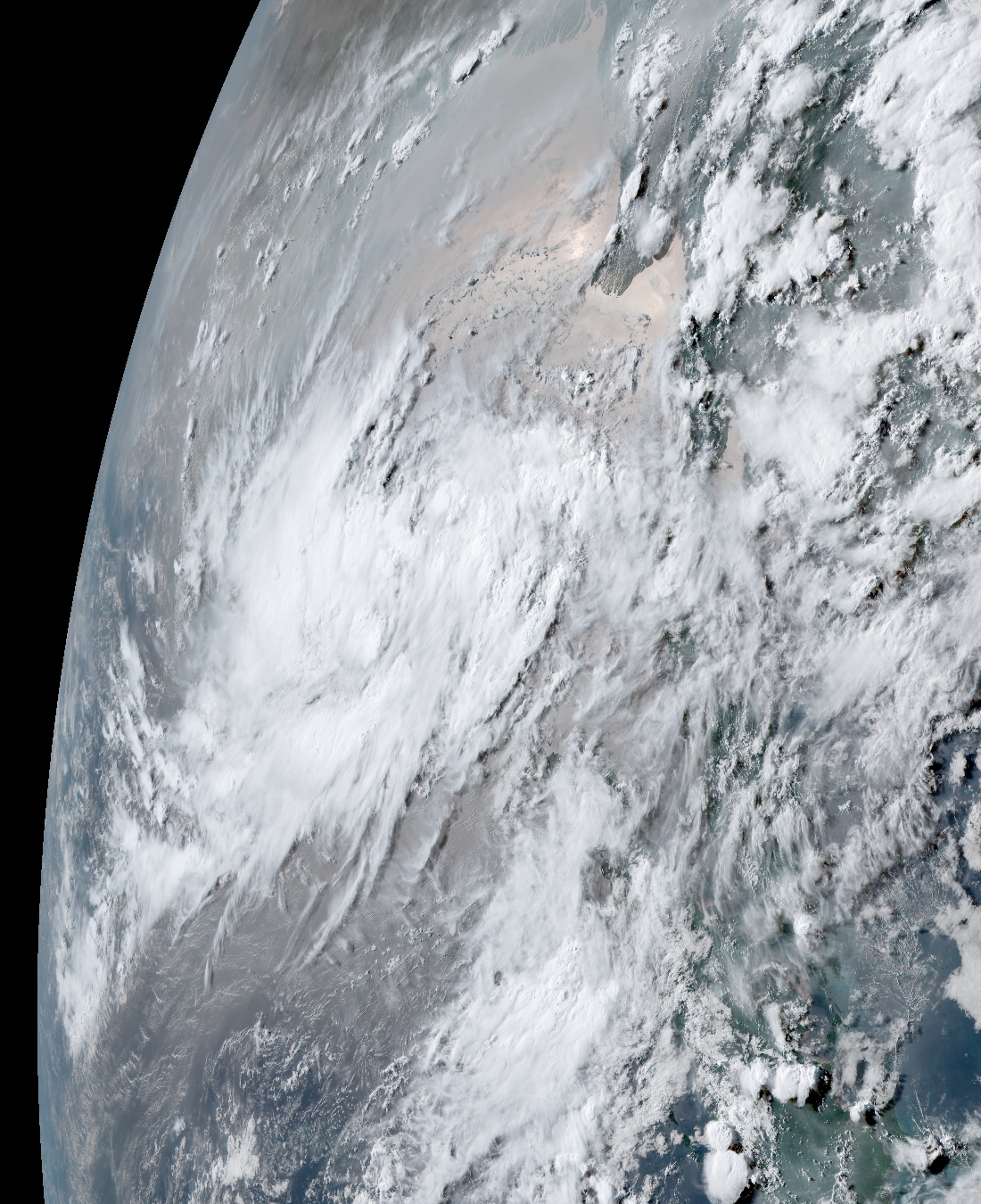
English: This geo-color image of a Depression over the Bay of Bengal was captured during the late afternoon hours on 10 May 2023, at 4:30 P.M. Myanmar Local Time (09:30 UTC), by the Advanced Himawari Imager (AHI) instrument flying aboard JMA's Himawari 9 satellite. At the time this image was taken, the Indian Meteorological Department designated this depression as "Deep Depression BOB 02," and it posed a threat to Myanmar and the surrounding areas. At the time, the depression had winds of 55 km/h (35 mph) (35 knots) on the Indian Meteorological Department cyclone scale, making it a "Deep Depression" on the scale as mentioned earlier, the minimum central atmospheric pressure at the time was 1,000 mbar (29.5 inHg), and according to the Joint Typhoon Warning Center the depression was still a Tropical Disturbance designated as "91B" with 1-min sustained winds of 55 km/h (35 mph) (35 knots), according to the JTWC the depression had a high chance of developing within 48 hours. |
| Date | |
| Source | RAMSDIS Online Archive |
| Author | AHI imagery from JMA's Himawari 9 Satellite |
Licensing
[edit]This image is in the public domain because it contains materials that originally came from the U.S. National Oceanic and Atmospheric Administration, taken or made as part of an employee's official duties.
|
This image was produced by the Japan Meteorological Agency. The legal notice (archive) stated that all the images published on their website is compatible with the Creative Commons Attribution 4.0 License, which means that all the images on this website is published under the Creative Commons Attribution 4.0 License unless otherwise specified.
This file is licensed under the Creative Commons Attribution 4.0 International license. Attribution: Japan Meteorological Agency
|
 |

File history
Click on a date/time to view the file as it appeared at that time.
| Date/Time | Thumbnail | Dimensions | User | Comment | |
|---|---|---|---|---|---|
| current | 10:59, 10 May 2023 | | 1,100 × 1,350 (1.41 MB) | TheWxResearcher (talk | contribs) | Uploaded a work by AHI imagery from JMA's Himawari 9 Satellite from [https://rammb.cira.colostate.edu/ramsdis/online/archive_hi_res.asp?data_folder=himawari-8/full_disk_ahi_true_color&width=800&height=800 RAMSDIS Online Archive] with UploadWizard |
You cannot overwrite this file.
File usage on Commons
There are no pages that use this file.