File:BD Habiganj District locator map.svg
Jump to navigation
Jump to search

Size of this PNG preview of this SVG file: 441 × 600 pixels. Other resolutions: 176 × 240 pixels | 353 × 480 pixels | 565 × 768 pixels | 753 × 1,024 pixels | 1,506 × 2,048 pixels | 1,129 × 1,535 pixels.
Original file (SVG file, nominally 1,129 × 1,535 pixels, file size: 1.64 MB)
Captions
Captions
Add a one-line explanation of what this file represents
Summary
[edit]
| Description |
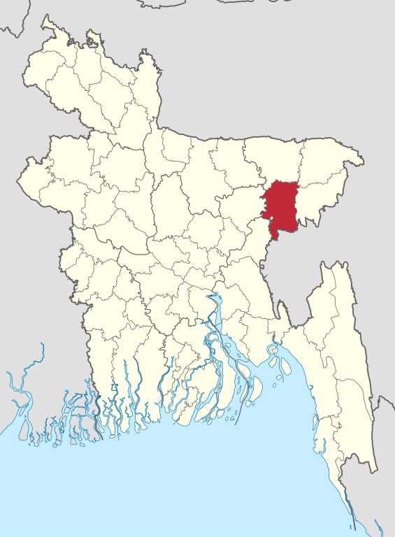
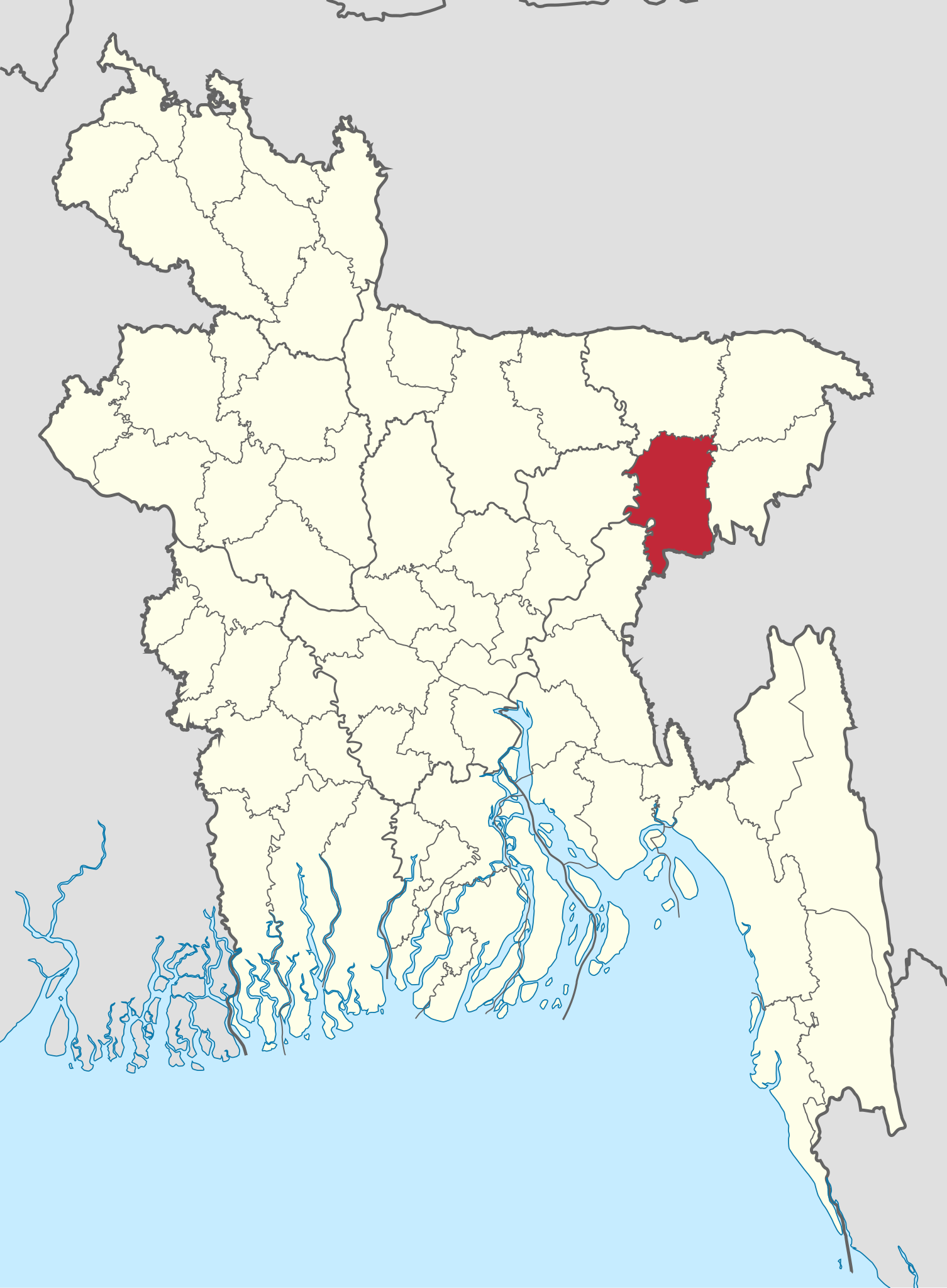
বাংলা: বাংলাদেশে হবিগঞ্জ জেলার অবস্থান।
English: location of Habiganj District in Bangladesh |
| Date | |
| Source | Own work |
| Author | Nafsadh |
| SVG development | This map was created with Adobe Illustrator. |
Licensing
[edit]
I, the copyright holder of this work, hereby publish it under the following license:
| This file is made available under the Creative Commons CC0 1.0 Universal Public Domain Dedication. | |
| The person who associated a work with this deed has dedicated the work to the public domain by waiving all of their rights to the work worldwide under copyright law, including all related and neighboring rights, to the extent allowed by law. You can copy, modify, distribute and perform the work, even for commercial purposes, all without asking permission.
|
File history
Click on a date/time to view the file as it appeared at that time.
| Date/Time | Thumbnail | Dimensions | User | Comment | |
|---|---|---|---|---|---|
| current | 06:40, 4 November 2021 | | 1,129 × 1,535 (1.64 MB) | C1MM (talk | contribs) | updated bounds |
| 04:41, 22 March 2015 |  | 1,559 × 2,152 (80 KB) | Nafsadh (talk | contribs) | Color convention | |
| 23:45, 24 October 2014 |  | 1,531 × 2,138 (81 KB) | Nafsadh (talk | contribs) | User created page with UploadWizard |
You cannot overwrite this file.
File usage on Commons
The following 2 pages use this file:
File usage on other wikis
The following other wikis use this file:
- Usage on bn.wikipedia.org
- সিলেটি ভাষা
- হবিগঞ্জ জেলা
- মাধবপুর উপজেলা
- ব্যবহারকারী:Mohaguru
- মাধবপুর পৌরসভা
- রাণীগাঁও ইউনিয়ন
- ইনাতগঞ্জ ইউনিয়ন
- আদাঐর ইউনিয়ন
- বাঘাসুরা ইউনিয়ন
- নবীগঞ্জ পৌরসভা
- শাহজাহানপুর ইউনিয়ন, মাধবপুর
- মাধবপুর ইউনিয়ন, মাধবপুর
- বহরা ইউনিয়ন
- বুল্লা ইউনিয়ন, মাধবপুর
- নোয়াপাড়া ইউনিয়ন, মাধবপুর
- ধর্মঘর ইউনিয়ন
- জগদীশপুর ইউনিয়ন, মাধবপুর
- ছাতিয়াইন ইউনিয়ন
- চৌমুহনী ইউনিয়ন
- আন্দিউড়া ইউনিয়ন
- আজমিরীগঞ্জ পৌরসভা
- চুনারুঘাট পৌরসভা
- শায়েস্তাগঞ্জ পৌরসভা
- হবিগঞ্জ পৌরসভা
- বাংলাদেশের জেলাসমূহের তালিকা
- শায়েস্তাগঞ্জ উপজেলা
- পাইকপাড়া ইউনিয়ন, চুনারুঘাট
- শানখলা ইউনিয়ন
- করাব ইউনিয়ন
- লাখাই ইউনিয়ন
- ব্যবহারকারী:Mohaguru/ইউনিয়ন টেমপ্লেট
- মোড়াকরি ইউনিয়ন
- টেমপ্লেট:ব্যবহারকারী/হবিগঞ্জ জেলা
- মুড়িয়াউক ইউনিয়ন
- বামৈ ইউনিয়ন
- বুল্লা ইউনিয়ন, লাখাই
- চুনারুঘাট ইউনিয়ন
- আহম্মদাবাদ ইউনিয়ন
- গাজীপুর ইউনিয়ন, চুনারুঘাট
- দেওরগাছ ইউনিয়ন
- মিরাশী ইউনিয়ন
- সাটিয়াজুরী ইউনিয়ন
- উবাহাটা ইউনিয়ন
- টেমপ্লেট:হবিগঞ্জ জেলার প্রশাসনিক বিন্যাস
- লস্করপুর ইউনিয়ন
- বদলপুর ইউনিয়ন
- আজমিরীগঞ্জ সদর ইউনিয়ন
- কাকাইলছেও ইউনিয়ন
- শিবপাশা ইউনিয়ন
- জলসুখা ইউনিয়ন
View more global usage of this file.