File:BART map effective July 7, 1980.png

Original file (8,300 × 6,900 pixels, file size: 566 KB, MIME type: image/png)
Captions
Captions
Summary
[edit]| Description |
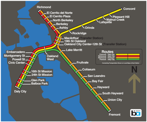
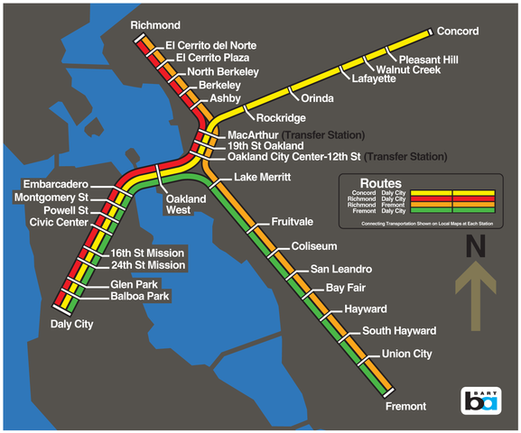
English: The original BART map, accurate to the start of full-time Richmond-Daly City service on July 7, 1980. |
|||
| Date | ||||
| Source | BART: Explore the history of the BART map | |||
| Author | San Francisco Bay Area Rapid Transit District | |||
| Permission (Reusing this file) |
|

File history
Click on a date/time to view the file as it appeared at that time.
| Date/Time | Thumbnail | Dimensions | User | Comment | |
|---|---|---|---|---|---|
| current | 05:41, 13 July 2019 | | 8,300 × 6,900 (566 KB) | Pi.1415926535 (talk | contribs) | == {{int:filedesc}} == {{Information |description ={{en|1=The original BART map, accurate to the start of full-time Richmond-Daly City service on July 7, 1980.}} |date =1980-07-07 |source =[https://www.bart.gov/news/articles/2019/news20190712-1 BART: Explore the history of the BART map] |author =San Francisco Bay Area Rapid Transit District |permission ={{PD-CAGov}} }} Category:BART in 1980 19800707 [[Category:Other images uploa... |
You cannot overwrite this file.
File usage on Commons
The following 4 pages use this file: