File:BART map effective July 7, 1980.jpg
BART_map_effective_July_7,_1980.jpg (716 × 598 pixels, file size: 73 KB, MIME type: image/jpeg)
Captions
Captions
Summary
[edit]| Description |
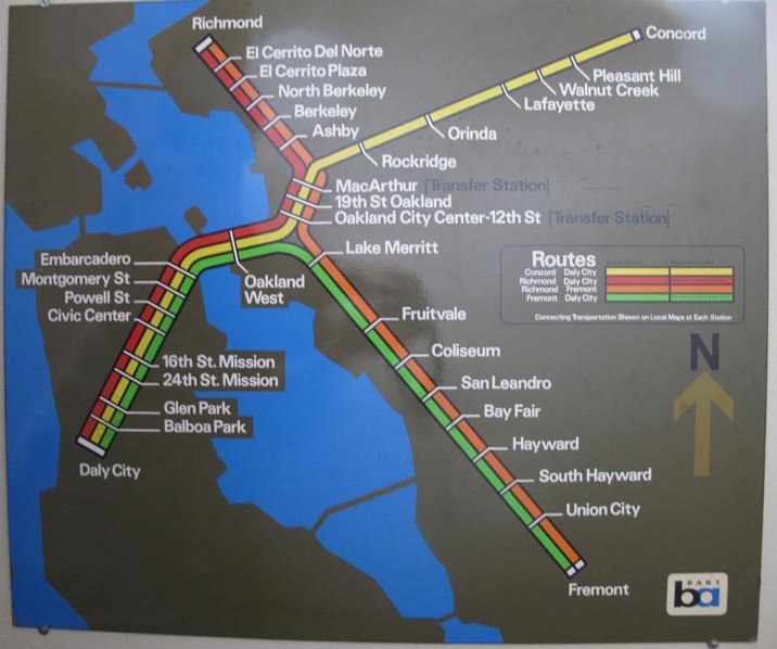
English: A BART map formerly hung in a station. The map is accurate to the start of full-time Richmond-Daly City service on July 7, 1980. |
|||
| Date | ||||
| Source | Photograph of map from comment on A Makeover for the BART Map | |||
| Author | San Francisco Bay Area Rapid Transit District | |||
| Permission (Reusing this file) |
|

File history
Click on a date/time to view the file as it appeared at that time.
| Date/Time | Thumbnail | Dimensions | User | Comment | |
|---|---|---|---|---|---|
| current | 11:59, 20 January 2019 | | 716 × 598 (73 KB) | Pi.1415926535 (talk | contribs) | {{Information |description ={{en|1=A BART map formerly hung in a station. The map is accurate to the start of full-time Richmond-Daly City service on July 7, 1980.}} |date =1980-07-07 |source =Photograph of map from comment on [https://designobserver.com/feature/a-makeover-for-the-bart-map/12397 A Makeover for the BART Map] |author =San Francisco Bay Area Rapid Transit District |permission ={{PD-MAGov}} }} Category:BART in 1980 [[Category:Official BART maps|19... |
You cannot overwrite this file.
File usage on Commons
The following 4 pages use this file: