File:Bản Đồ Xứ Gia Định Hậu Bản XVIII.png
Jump to navigation
Jump to search

Size of this preview: 800 × 476 pixels. Other resolutions: 320 × 190 pixels | 640 × 381 pixels | 908 × 540 pixels.
Original file (908 × 540 pixels, file size: 401 KB, MIME type: image/png)
Captions
Captions
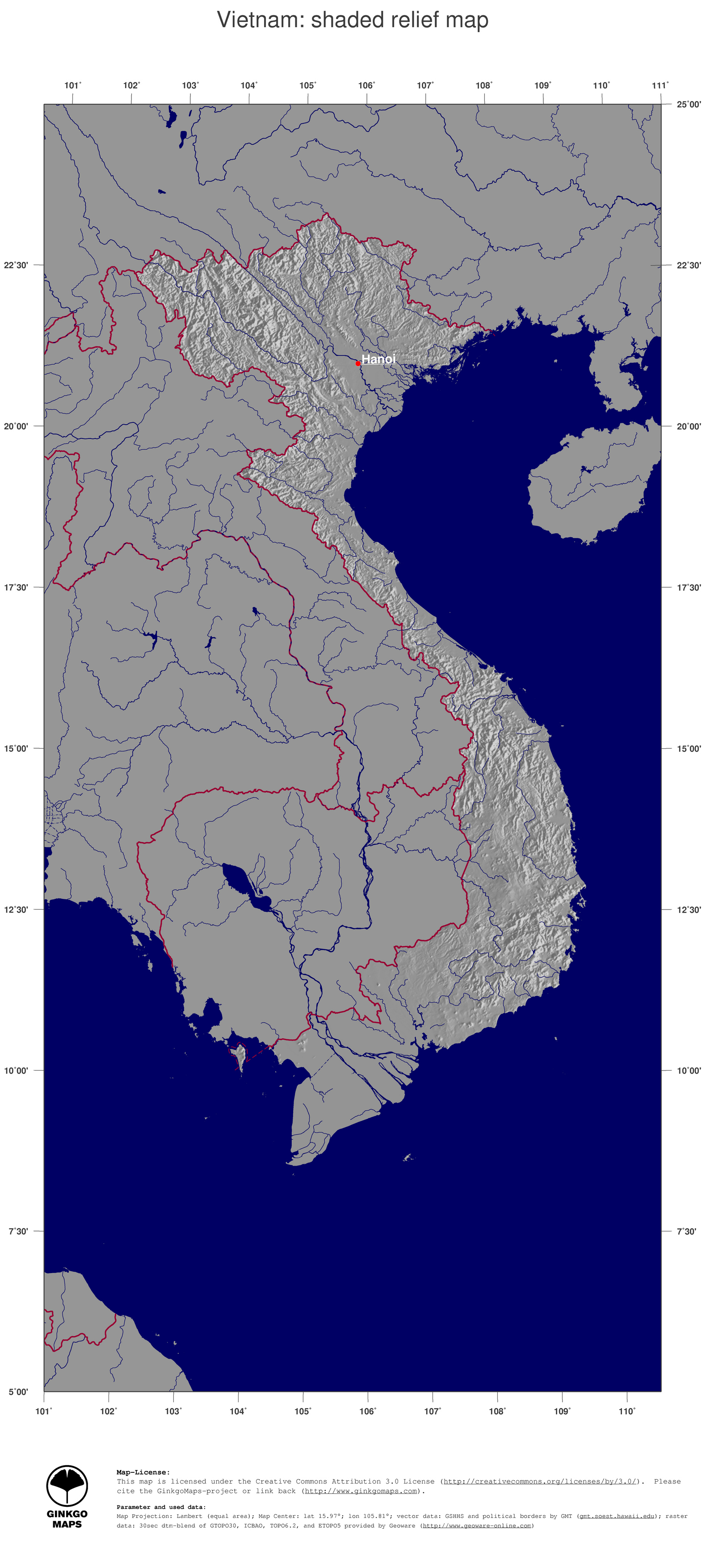
Map of Gia Định region in late 18th century.
Summary
[edit]
| Description |
Tiếng Việt: Bản Đồ Xứ Gia Định, Việt Nam khoảng cuối thế kỷ 18. Vẽ lại một phần từ lược đồ của tác giả Tạ Chí Đại Trường (Tạ Chí Đại Trường (1973), Lịch Sử Nội Chiến Việt Nam 1771- 1802, Sài Gòn: Nhà xuất bản Văn Sử Học, tr. 95 |
| Date | |
| Source | Phần nền lấy từ: http://www.ginkgomaps.com/en/rl3c_vn_vietnam_map_illdtmgreygw30s_ja_hres.jpg. Phần chữ do tôi thêm vào |
| Author | Ginkgomaps và người tải lên |
Lưu ý:
- Ginkgomaps phát hành bản đồ theo giấy phép Attribution 3.0 Unported (CC BY 3.0). Có nghĩa phần bản đồ được phép tự do sử dụng, miễn bạn ghi công và để lại liên kết tới phần tập tin bạn sử dụng.
- Vị trí trên bản đồ có thể hơi lệch so với thực tế. Về mặt địa lý học, nó chỉ là vị trí tương đối theo từng khu vực của các địa danh cũ vì vẽ theo phác thảo; chứ không phải bản đồ địa lý chính xác.
- Đường kẻ đỏ biểu thị biên giới hiện đại, không đúng với biên giới vào cuối thế kỷ 18.
Licensing
[edit]
This file is licensed under the Creative Commons Attribution-Share Alike 3.0 Unported license.
Attribution: http://www.ginkgomaps.com và Conongchamchi
- You are free:
- to share – to copy, distribute and transmit the work
- to remix – to adapt the work
- Under the following conditions:
- attribution – You must give appropriate credit, provide a link to the license, and indicate if changes were made. You may do so in any reasonable manner, but not in any way that suggests the licensor endorses you or your use.
- share alike – If you remix, transform, or build upon the material, you must distribute your contributions under the same or compatible license as the original.
File history
Click on a date/time to view the file as it appeared at that time.
| Date/Time | Thumbnail | Dimensions | User | Comment | |
|---|---|---|---|---|---|
| current | 15:35, 21 March 2014 | | 908 × 540 (401 KB) | Conongchamchi (talk | contribs) | thêm Chân Lạp |
| 15:29, 21 March 2014 |  | 908 × 540 (403 KB) | Conongchamchi (talk | contribs) | nhầm | |
| 15:27, 21 March 2014 |  | 908 × 540 (403 KB) | Conongchamchi (talk | contribs) | bổ sung thêm mấy địa danh hay nghe | |
| 19:16, 15 March 2014 |  | 908 × 540 (398 KB) | Conongchamchi (talk | contribs) | bổ sung | |
| 18:03, 15 March 2014 |  | 908 × 540 (398 KB) | Conongchamchi (talk | contribs) | chỉnh lại text đè nhau | |
| 17:42, 15 March 2014 |  | 908 × 540 (392 KB) | Conongchamchi (talk | contribs) | {{Thông tin |Miêu tả = Bản Đồ Xứ Gia Định, Việt Nam khoảng cuối thế kỷ 18. Vẽ lại một phần từ lược đồ của tác giả Tạ Chí Đại Trường (Tạ Chí Đại Trường (1973), Lịch Sử Nội Chi�… |
You cannot overwrite this file.
File usage on Commons
There are no pages that use this file.
File usage on other wikis
The following other wikis use this file:
- Usage on vi.wikipedia.org