File:Béziers-Panorama du Pont Vieux.jpg
Jump to navigation
Jump to search
Size of this preview: 800 × 200 pixels. Other resolutions: 320 × 80 pixels | 640 × 160 pixels | 1,024 × 256 pixels | 1,280 × 320 pixels | 4,800 × 1,200 pixels.
Original file (4,800 × 1,200 pixels, file size: 1.33 MB, MIME type: image/jpeg)
Captions
Captions
Add a one-line explanation of what this file represents
Summary
[edit]
| Description |
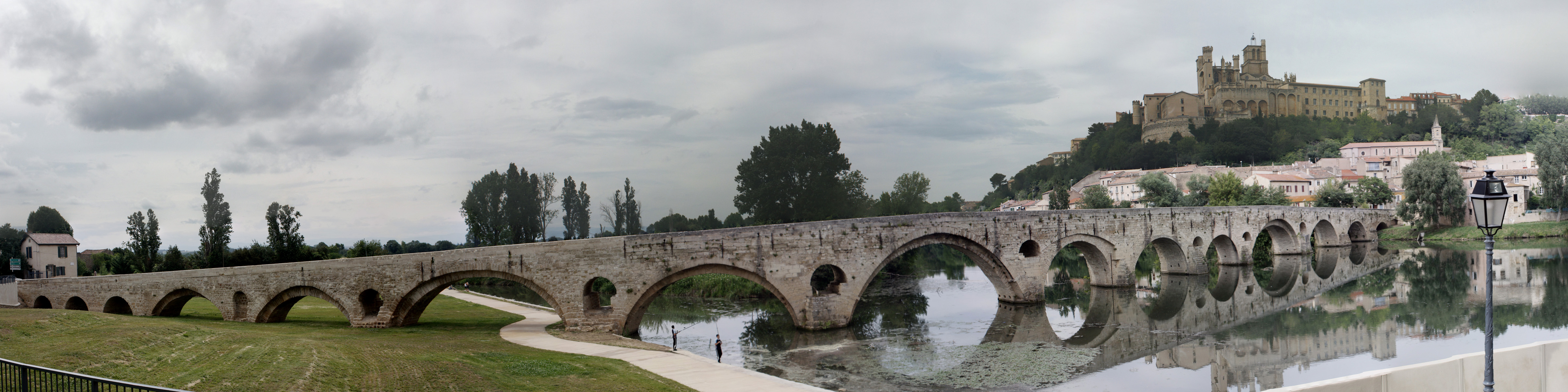
English: Panorama of Old Bridge that spans the Orb at the foot of the Cathedral Saint-Nazaire, in the city of Béziers (France). Rainy Day! image assembly of shots taken in flight, has need some changes, because of the misdeeds of polarizing filter. Español: Panorama del Puente Viejo sobre el rio Orb, al pie de la catedral de "Saint-Nazaire", en la ciudad de Béziers (France). ¡Dia de lluvia! Montaje de las imágenes de fotos tomadas sin pied, han necesitado algunos cambios, debido a las fechorías del filtro polarizante. Français : Panorama du Pont Vieux qui enjambe l'Orb, au pied de la Cathédrale Saint-Nazaire, à la Béziers (France). |
| Date | Taken on 6 June 2010 |
| Source | Own work |
| Author | Daniel VILLAFRUELA. |
| Permission (Reusing this file) |
Daniel VILLAFRUELA, the copyright holder of this work, hereby publishes it under the following license: This file is licensed under the Creative Commons Attribution-Share Alike 3.0 Unported license. Attribution: Daniel VILLAFRUELA
|
| Object location | | View this and other nearby images on: OpenStreetMap |
|---|
| Camera location | | View this and other nearby images on: OpenStreetMap |
|---|
| This is a retouched picture, which means that it has been digitally altered from its original version. Modifications: Sharpened. Modifications made by Daniel VILLAFRUELA.
|
File history
Click on a date/time to view the file as it appeared at that time.
| Date/Time | Thumbnail | Dimensions | User | Comment | |
|---|---|---|---|---|---|
| current | 13:28, 8 June 2010 | 4,800 × 1,200 (1.33 MB) | Daniel VILLAFRUELA (talk | contribs) | {{Information |Description={{fr|1=Vue panoramique du pont vieux}} |Source={{own}} |Author=D Villafruela |Date=2010-06-06 |Permission= |other_versions= }} Category:Béziers |
You cannot overwrite this file.
File usage on Commons
The following 2 pages use this file:
File usage on other wikis
The following other wikis use this file:
- Usage on ca.wikipedia.org
- Usage on eu.wikipedia.org