File:Averill's map of western Va. LOC 99446734.jpg
Jump to navigation
Jump to search

Size of this preview: 452 × 599 pixels. Other resolutions: 181 × 240 pixels | 362 × 480 pixels | 579 × 768 pixels | 772 × 1,024 pixels | 1,545 × 2,048 pixels | 7,397 × 9,804 pixels.
Original file (7,397 × 9,804 pixels, file size: 5.97 MB, MIME type: image/jpeg)
Captions
Captions
Add a one-line explanation of what this file represents
Summary
[edit]| Description |
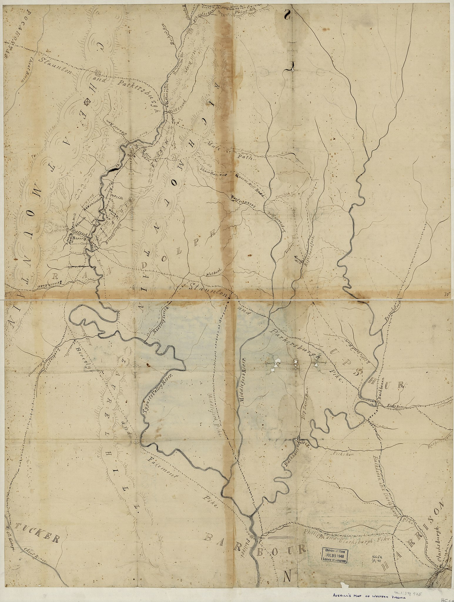
English: Shows Rich Mountain Region including Randolph, Upshur, and parts of adjoining counties, W. Va., as well as the names of some residents. Relief shown by hachures. Pen-and-ink and pencil on 4 sheets pasted together, sectioned in 2 and mounted on cloth. The title, written in pencil on the verso, is now covered by the mounting. Date from Stephenson's Civil War maps, 1989. LC Civil War maps (2nd ed.), H69 Imperfect: Fold-lined, with discoloration along pasted lines, some losses along fold lines, some liquid staining, and spotting throughout. Available also through the Library of Congress web site as raster image. |
||
| Title | Averill's map of western Va. | ||
| Shelf ID | G3892.R5 1861 .A9 | ||
| Date | |||
| Source | https://www.loc.gov/item/99446734/ | ||
| Author | Averill, F. L. (Frank L.) | ||
| Permission (Reusing this file) |
|
||
| Other versions |
|
||
| Location | Rich Mountain Region (Randolph County) · United States · Randolph County · Rich Mountain Region · West Virginia | ||
| Part of | Civil War Maps · Hotchkiss Map Collection · Military Battles And Campaigns · Catalog · American Memory · Geography And Map Division | ||
| Subject | Maps, Manuscript · Rich Mountain Region (Randolph County) · Rich Mountain Region (Randolph County, W. Va.) · Landowners · United States · Maps · Rich Mountain Region · West Virginia · Randolph County |


Licensing
[edit]
|
This is a faithful photographic reproduction of a two-dimensional, public domain work of art. The work of art itself is in the public domain for the following reason:
The official position taken by the Wikimedia Foundation is that "faithful reproductions of two-dimensional public domain works of art are public domain".
This photographic reproduction is therefore also considered to be in the public domain in the United States. In other jurisdictions, re-use of this content may be restricted; see Reuse of PD-Art photographs for details. | ||||
File history
Click on a date/time to view the file as it appeared at that time.
| Date/Time | Thumbnail | Dimensions | User | Comment | |
|---|---|---|---|---|---|
| current | 05:35, 8 June 2018 | | 7,397 × 9,804 (5.97 MB) | Fæ (talk | contribs) | LOC Maps https://www.loc.gov/item/99446734/ #8356 |
You cannot overwrite this file.
File usage on Commons
The following page uses this file: