File:Autopista Central map.png
Jump to navigation
Jump to search
Size of this preview: 712 × 600 pixels. Other resolutions: 285 × 240 pixels | 570 × 480 pixels | 837 × 705 pixels.
Original file (837 × 705 pixels, file size: 9 KB, MIME type: image/png)
Captions
Captions
Add a one-line explanation of what this file represents
Summary
[edit]
| Description |
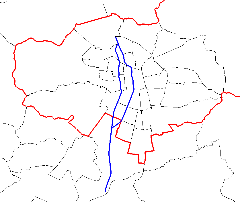
English: Map of Autopista Central in Santiago, Chile. The highway is in blue. In red, Santiago Province borders. In black, communal borders. |
| Source | http://www.openstreetmap.org/ |
| Author | OpenStreetMap |
| Permission (Reusing this file) |
http://www.openstreetmap.org/copyright |
- Other information
English: Only the administrative borders were derived from OpenStreetMap data.
Licensing
[edit]
This file is licensed under the Creative Commons Attribution-Share Alike 3.0 Unported license.
- You are free:
- to share – to copy, distribute and transmit the work
- to remix – to adapt the work
- Under the following conditions:
- attribution – You must give appropriate credit, provide a link to the license, and indicate if changes were made. You may do so in any reasonable manner, but not in any way that suggests the licensor endorses you or your use.
- share alike – If you remix, transform, or build upon the material, you must distribute your contributions under the same or compatible license as the original.
File history
Click on a date/time to view the file as it appeared at that time.
| Date/Time | Thumbnail | Dimensions | User | Comment | |
|---|---|---|---|---|---|
| current | 05:12, 2 March 2015 | | 837 × 705 (9 KB) | Cantus (talk | contribs) | {{subst:Upload marker added by en.wp UW}} {{Information |Description = {{en|Map of Autopista Central in Santiago, Chile. The highway is in blue. In red, Santiago Province borders. In black, communal borders.}} |Source = http://www.openstreetmap.org/ |A... |
You cannot overwrite this file.
File usage on Commons
The following page uses this file:
File usage on other wikis
The following other wikis use this file:
- Usage on en.wikipedia.org