File:Autobahn Notlandeplatz A29 Ahlhorn DoD DF-ST-85-05075.jpg
Jump to navigation
Jump to search
Size of this preview: 434 × 599 pixels. Other resolutions: 174 × 240 pixels | 348 × 480 pixels | 556 × 768 pixels | 742 × 1,024 pixels | 1,878 × 2,593 pixels.
Original file (1,878 × 2,593 pixels, file size: 3.36 MB, MIME type: image/jpeg)
Captions
Captions
Add a one-line explanation of what this file represents
Summary
[edit]
| Description |
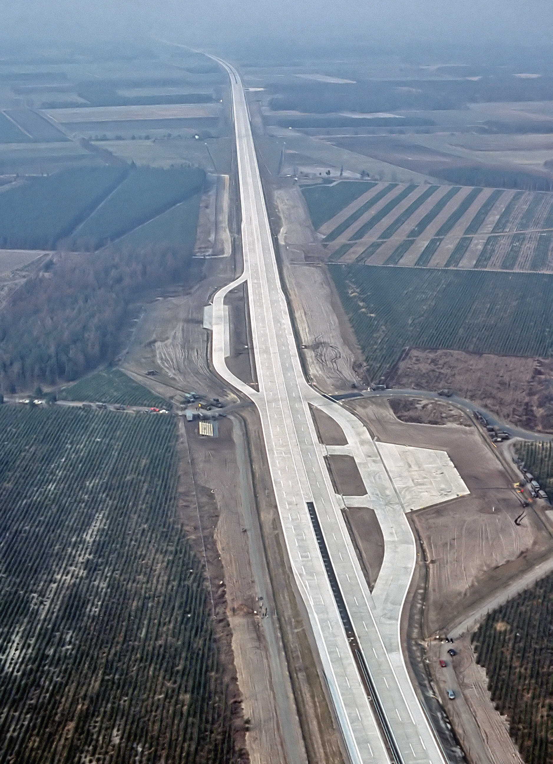
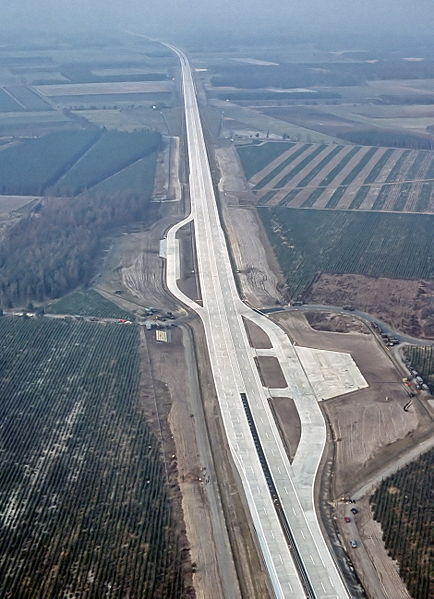
English: An aerial view of the autobahn A29 near Ahlhorn, Germany. Construction of A29 completed in 1984, the emergency-runway had been in the initial design. The highway had been cleared of traffic to allow it to be used to land aircraft during NATO exercise "highway 84".
Deutsch: Luftbild der Bundesautobahn A29 in der Nähe von Ahlhorn im Jahr ihrer Fertigstellung. Im Rahmen der Nato-Übung "Highway 84" wurde der Notlandeplatz genutzt. |
|||
| Date | ||||
| Source |
|
|||
| Author | TSgt. Rod Prouty, USAF | |||
| Permission (Reusing this file) |
Released to Public Photo ID:DF-ST-85-05075 |
| Camera location | | View this and other nearby images on: OpenStreetMap |
|---|
Licensing
[edit]
This image or file is a work of a U.S. Air Force Airman or employee, taken or made as part of that person's official duties. As a work of the U.S. federal government, the image or file is in the public domain in the United States.
|
 |
File history
Click on a date/time to view the file as it appeared at that time.
| Date/Time | Thumbnail | Dimensions | User | Comment | |
|---|---|---|---|---|---|
| current | 06:12, 4 August 2007 | | 1,878 × 2,593 (3.36 MB) | -jha- (talk | contribs) | {{Information |Description={{en|An aerial view of the autobahn A29 near Ahlhorn. construction of A29 just completed in 1984, the emergency-runway has been in the initial design. The highway has been cleared of traffic to allow it to be used to land aircr |
You cannot overwrite this file.
File usage on Commons
The following page uses this file:
File usage on other wikis
The following other wikis use this file:
- Usage on de.wikipedia.org
- Usage on de.wikivoyage.org
- Usage on en.wikipedia.org
- Usage on fa.wikipedia.org
- Usage on fr.wikipedia.org
- Usage on fy.wikipedia.org
- Usage on he.wikipedia.org
- Usage on hu.wikipedia.org
- Usage on id.wikipedia.org
- Usage on it.wikipedia.org
- Usage on ja.wikipedia.org
- Usage on nds.wikipedia.org
- Usage on nl.wikipedia.org
- Usage on pl.wikipedia.org
- Usage on sv.wikipedia.org
- Usage on th.wikipedia.org
- Usage on tr.wikipedia.org
- Usage on zh.wikipedia.org