File:Australian Peacekeeping.PNG
Jump to navigation
Jump to search

Size of this preview: 800 × 351 pixels. Other resolutions: 320 × 140 pixels | 640 × 281 pixels | 1,425 × 625 pixels.
Original file (1,425 × 625 pixels, file size: 55 KB, MIME type: image/png)
Captions
Captions
Add a one-line explanation of what this file represents
Summary
[edit]
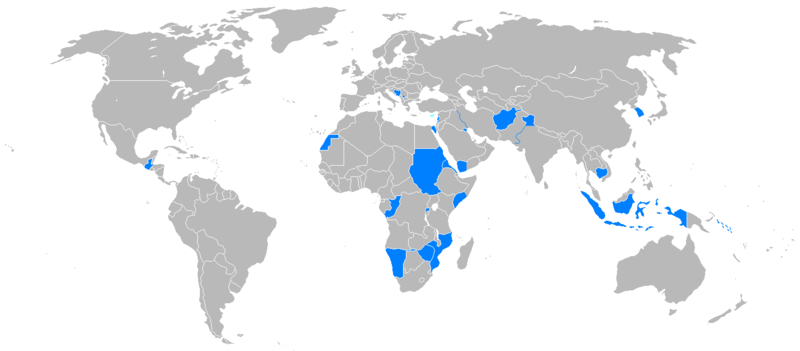
| Description | Areas and countries in which Australian peacekeepers have served since 1945. The map is based on that in John Coates' Atlas of Australia's Wars and was developed from Image:BlankMap-World.png. |
| Date | |
| Source | Own work |
| Author | Nick Dowling |
Licensing
[edit]
| This work has been released into the public domain by its author, I, Nick Dowling. This applies worldwide. In some countries this may not be legally possible; if so: I, Nick Dowling grants anyone the right to use this work for any purpose, without any conditions, unless such conditions are required by law. |
File history
Click on a date/time to view the file as it appeared at that time.
| Date/Time | Thumbnail | Dimensions | User | Comment | |
|---|---|---|---|---|---|
| current | 08:41, 1 July 2007 | | 1,425 × 625 (55 KB) | Nick-D (talk | contribs) | {{Information |Description=Areas and countries in which Australian peacekeepers have served since 1945. The map is based on that in John Coates' ''Atlas of Australia's Wars'' and was developed from Image:BlankMap-World.png. |Source=self-made |Date=1 July |
You cannot overwrite this file.
File usage on Commons
There are no pages that use this file.
File usage on other wikis
The following other wikis use this file:
- Usage on en.wikipedia.org
- Usage on es.wikipedia.org
- Usage on fr.wikipedia.org
- Usage on he.wikipedia.org
- Usage on ro.wikipedia.org
- Usage on ru.wikipedia.org