File:Australian Electoral Divisions of Sydney, 2016 (Labelled).png
Jump to navigation
Jump to search
Size of this preview: 616 × 600 pixels. Other resolutions: 247 × 240 pixels | 493 × 480 pixels | 789 × 768 pixels | 1,052 × 1,024 pixels | 2,104 × 2,048 pixels | 5,650 × 5,500 pixels.
Original file (5,650 × 5,500 pixels, file size: 405 KB, MIME type: image/png)
Captions
Captions
Add a one-line explanation of what this file represents
Summary
[edit].png&action=edit§ion=1)
| Description |
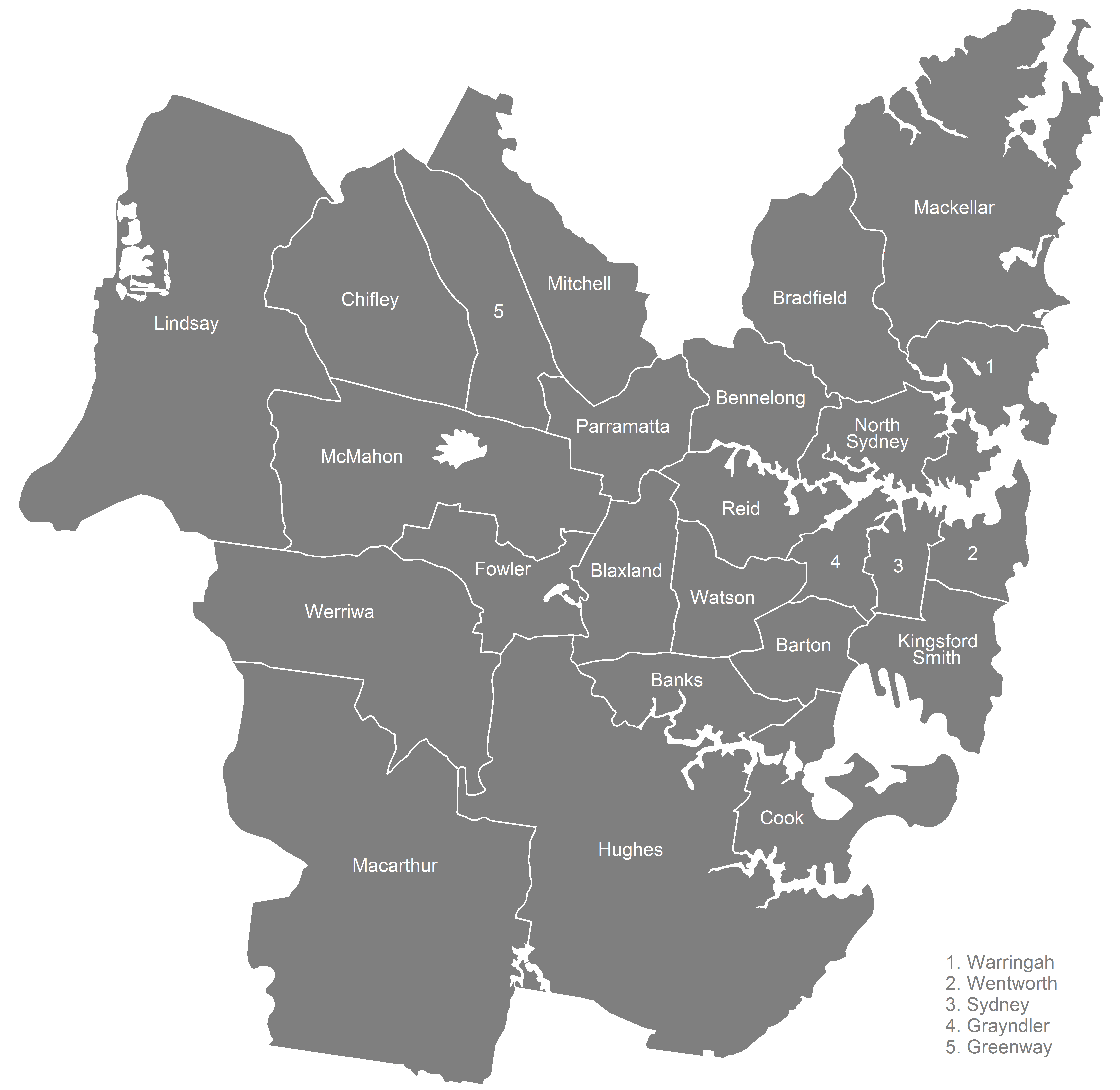
English: Labelled map of federal electoral divisions for the Australian House of Representatives in the Sydney metropolitan area, as of the 2016 federal election. |
| Date | |
| Source | Own work |
| Author | Philip Terry Graham |
Licensing
[edit].png&action=edit§ion=2)
I, the copyright holder of this work, hereby publish it under the following license:
| This file is made available under the Creative Commons CC0 1.0 Universal Public Domain Dedication. | |
| The person who associated a work with this deed has dedicated the work to the public domain by waiving all of their rights to the work worldwide under copyright law, including all related and neighboring rights, to the extent allowed by law. You can copy, modify, distribute and perform the work, even for commercial purposes, all without asking permission.
|
File history
Click on a date/time to view the file as it appeared at that time.
| Date/Time | Thumbnail | Dimensions | User | Comment | |
|---|---|---|---|---|---|
| current | 21:57, 9 May 2016 | | 5,650 × 5,500 (405 KB) | PhilipTerryGraham (talk | contribs) | Darkened text and electorate plates; the first one was hardly readable. |
| 21:26, 9 May 2016 |  | 5,650 × 5,500 (424 KB) | PhilipTerryGraham (talk | contribs) | Fixed - part of Robertson was accidentally visible | |
| 21:17, 9 May 2016 |  | 5,650 × 5,500 (424 KB) | PhilipTerryGraham (talk | contribs) | User created page with UploadWizard |
You cannot overwrite this file.
File usage on Commons
The following page uses this file:
File usage on other wikis
The following other wikis use this file:
- Usage on en.wikipedia.org
.png&oldid=808206990)