File:Australia Wind Power Density Map.png
Jump to navigation
Jump to search

Size of this preview: 800 × 560 pixels. Other resolutions: 320 × 224 pixels | 640 × 448 pixels | 1,024 × 716 pixels | 1,280 × 895 pixels | 1,976 × 1,382 pixels.
Original file (1,976 × 1,382 pixels, file size: 1.51 MB, MIME type: image/png)
Captions
Captions
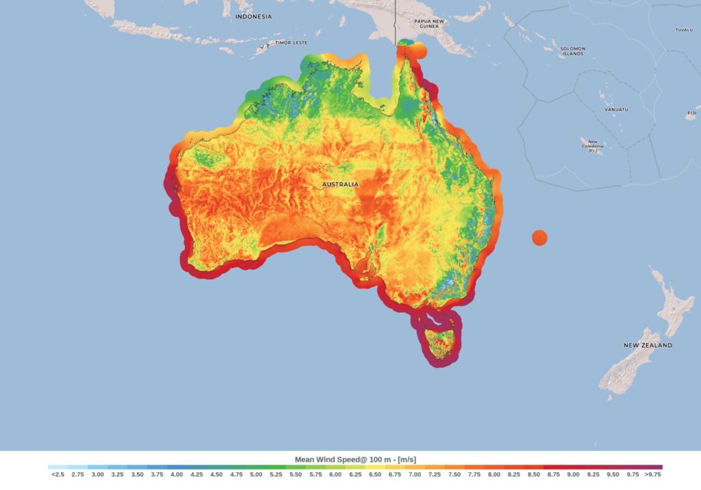
Wind resource map of Australia
Summary
[edit]
| Description |
English: This wind resource map provides an estimated summary of mean wind power density at 100 m above surface level. Power density indicates wind power potential, part of which can be extracted by wind turbines. The map is derived from high-resolution wind speed distributions based on a chain of models, which downscales winds from global models (~70 km), to mesoscale (9 km) to microscale (150 m terrain). The resulting resolution is 250 m. |
| Date | |
| Source | https://globalwindatlas.info/en/area/Australia?print=true |
| Author | Technical University of Denmark |
Licensing
[edit]
This file is licensed under the Creative Commons Attribution-Share Alike 4.0 International license.
- You are free:
- to share – to copy, distribute and transmit the work
- to remix – to adapt the work
- Under the following conditions:
- attribution – You must give appropriate credit, provide a link to the license, and indicate if changes were made. You may do so in any reasonable manner, but not in any way that suggests the licensor endorses you or your use.
- share alike – If you remix, transform, or build upon the material, you must distribute your contributions under the same or compatible license as the original.
File history
Click on a date/time to view the file as it appeared at that time.
| Date/Time | Thumbnail | Dimensions | User | Comment | |
|---|---|---|---|---|---|
| current | 12:53, 10 March 2021 | | 1,976 × 1,382 (1.51 MB) | MDRX (talk | contribs) | Uploaded a work by Technical University of Denmark from https://globalwindatlas.info/en/area/Australia?print=true with UploadWizard |
You cannot overwrite this file.
File usage on Commons
There are no pages that use this file.
File usage on other wikis
The following other wikis use this file:
- Usage on de.wikipedia.org
- Usage on en.wikipedia.org