File:Australia Perth location map.svg
Jump to navigation
Jump to search

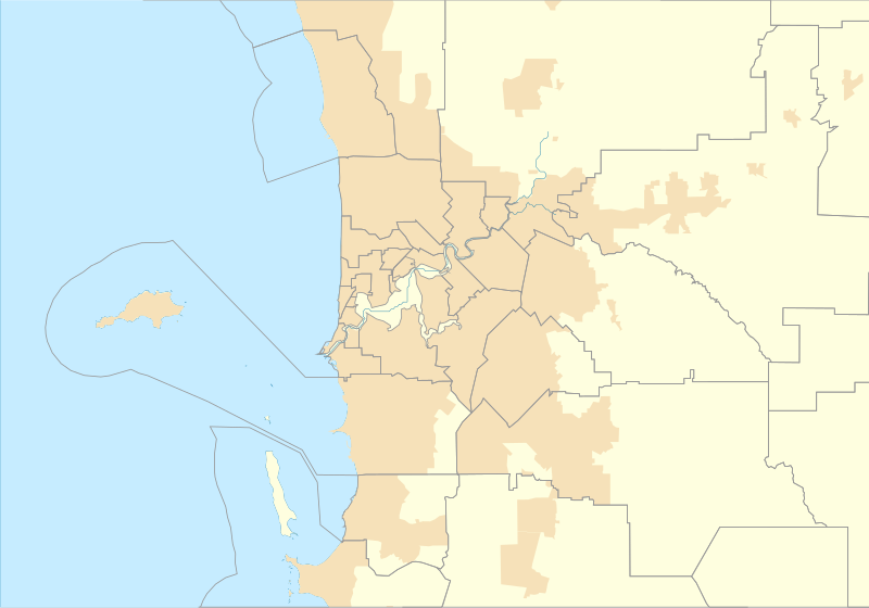
Size of this PNG preview of this SVG file: 800 × 559 pixels. Other resolutions: 320 × 224 pixels | 640 × 447 pixels | 1,024 × 716 pixels | 1,280 × 895 pixels | 2,560 × 1,790 pixels | 1,250 × 874 pixels.
Original file (SVG file, nominally 1,250 × 874 pixels, file size: 130 KB)
Captions
Captions
Add a one-line explanation of what this file represents
Summary
[edit]
| Description |
English: Location map of Perth in Western Australia |
| Date | |
| Source | Own work |
| Author | Run to the hills, cos the end of the world is soon! |
Licensing
[edit]
I, the copyright holder of this work, hereby publish it under the following license:
This file is licensed under the Creative Commons Attribution-Share Alike 4.0 International license.
- You are free:
- to share – to copy, distribute and transmit the work
- to remix – to adapt the work
- Under the following conditions:
- attribution – You must give appropriate credit, provide a link to the license, and indicate if changes were made. You may do so in any reasonable manner, but not in any way that suggests the licensor endorses you or your use.
- share alike – If you remix, transform, or build upon the material, you must distribute your contributions under the same or compatible license as the original.
File history
Click on a date/time to view the file as it appeared at that time.
| Date/Time | Thumbnail | Dimensions | User | Comment | |
|---|---|---|---|---|---|
| current | 00:43, 17 September 2016 | | 1,250 × 874 (130 KB) | Run to the hills, cos the end of the world is soon! (talk | contribs) | User created page with UploadWizard |
You cannot overwrite this file.
File usage on Commons
There are no pages that use this file.
File usage on other wikis
The following other wikis use this file:
- Usage on en.wikipedia.org
- Fremantle
- Cape Peron
- Jualbup Lake
- Mount Eliza (Western Australia)
- Solidarity Park
- Barracks Arch
- Lake Monger
- Herdsman Lake
- Old Jarrah Tree
- Cottesloe Beach
- Forrestdale Lake
- Booragoon Lake
- Albany Bell Castle
- Beatty Park
- Bishop's House, Perth
- Perth Hebrew Congregation
- Thomsons Lake
- Castledare Boys' Home
- Public Transport Centre
- 2014 Perth Hills bushfire
- Module:Location map/data/Australia Perth
- User:Run to the hills, cos the end of the world is soon!/sandbox
- Module:Location map/data/Australia Perth/doc
- Shalom House
- Mundaring Weir Hotel
- Mahogany Inn
- Bassendean Fire Station
- Woodloes Homestead
- Newmarket Hotel
- Challenger Battery
- North Lake (Western Australia)
- Bibra Lake (Western Australia)
- 2021 Beechina bushfire
- User:Garzo/New Sandbox
- Usage on fr.wikipedia.org
View more global usage of this file.