File:Australia Hobart location map.svg
Jump to navigation
Jump to search

Size of this PNG preview of this SVG file: 542 × 599 pixels. Other resolutions: 217 × 240 pixels | 434 × 480 pixels | 695 × 768 pixels | 926 × 1,024 pixels | 1,853 × 2,048 pixels | 1,131 × 1,250 pixels.
Original file (SVG file, nominally 1,131 × 1,250 pixels, file size: 262 KB)
Captions
Captions
Add a one-line explanation of what this file represents
Summary
[edit]
| Description |
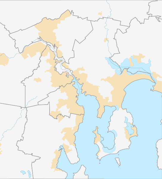
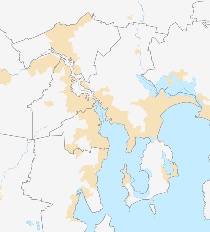
English: Location map of Hobart in Australia, showing only municipality boundaries |
| Date | |
| Source | Own work |
| Author | Run to the hills, cos the end of the world is soon! |
Licensing
[edit]
I, the copyright holder of this work, hereby publish it under the following license:
This file is licensed under the Creative Commons Attribution-Share Alike 4.0 International license.
- You are free:
- to share – to copy, distribute and transmit the work
- to remix – to adapt the work
- Under the following conditions:
- attribution – You must give appropriate credit, provide a link to the license, and indicate if changes were made. You may do so in any reasonable manner, but not in any way that suggests the licensor endorses you or your use.
- share alike – If you remix, transform, or build upon the material, you must distribute your contributions under the same or compatible license as the original.
File history
Click on a date/time to view the file as it appeared at that time.
| Date/Time | Thumbnail | Dimensions | User | Comment | |
|---|---|---|---|---|---|
| current | 12:15, 17 September 2016 | | 1,131 × 1,250 (262 KB) | Run to the hills, cos the end of the world is soon! (talk | contribs) | User created page with UploadWizard |
You cannot overwrite this file.
File usage on Commons
There are no pages that use this file.
File usage on other wikis
The following other wikis use this file:
- Usage on en.wikipedia.org
- Glenorchy, Tasmania
- Kingston, Tasmania
- Brighton, Tasmania
- Bridgewater, Tasmania
- Richmond, Tasmania
- Sorell, Tasmania
- New Town, Tasmania
- Midway Point, Tasmania
- Blackmans Bay, Tasmania
- Bellerive, Tasmania
- Rosny, Tasmania
- Hobart Airport
- Cambridge Aerodrome
- Cambridge, Tasmania
- Sandy Bay, Tasmania
- North Hobart, Tasmania
- Claremont, Tasmania
- Howrah, Tasmania
- Tranmere, Tasmania
- Fern Tree, Tasmania
- Lindisfarne, Tasmania
- Montagu Bay, Tasmania
- Rokeby, Tasmania
- South Hobart, Tasmania
- Risdon Vale, Tasmania
- Mount Nelson, Tasmania
- Moonah, Tasmania
- Geilston Bay, Tasmania
- Lauderdale, Tasmania
- Taroona
- Battery Point, Tasmania
- Royal Tasmanian Botanical Gardens
- Chigwell, Tasmania
- North Hobart Oval
- Berriedale, Tasmania
- Rosetta, Tasmania
- Montrose, Tasmania
- Old Beach, Tasmania
- Green Point, Tasmania
- Cascades, Tasmania
- Glenlusk, Tasmania
- Risdon, Tasmania
- South Arm, Tasmania
- Opossum Bay, Tasmania
- Gagebrook, Tasmania
- Neika
- Lenah Valley, Tasmania
- Tolmans Hill, Tasmania
- Dynnyrne, Tasmania
- Abbotsfield, Tasmania
View more global usage of this file.