File:Ausschnitt Plan von Dresden (1863) - Ortsteile Innere Neustadt, Antonstadt.JPG
Jump to navigation
Jump to search
Size of this preview: 449 × 600 pixels. Other resolutions: 180 × 240 pixels | 359 × 480 pixels | 575 × 768 pixels | 767 × 1,024 pixels | 1,533 × 2,048 pixels | 4,897 × 6,540 pixels.
Original file (4,897 × 6,540 pixels, file size: 27.77 MB, MIME type: image/jpeg)
Captions
Captions
Add a one-line explanation of what this file represents
Summary
[edit]_-_Ortsteile_Innere_Neustadt,_Antonstadt.JPG&action=edit§ion=1)
| Description |
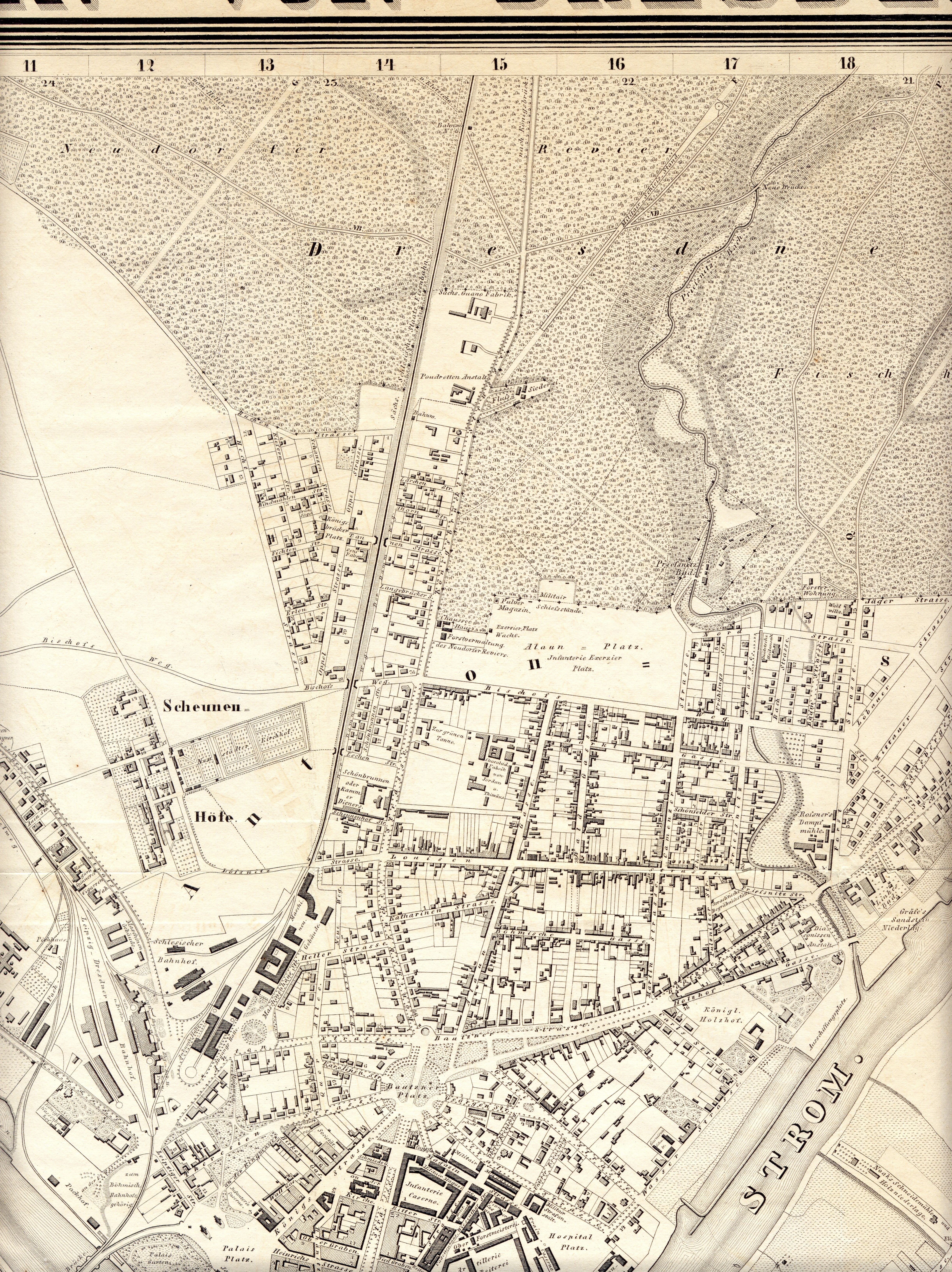
Deutsch: Plan von Dresden (1863), Ausschnitt vom Gebiet der Inneren Neustadt und der Antonstadt sowie angrenzender Areale ein anderes Exemplar desselben kartografischen Druckwerkes (Gesamtansicht) unter diesem Link: Saxon State and University Library Dresden, Deutsche Fotothek |
| Date | |
| Source | Plan von Dresden, 1863 (Scan) |
| Author | Behrisch (Vermessung, Gezeichnet), Julius Keyl (Stich), Dresden |
Licensing
[edit]_-_Ortsteile_Innere_Neustadt,_Antonstadt.JPG&action=edit§ion=2)
|
This work is in the public domain in its country of origin and other countries and areas where the copyright term is the author's life plus 70 years or fewer. | |
| This file has been identified as being free of known restrictions under copyright law, including all related and neighboring rights. | |
File history
Click on a date/time to view the file as it appeared at that time.
| Date/Time | Thumbnail | Dimensions | User | Comment | |
|---|---|---|---|---|---|
| current | 18:15, 2 July 2017 | | 4,897 × 6,540 (27.77 MB) | Lysippos (talk | contribs) | {{Information |Description ={{de|1=Plan von Dresden (1863), Ausschnitt vom Gebiet der Inneren Neustadt und der Antonstadt sowie angrenzender Areale}} |Source =Plan von Dresden, 1863 (Scan) |Author =Behrisch (Vermessung, Gezeichnet),... |
You cannot overwrite this file.
File usage on Commons
The following page uses this file:
_-_Ortsteile_Innere_Neustadt,_Antonstadt.JPG&oldid=807676412)