File:Augsburg-Karte Matthäus Seutter ca. 1730.jpg
Jump to navigation
Jump to search
Size of this preview: 692 × 600 pixels. Other resolutions: 277 × 240 pixels | 554 × 480 pixels | 887 × 768 pixels | 1,182 × 1,024 pixels | 2,364 × 2,048 pixels | 3,038 × 2,632 pixels.
Original file (3,038 × 2,632 pixels, file size: 3 MB, MIME type: image/jpeg)
Captions
Captions
Add a one-line explanation of what this file represents
Summary
[edit]
| Description |
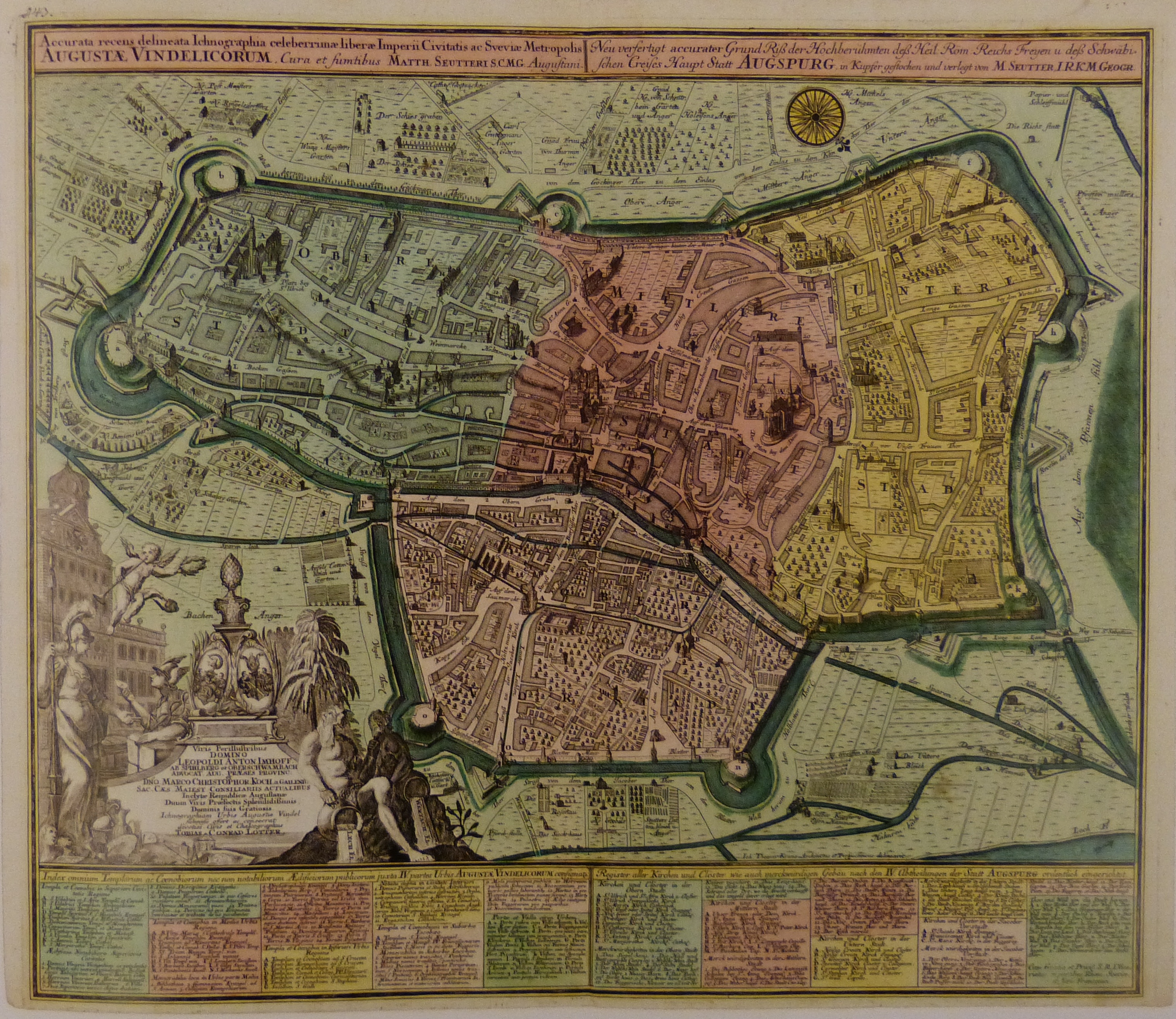
Titel: "Accurata recens delineata Ichnographia celeberrimæ liberæ Imperii Civitatis ac Sveviæ Metropolis AUGUSTÆ VINDELICORUM" Deutsch: Karte von Augsburg, erschienen um 1730/1731 bei Matthäus Seutter, ab 1762 bei Tobias Conrad Lotter. Da Matthäus Seutter auf der Erstauflage noch nicht den Titel eines Kaiserlichen Geographen (ab 1731) führt, lässt sich die Entstehung des Blattes ziemlich genau in die Jahre 1730/1731 datieren. Die vier Stadtteile sind farblich hinterlegt, die Wasserkanäle grün hervorgehoben. |
| Date | circa 1730/1731 |
| Source | Fotografie einer Reproduktion |
| Author | Johann Thomas Kraus (1697-1775) |
| Other versions |
 , ,  , ,  , ,  |
Licensing
[edit]
|
This work is in the public domain in its country of origin and other countries and areas where the copyright term is the author's life plus 100 years or fewer. | |
| This file has been identified as being free of known restrictions under copyright law, including all related and neighboring rights. | |
| Annotations | This image is annotated: View the annotations at Commons |
File history
Click on a date/time to view the file as it appeared at that time.
| Date/Time | Thumbnail | Dimensions | User | Comment | |
|---|---|---|---|---|---|
| current | 19:22, 27 August 2014 | | 3,038 × 2,632 (3 MB) | Neitram (talk | contribs) | {{Information |Description= {{de|1= "Accurata recens delineata Ichnographia celeberrimæ liberæ Imperii Civitatis ac Sveviæ Metropolis AUGUSTÆ VINDELICORUM". Karte von Augsburg, erschienen um 1730/1731 bei Matthäus Seutter, ab 1762 bei Tobias Conra... |
You cannot overwrite this file.
File usage on Commons
There are no pages that use this file.