File:Aufnahmeblatt 4856-2 d Sollenau Felixdorf Großes und Kleines Mittel.jpg
Jump to navigation
Jump to search

Size of this preview: 800 × 576 pixels. Other resolutions: 320 × 230 pixels | 640 × 461 pixels | 1,024 × 737 pixels | 1,280 × 922 pixels | 2,560 × 1,844 pixels | 10,379 × 7,475 pixels.
Original file (10,379 × 7,475 pixels, file size: 36.02 MB, MIME type: image/jpeg)
Captions
Captions
Add a one-line explanation of what this file represents
Summary
[edit]
| Warning | The original file is very high-resolution. It might not load properly or could cause your browser to freeze when opened at full size. |
|---|
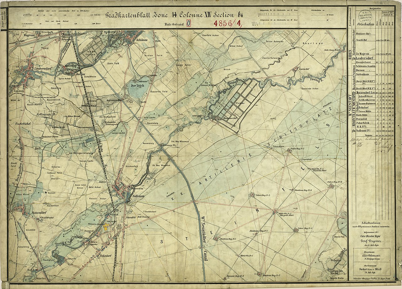
| Description | historische Landkarte: Gradkartenblatt Zone 14 Colonne XIV Section b4 (später 4856/2d). Sollenau, Felixdorf, Leobersdorf, Matzendorf, Blumau, Neurisshof und der Truppenübungsplatz in Großmittel in Niederösterreich, Österreich. Franzisco-josephinische (3.) Landesaufnahme der österreichisch-ungarischen Monarchie. Aufnahmeblatt 1:12.500. |
| Date | mit einzelnen Nachträgen |
| Source | Archiv des Militärgeographischen Institutes |
| Author | Österreichisch-Ungarische Monarchie, Militärgeographisches Institut |
| Permission (Reusing this file) |
historisches amtliches Werk aus dem 19. Jahrhundert, freies Werk |
Licensing
[edit]
|
This work is in the public domain in its country of origin and other countries and areas where the copyright term is the author's life plus 70 years or fewer. | |
| This file has been identified as being free of known restrictions under copyright law, including all related and neighboring rights. | |
File history
Click on a date/time to view the file as it appeared at that time.
| Date/Time | Thumbnail | Dimensions | User | Comment | |
|---|---|---|---|---|---|
| current | 19:02, 1 March 2010 | | 10,379 × 7,475 (36.02 MB) | Josef Moser (talk | contribs) | {{Information |Description=historische Landkarte: Gradkartenblatt Zone 14 Colonne XIV Section b4 (später 4856/2d). Sollenau, Felixdorf, Leobersdorf, Matzendorf, Blumau, Neurisshof und der Truppenübungsplatz in Großmittel in Niederösterreich, Österrei |
You cannot overwrite this file.
File usage on Commons
The following page uses this file:
File usage on other wikis
The following other wikis use this file:
- Usage on de.wikipedia.org