File:Außerdorf16 15.JPG
Jump to navigation
Jump to search

Size of this preview: 800 × 483 pixels. Other resolutions: 320 × 193 pixels | 640 × 386 pixels | 1,024 × 618 pixels | 1,280 × 773 pixels | 2,905 × 1,754 pixels.
Original file (2,905 × 1,754 pixels, file size: 1.24 MB, MIME type: image/jpeg)
Captions
Captions
Add a one-line explanation of what this file represents
| Description |
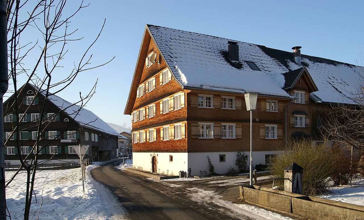
Deutsch: Im Zentrum von Großdorf, einem Ortsteil von Egg. Links Außerdorf Nr.16; Rechts Außerdorf Nr.15; aus dem DEHIO Vorarlberg 1983: BAUERNHÖFE: Um den Kern des Dorfes, zum Teil reihendorfartig gruppierte Höfe mit breiten, in der Regel nach Osten ausgerichteten Giebelfronten. Sie bilden am Nord- und Nordwestrand (Oberdorf, Außerdorf) eindrucksvolle Ensembles der jüngeren Variante des Bregenzerwälder Hofes; zum Teil um 1800 errichtet Nr.1: Bezeichnet 1788. - Nr.15: Mit Korbbogenportal bezeichnet F 1791, zum Teil im Kern 17./18. Jh., seit dem frühen 19. Jh. erhöht beziehungsweise das Dach aufgesteilt, die Wohnteile auf Kellersockel errichtete gestrickte Blockbauten, traufseitig erschlossen mit Flurküche oder Eckflur, teilweise unter Einbeziehung des Schopfes verbreitert und verschindelt. In den höher gelegenen Weilern (Fallenbach, Freien, Sieban, Schmarüty, Stanstatt) einige Höfe des älteren Bregenzerwälder Typus zum Teil mit offenem Schopf, flach geneigtem Satteldach und mit Baudetails aus dem 17. Jh.: Nr.58,61,90,92(bez.1618), 93,96.
|
| Date | |
| Source | Own work Quelle: Dehio Vorarlberg |
| Author | böhringer friedrich |
| Permission (Reusing this file) |
I, the copyright holder of this work, hereby publish it under the following license: This file is licensed under the Creative Commons Attribution-Share Alike 3.0 Unported license.
|
| Other versions |
|

This Photo was taken by Böhringer Friedrich.
|
Feel free to use my photos, but please mention me as the author and if you want send me a message. or (rufre@lenz-nenning.at) |
| Object location | | View this and other nearby images on: OpenStreetMap |
|---|
| Camera location | | View this and other nearby images on: OpenStreetMap |
|---|
File history
Click on a date/time to view the file as it appeared at that time.
| Date/Time | Thumbnail | Dimensions | User | Comment | |
|---|---|---|---|---|---|
| current | 12:27, 12 January 2009 | | 2,905 × 1,754 (1.24 MB) | Böhringer (talk | contribs) | {{Information |Description= {{de| Im Zentrum von Großdorf, einem Ortsteil von Egg. Links Außerdorf Nr.15; Rechts Außerdorf Nr.14: Beschreibung folgt.}} |Source= own work |Date= 2009-01-10 |Author= [[User:Böhringer|böhringer f |
You cannot overwrite this file.
File usage on Commons
The following page uses this file:
File usage on other wikis
The following other wikis use this file:
- Usage on de.wikipedia.org
- Usage on www.wikidata.org