File:Atsipapi, Naxos, Greece 2018081215230NP8487.jpg
Jump to navigation
Jump to search
Size of this preview: 800 × 552 pixels. Other resolutions: 320 × 221 pixels | 640 × 441 pixels | 1,024 × 706 pixels | 1,280 × 883 pixels | 2,451 × 1,690 pixels.
Original file (2,451 × 1,690 pixels, file size: 1.97 MB, MIME type: image/jpeg)
Captions
Captions
Atsipapi, Naxos, Greece
Summary
[edit]
| Description |
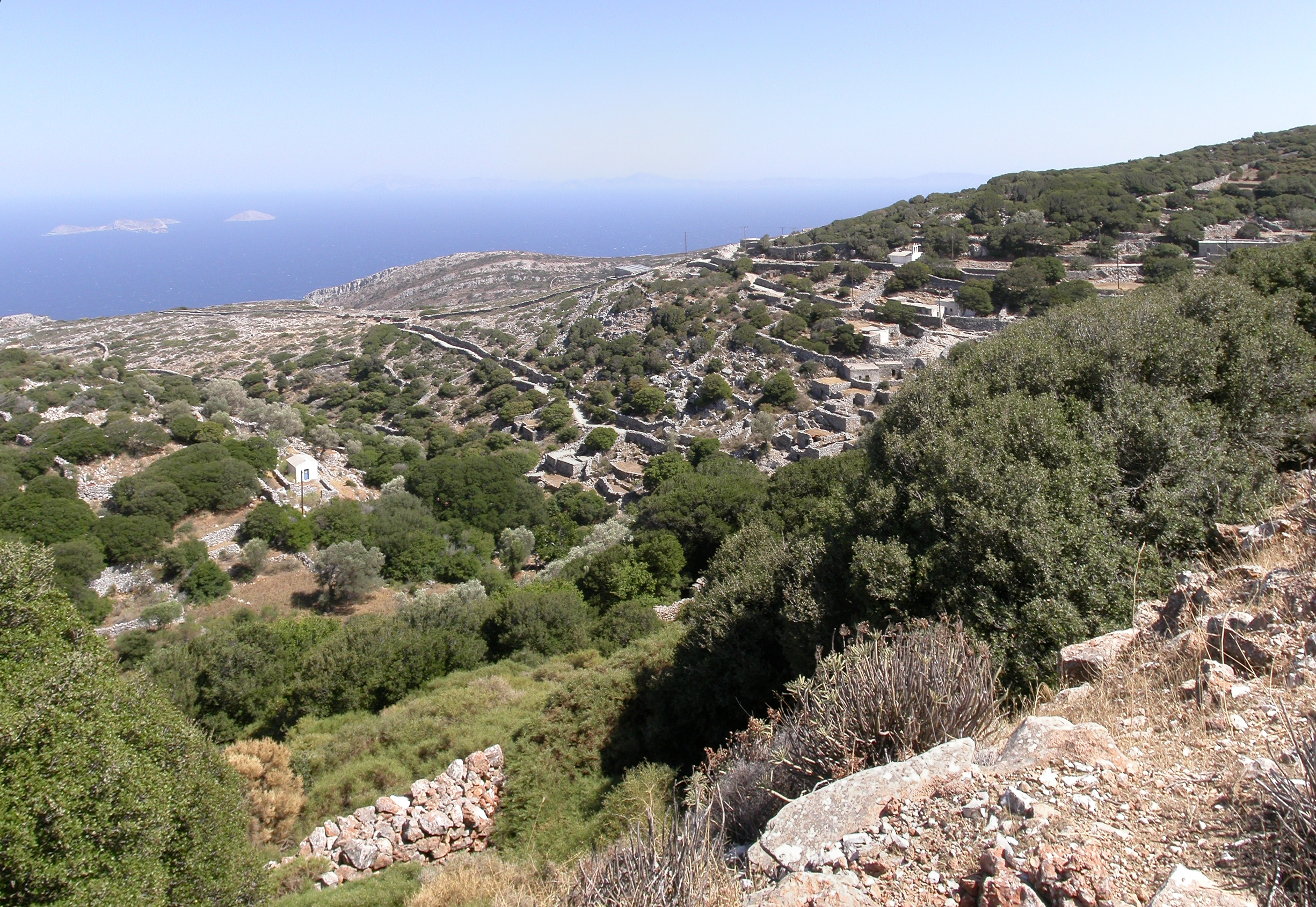
English: Northwest view of the settlement of Atsipapi. Many houses of an earlier age, built of stone and with earthy roofs. The Byzantine church of St. Isidore, built in the 11th century AD, can be seen in the upper and middle of the photo. On the horizon is the island of Amorgos. On the left is the complex of the islets Makares. Naxos, Cyclades, Greece
Ελληνικά: Βορειοδυτική άποψη του οικισμού της Ατσιπάπη της Νάξου στις Κυκλάδες. Πολλά σπίτια, μιάς παλαιότερης εποχής, κτισμένα από πέτρα και με χωμάτινες σκεπές. Στο πάνω και μέσον της φωτογραφίας διακρίνεται ο βυζαντινός ναός του Αγίου Ισιδώρου, κτισμένος τον 11ο αιώνα μ.Χ. Στον ορίζοντα φαίνεται η Αμοργός. Στα αριστερά φαίνεται το σύμπλεγμα των νησίδων Μάκαρες. |
| Date | |
| Source | Own work |
| Author | Stepanps |
Licensing
[edit]
I, the copyright holder of this work, hereby publish it under the following license:
This file is licensed under the Creative Commons Attribution-Share Alike 4.0 International license.
- You are free:
- to share – to copy, distribute and transmit the work
- to remix – to adapt the work
- Under the following conditions:
- attribution – You must give appropriate credit, provide a link to the license, and indicate if changes were made. You may do so in any reasonable manner, but not in any way that suggests the licensor endorses you or your use.
- share alike – If you remix, transform, or build upon the material, you must distribute your contributions under the same or compatible license as the original.
| Camera location | | View this and other nearby images on: OpenStreetMap |
|---|
File history
Click on a date/time to view the file as it appeared at that time.
| Date/Time | Thumbnail | Dimensions | User | Comment | |
|---|---|---|---|---|---|
| current | 01:56, 14 March 2019 | | 2,451 × 1,690 (1.97 MB) | Stepanps (talk | contribs) | User created page with UploadWizard |
You cannot overwrite this file.
File usage on Commons
There are no pages that use this file.
File usage on other wikis
The following other wikis use this file:
- Usage on el.wikipedia.org