File:Atlas des concessions du terrain houiller de la Sarre (feuille 37).jpg
Jump to navigation
Jump to search

Size of this preview: 800 × 558 pixels. Other resolutions: 320 × 223 pixels | 640 × 446 pixels | 1,024 × 714 pixels | 1,280 × 893 pixels | 2,560 × 1,786 pixels | 6,375 × 4,447 pixels.
Original file (6,375 × 4,447 pixels, file size: 14.31 MB, MIME type: image/jpeg)
Captions
Captions
Add a one-line explanation of what this file represents
Summary
[edit].jpg&action=edit§ion=1)
| Title |
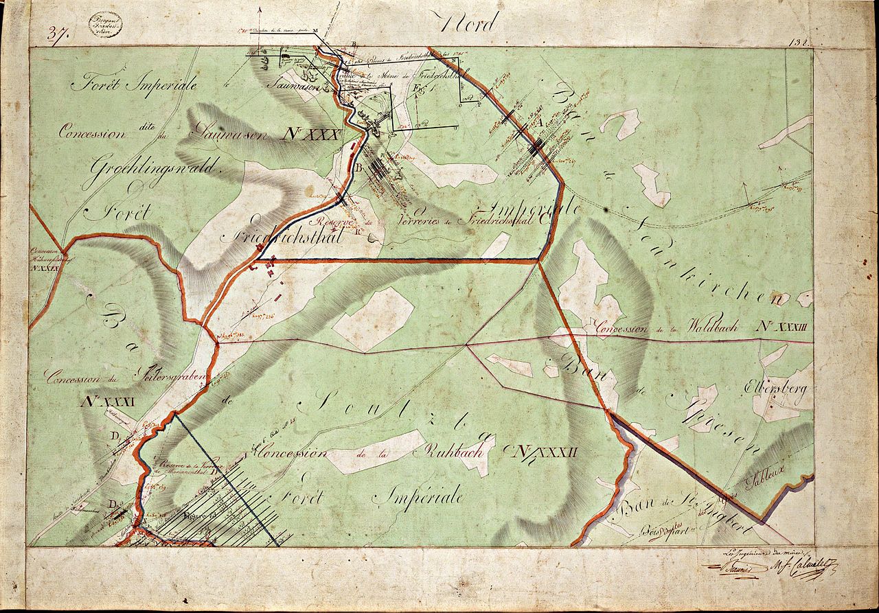
Atlas des concessions du terrain houiller de la Sarre par Mrs Beaunier & Calmelet, ingénieurs du corps des mines. Sarrebruck, de l'an 1810 / Carte n°37 |
|||||||||
| Date | ||||||||||
| Source | Bibliotheque Patrimoniale Numérique (online) | |||||||||
| Creator |
Beaunier, Louis-Antoine (1779-1835); Calmelet, Michel-François-Timoléon (1782-1817) |
|||||||||
| Geotemporal data | ||||||||||
| Map location | Neunkirchen (Saar) | |||||||||
| Scale | 1:2,500 | |||||||||
| Heading |
 |
|||||||||
| Bounding box |
|
|||||||||
| Georeferencing | ||||||||||
| Bibliographic data | ||||||||||
| Part of the series | Atlas des concessions du terrain houiller de la Sarre | |||||||||
| Map sheet | Carte n°37 recto | |||||||||
| Language | French | |||||||||
| Archival data | ||||||||||
| Collection | Bibliothèque de Mines ParisTech | |||||||||
| Accession number | ||||||||||
| Dimensions | height: 62 cm (24.4 in); width: 94 cm (37 in) | |||||||||
| Medium | drawing | |||||||||
Licensing
[edit].jpg&action=edit§ion=2)
|
This is a faithful photographic reproduction of a two-dimensional, public domain work of art. The work of art itself is in the public domain for the following reason:
The official position taken by the Wikimedia Foundation is that "faithful reproductions of two-dimensional public domain works of art are public domain".
This photographic reproduction is therefore also considered to be in the public domain in the United States. In other jurisdictions, re-use of this content may be restricted; see Reuse of PD-Art photographs for details. | ||||
File history
Click on a date/time to view the file as it appeared at that time.
| Date/Time | Thumbnail | Dimensions | User | Comment | |
|---|---|---|---|---|---|
| current | 16:50, 9 January 2017 | | 6,375 × 4,447 (14.31 MB) | Alexrk2 (talk | contribs) | full res version |
| 21:08, 16 December 2016 |  | 3,048 × 2,129 (3.77 MB) | Chumwa (talk | contribs) | == {{int:filedesc}} == {{Information |Description={{fr|Atlas des concessions du terrain houiller de la Sarre par Mrs Beaunier & Calmelet, ingénieurs du corps des mines. Sarrebruck, de l'an 1810}} |Source=[https://patrimoine.mines-paristech.fr/document... |
You cannot overwrite this file.
File usage on Commons
The following 2 pages use this file:
File usage on other wikis
The following other wikis use this file:
- Usage on azb.wikipedia.org
- Usage on de.wikipedia.org
.jpg&oldid=806483499)