File:Atlas and plat book of Holt County, Nebraska - containing outline map of the county, plats of all the townships with owners' names, plats of all towns in the county, also state map and United LOC 2010592815-37.jpg
Jump to navigation
Jump to search

Size of this preview: 456 × 599 pixels. Other resolutions: 182 × 240 pixels | 365 × 480 pixels | 584 × 768 pixels | 779 × 1,024 pixels | 1,558 × 2,048 pixels | 3,488 × 4,585 pixels.
Original file (3,488 × 4,585 pixels, file size: 2.13 MB, MIME type: image/jpeg)
Captions
Captions
Add a one-line explanation of what this file represents
Summary
[edit]| Description |
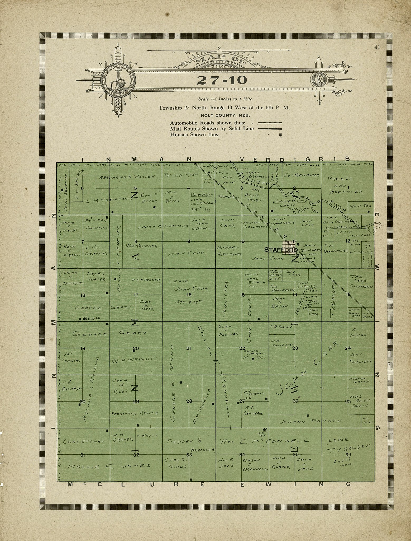
English: Copyright: The Kenyon Company, map makers, Des Moines, Iowa. LeGear. Atlases of the United States, 5482 Includes index and advertisements. Available also through the Library of Congress Web site as a raster image. LC copy imperfect: All pages with minor foxing. Pages 98-[100] wanting. |
||
| Title | Atlas and plat book of Holt County, Nebraska : containing outline map of the county, plats of all the townships with owners' names, plats of all towns in the county, also state map and United States map : compiled from latest data on record. | ||
| Shelf ID | G1453.H7 K4 1915 | ||
| Parent | https://www.loc.gov/resource/g4193hm.gla00201/ | ||
| Sheet title | Map of 27-10 | ||
| Date | |||
| Source | https://www.loc.gov/item/2010592815/ | ||
| Author | Kenyon Company (Des Moines, Iowa) | ||
| Permission (Reusing this file) |
|
||
| Other versions |
|
||
| Location | United States · Nebraska · Holt County | ||
| Part of | American Memory · Catalog · County Landownership Maps · Geography And Map Division · Cultural Landscapes | ||
| Subject | Cadastral Maps · Atlases · Holt County (Ne) · United States · Maps · Nebraska · Real Property · Holt County · Landowners |

Licensing
[edit]
|
This is a faithful photographic reproduction of a two-dimensional, public domain work of art. The work of art itself is in the public domain for the following reason:
The official position taken by the Wikimedia Foundation is that "faithful reproductions of two-dimensional public domain works of art are public domain".
This photographic reproduction is therefore also considered to be in the public domain in the United States. In other jurisdictions, re-use of this content may be restricted; see Reuse of PD-Art photographs for details. | ||||
File history
Click on a date/time to view the file as it appeared at that time.
| Date/Time | Thumbnail | Dimensions | User | Comment | |
|---|---|---|---|---|---|
| current | 02:56, 20 February 2019 | | 3,488 × 4,585 (2.13 MB) | Fæ (talk | contribs) | LOC Maps multisheet https://www.loc.gov/item/2010592815/ sheet 37 of 99 #1799 |
You cannot overwrite this file.
File usage on Commons
The following page uses this file: