File:Atlas Van der Hagen-KW1049B10 066-HOLSATIAE TABULA GENERALIS in qua sunt DUCATUS HOLSATIAE, DITHMASIAE STORMARIAE et WAGRIAE.jpeg
Jump to navigation
Jump to search

Size of this preview: 708 × 599 pixels. Other resolutions: 284 × 240 pixels | 567 × 480 pixels | 907 × 768 pixels | 1,210 × 1,024 pixels | 2,419 × 2,048 pixels | 5,500 × 4,656 pixels.
Original file (5,500 × 4,656 pixels, file size: 4.76 MB, MIME type: image/jpeg)
Captions
Captions
Add a one-line explanation of what this file represents
Summary
[edit]| Dirk Jansz van Santen: Atlas van Dirk van der Hagen (volledig, collectie KB)
|
|||||||||||||||||||||||||||
|---|---|---|---|---|---|---|---|---|---|---|---|---|---|---|---|---|---|---|---|---|---|---|---|---|---|---|---|
| Artist |
Author: F. de Wit Amstelodami Publisher: Frederik de Wit |
 | |||||||||||||||||||||||||
| Author |
Author: F. de Wit Amstelodami Publisher: Frederik de Wit |
||||||||||||||||||||||||||
| Title |
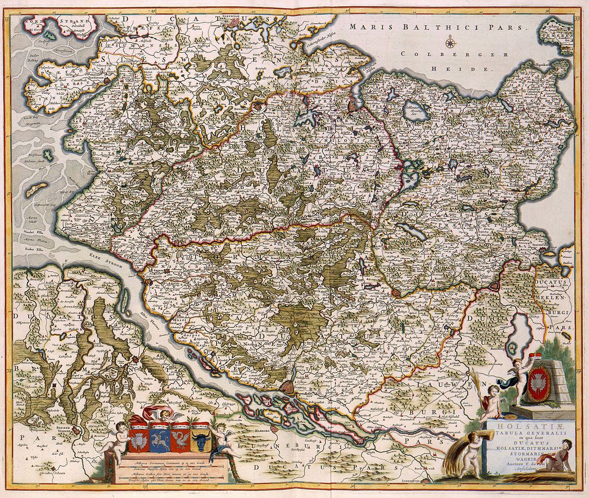
HOLSATIAE TABULA GENERALIS in qua sunt DUCATUS HOLSATIAE, DITHMASIAE STORMARIAE et WAGRIAE |
||||||||||||||||||||||||||
| Object type | map | ||||||||||||||||||||||||||
| Description |
Nederlands: De Deense wiskundige Johannes Mejer (1606-1674) werkte vanaf 1638 aan de samenstelling van een kaart van Sleeswijk-Holstein, dat toen voor een groot deel Deense grondgebied was. De resultaten van dat werk - een atlas met 43 detailkaarten van Sleeswijk-Holstein - werd in 1652 door Caspar Dankwerth gepubliceerd. Omdat de topografische opname van Sleeswijk-Holstein als de beste van zijn tijd gold, was het dan ook weinig verrassend dat Joan Blaeu (1598-1673) de belangrijkste kaarten uit deze reeks in zijn Atlas Maior van 1662 opnam. Ook daarna waren deze kaarten bijzonder populair. Deze versie van de kaart van Holstein werd verzorgd door Frederik de Wit (1630-1706).
English: The Danish mathematician Johannes Mejer (1606-1674) had been working from 1638 on a composition of a map of Schleswig-Holstein, at that time mostly on Danish territory. The results of that work - an atlas with 43 detailed maps about Schleswig-Holstein - was published in 1652 by Caspar Dankwerth. Because the topographical survey of Schleswig-Holstein was one of the best of its time, Joan Blaeu (1598-1673) used these important maps in his Atlas Maior in 1662. Years later the maps were still very popular. This version of the map of Schleswig-Holstein was produced by Frederik de Wit (1630-1706). |
||||||||||||||||||||||||||
| Language |
Dutch |
||||||||||||||||||||||||||
| Date | after 1688 | ||||||||||||||||||||||||||
| Publication date |
circa |
||||||||||||||||||||||||||
| Medium |
Nederlands: kopergravure
English: copper engraving print |
||||||||||||||||||||||||||
| Dimensions | 50 x 61 cm | ||||||||||||||||||||||||||
| Collection |
|
||||||||||||||||||||||||||
| Accession number |
Description of the Atlas Van der Hagen in the catalogue of the KB: http://opc4.kb.nl/DB=1/TTL=1/LNG=EN/PPN?PPN=353012750 |
||||||||||||||||||||||||||
| Place of creation | Amsterdam | ||||||||||||||||||||||||||
| Notes | KW1049B10_066 - Volume 1 | ||||||||||||||||||||||||||
| Related persons | Frederik de Wit - Johannes Mejer - Dankwerth, Caspar - Joan Blaeu | ||||||||||||||||||||||||||
| Depicted locations | Schleswig-Holstein - Germany | ||||||||||||||||||||||||||
| References | |||||||||||||||||||||||||||
| Source/Photographer |
Source page at the Geheugen van Nederland / Memory of the Netherlands website.
|
||||||||||||||||||||||||||
| Permission (Reusing this file) |
|
||||||||||||||||||||||||||
| Other versions |
|
||||||||||||||||||||||||||

.jpg)
File history
Click on a date/time to view the file as it appeared at that time.
| Date/Time | Thumbnail | Dimensions | User | Comment | |
|---|---|---|---|---|---|
| current | 00:46, 19 July 2015 | | 5,500 × 4,656 (4.76 MB) | OlafJanssen (talk | contribs) | GWToolset: Creating mediafile for OlafJanssen. |
You cannot overwrite this file.
File usage on Commons
The following 5 pages use this file:
- Atlas van der Hagen
- Atlas van der Hagen (Volume 1)
- File:Atlas Van der Hagen-KW1049B10 066-HOLSATIAE TABULA GENERALIS in qua sunt DUCATUS HOLSATIAE, DITHMASIAE STORMARIAE et WAGRIAE.jpeg
- File:Holsatiae tabula generalis in qua sunt Ducatus Holsatiae, Dithmarsiae, Stormariae et Wagriae (8343681384).jpg
- File:Map - Special Collections University of Amsterdam - OTM- HB-KZL 31-27-26.tif