File:Atlantic Ocean, Nags Head, Outer Banks, North Carolina (14261632779).jpg

Original file (4,000 × 3,000 pixels, file size: 2.77 MB, MIME type: image/jpeg)
Captions
Captions
Summary
[edit].jpg&action=edit§ion=1)
| Description |
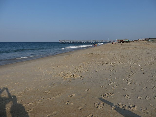
Nags Head is a town in Dare County, North Carolina, United States. The population was 2,757 at the 2010 census. Early maps of the area show Nags Head as a promontory of land characterized by high sand dunes visible from miles at sea. The origin of the town's name is obscure but it may have been named after Nag's Head Island, an island in the River Thames in England at Abingdon. Another possible source of the name was in reference to the lights hung on mules' heads by "wreckers" who would lead ships to be shipwrecked near shore where nefarious individuals could loot the ships of their valuables. Around 1830, Nags Head became known as a resort area, and so remains today. Jockey's Ridge is the last vestige of the sand dunes seen by the first explorers, as the area is now highly developed. The town incorporated in 1961. As in any other beach town, the ocean and shoreline are the major attractions, providing beaches for swimming, sunbathing, and a variety of water sports. A series of historic cottages overlook the beach in sections. There are three piers, Nags Head Pier, Jennette's Pier (destroyed by Hurricane Isabel in 2003 and bought and renovated by the North Carolina Aquariums; it reopened in May 2011), and Outer Banks Pier which are popular for fishing. The town also features miniature golf courses and small amusement centers with go-karts and bumper cars for family entertainment. <a href="http://en.wikipedia.org/wiki/Nags_Head" rel="nofollow">en.wikipedia.org/wiki/Nags_Head</a> <a href="http://en.wikipedia.org/wiki/Wikipedia:Text_of_Creative_Commons_Attribution-ShareAlike_3.0_Unported_License" rel="nofollow">en.wikipedia.org/wiki/Wikipedia:Text_of_Creative_Commons_...</a> |
| Date | |
| Source | Atlantic Ocean, Nags Head, Outer Banks, North Carolina |
| Author | Ken Lund from Reno, Nevada, USA |
| Camera location | | View this and other nearby images on: OpenStreetMap |
|---|
.jpg¶ms=035.887702_N_-075.583256_E_globe:Earth_type:camera_source:Flickr_&language=en)
Licensing
[edit].jpg&action=edit§ion=2)
- You are free:
- to share – to copy, distribute and transmit the work
- to remix – to adapt the work
- Under the following conditions:
- attribution – You must give appropriate credit, provide a link to the license, and indicate if changes were made. You may do so in any reasonable manner, but not in any way that suggests the licensor endorses you or your use.
- share alike – If you remix, transform, or build upon the material, you must distribute your contributions under the same or compatible license as the original.
| This image was originally posted to Flickr by Ken Lund at https://flickr.com/photos/75683070@N00/14261632779 (archive). It was reviewed on 11 February 2020 by FlickreviewR 2 and was confirmed to be licensed under the terms of the cc-by-sa-2.0. |
File history
Click on a date/time to view the file as it appeared at that time.
| Date/Time | Thumbnail | Dimensions | User | Comment | |
|---|---|---|---|---|---|
| current | 02:23, 11 February 2020 | | 4,000 × 3,000 (2.77 MB) | Ser Amantio di Nicolao (talk | contribs) | Transferred from Flickr via #flickr2commons |
You cannot overwrite this file.
File usage on Commons
There are no pages that use this file.
.jpg&oldid=888779190)