File:Atlantic Bubble, 21 August 2020.jpg
Jump to navigation
Jump to search

Size of this preview: 800 × 439 pixels. Other resolutions: 320 × 176 pixels | 640 × 351 pixels | 1,024 × 562 pixels | 1,280 × 703 pixels | 2,560 × 1,405 pixels | 3,828 × 2,101 pixels.
Original file (3,828 × 2,101 pixels, file size: 3.89 MB, MIME type: image/jpeg)
Captions
Captions
Add a one-line explanation of what this file represents
Summary
[edit]
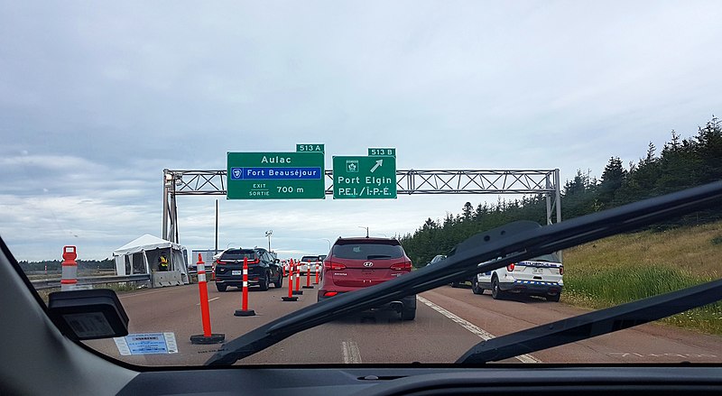
| Description | Checkpoint set up by the New Brunswick provincial government during the COVID-19 pandemic in Canada, seen on August 21, 2020, in Aulac, New Brunswick, while entering the province from Nova Scotia via the Trans-Canada Highway. Travel between the four Atlantic Canada provinces was mostly unrestricted at that time, because of an agreement called The Atlantic Bubble. |
| Date | |
| Source | Atlantic Bubble, 21 August 2020 |
| Author | Indrid__Cold |
| Camera location | | View this and other nearby images on: OpenStreetMap |
|---|
Licensing
[edit]
This file is licensed under the Creative Commons Attribution-Share Alike 2.0 Generic license.
- You are free:
- to share – to copy, distribute and transmit the work
- to remix – to adapt the work
- Under the following conditions:
- attribution – You must give appropriate credit, provide a link to the license, and indicate if changes were made. You may do so in any reasonable manner, but not in any way that suggests the licensor endorses you or your use.
- share alike – If you remix, transform, or build upon the material, you must distribute your contributions under the same or compatible license as the original.
| This image was originally posted to Flickr by Indrid__Cold at https://flickr.com/photos/29442760@N00/50669709473. It was reviewed on 2 December 2020 by FlickreviewR 2 and was confirmed to be licensed under the terms of the cc-by-sa-2.0. |
File history
Click on a date/time to view the file as it appeared at that time.
| Date/Time | Thumbnail | Dimensions | User | Comment | |
|---|---|---|---|---|---|
| current | 03:06, 2 December 2020 | | 3,828 × 2,101 (3.89 MB) | Gates of Ale (talk | contribs) | Transferred from Flickr via #flickr2commons |
You cannot overwrite this file.
File usage on Commons
There are no pages that use this file.
File usage on other wikis
The following other wikis use this file:
- Usage on en.wikipedia.org
- Usage on id.wikipedia.org
Metadata
Categories:
- Transport during the COVID-19 pandemic in Canada
- COVID-19 pandemic in New Brunswick
- Aulac, New Brunswick
- New Brunswick Route 2
- Road transport in New Brunswick
- Law enforcement in New Brunswick
- Police of New Brunswick
- Road signs in New Brunswick
- Bilingual English-French road signs in Canada
- Road sign gantries in Canada
- COVID-19 pandemic checkpoints in Canada
- August 2020 in New Brunswick
- 2020 in road transport in Canada