File:Atlante Español. Mapa de la Isla de Mallorca.png
Jump to navigation
Jump to search
Size of this preview: 800 × 573 pixels. Other resolutions: 320 × 229 pixels | 640 × 459 pixels | 1,024 × 734 pixels | 1,280 × 917 pixels | 1,961 × 1,405 pixels.
Original file (1,961 × 1,405 pixels, file size: 3.99 MB, MIME type: image/png)
Captions
Captions
Add a one-line explanation of what this file represents
Summary
[edit]
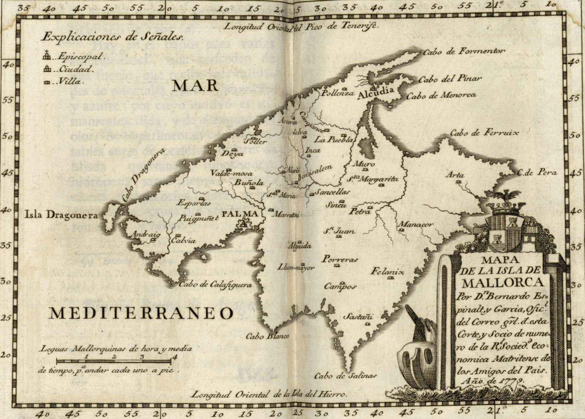
| Description | Estampa 15: Map of Mallorca | ||||
| Date | |||||
| Source | Atlante español (Q105513902) Vol. 3 | ||||
| Author | Mapa: Bernardo Espinalt (Q5726740). Litografia: Juan Fernando Palomino (Q5949416). | ||||
| Permission (Reusing this file) |
|
||||
File history
Click on a date/time to view the file as it appeared at that time.
| Date/Time | Thumbnail | Dimensions | User | Comment | |
|---|---|---|---|---|---|
| current | 14:43, 21 May 2022 | | 1,961 × 1,405 (3.99 MB) | Joan Gené (talk | contribs) | {{Information |Description=''Estampa 15'': {{LangSwitch|ca=Mapa de Mallorca |en=Map of Mallorca}} |Source={{Q|Q105513902}} [http://bdh.bne.es/bnesearch/detalle/bdh0000001375 Vol. 3] |Date=1779 |Author=Mapa: {{Q|Q5726740}}. Litografia: {{Q|Q5949416}}. }} Category:Atlante español (1778-1795) Category:Mallorca in the 18th century Category:Old maps of Mallorca |
You cannot overwrite this file.
File usage on Commons
There are no pages that use this file.