File:Ashchurch with ex-Midland Compound 4-4-0 geograph-2747922-by-Ben-Brooksbank.jpg
Jump to navigation
Jump to search
Size of this preview: 800 × 457 pixels. Other resolutions: 320 × 183 pixels | 640 × 366 pixels | 1,024 × 585 pixels | 1,280 × 732 pixels | 2,356 × 1,347 pixels.
Original file (2,356 × 1,347 pixels, file size: 1.25 MB, MIME type: image/jpeg)
Captions
Captions
Add a one-line explanation of what this file represents
Summary
[edit]
| Description |
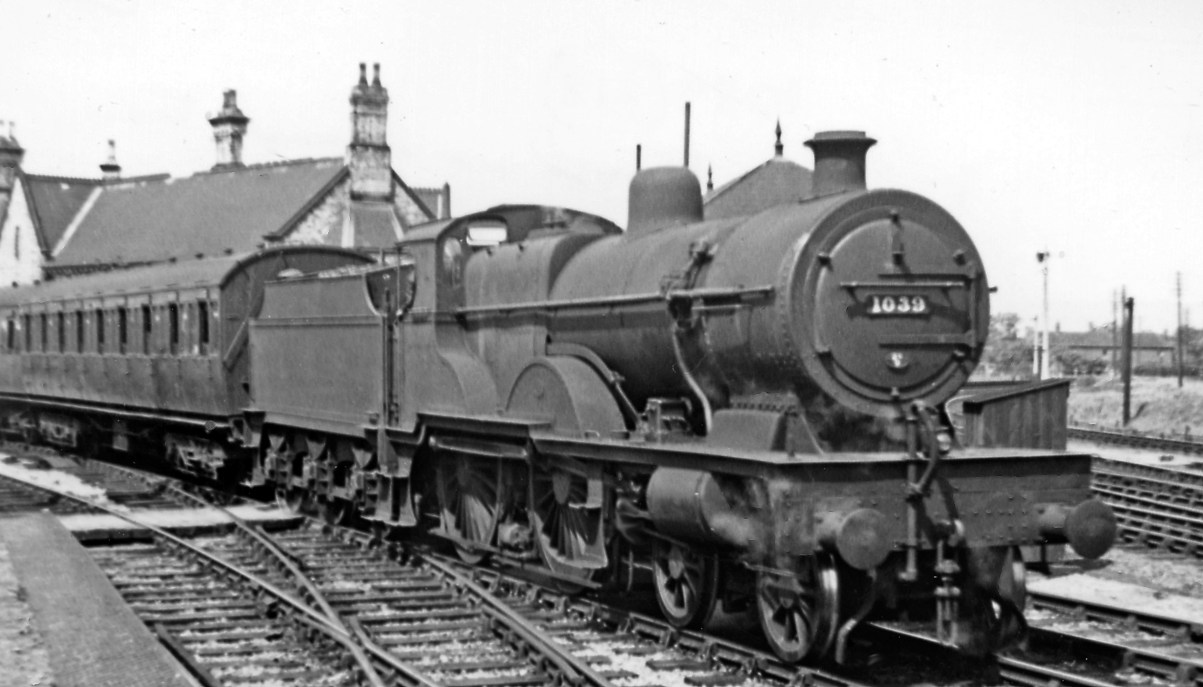
English: Ex-Midland Compound 4-4-0 at Ashchurch. View NE from the foot-crossing entrance to the station, over the Tewkesbury line (to the left), with the Birmingham - Bristol main line on the right and beyond it the line to Evesham, Redditch and Birmingham. No. 1039 is Deeley-modified Johnson 3-cylinder 7'0" Compound 4P 4-4-0 (built 1909, withdrawn 8/52). Here it is backing the stock of the 14.08 arrival from Birmingham New Street via Evesham and after stopping at the Evesham line platform opposite has drawn forward then backed onto the Tewkesbury line: it will reverse to Tewkesbury Junction, go forward over the flat crossing of the main line and finally reverse back into the Evesham platform to form the 14.20 return service. This palaver continued until the flat crossing was removed in 1957. |
| Date | |
| Source | From geograph.org.uk |
| Author | Ben Brooksbank |
| Permission (Reusing this file) |
Creative Commons Attribution Share-alike license 2.0 |
| Attribution (required by the license) | Ben Brooksbank / Ex-Midland Compound 4-4-0 at Ashchurch / |
| Camera location | | View this and other nearby images on: OpenStreetMap |
|---|
Licensing
[edit]

|
This image was taken from the Geograph project collection. See this photograph's page on the Geograph website for the photographer's contact details. The copyright on this image is owned by Ben Brooksbank and is licensed for reuse under the Creative Commons Attribution-ShareAlike 2.0 license.
|
This file is licensed under the Creative Commons Attribution-Share Alike 2.0 Generic license.
Attribution: Ben Brooksbank
- You are free:
- to share – to copy, distribute and transmit the work
- to remix – to adapt the work
- Under the following conditions:
- attribution – You must give appropriate credit, provide a link to the license, and indicate if changes were made. You may do so in any reasonable manner, but not in any way that suggests the licensor endorses you or your use.
- share alike – If you remix, transform, or build upon the material, you must distribute your contributions under the same or compatible license as the original.
File history
Click on a date/time to view the file as it appeared at that time.
| Date/Time | Thumbnail | Dimensions | User | Comment | |
|---|---|---|---|---|---|
| current | 19:04, 4 January 2012 | | 2,356 × 1,347 (1.25 MB) | Chevin (talk | contribs) | == {{int:filedesc}} == {{Information |Description={{en|1='''Ex-Midland Compound 4-4-0 at Ashchurch.'''<br/> View NE from the foot-crossing entrance to the station, over the Tewkesbury line (to the left), with the Birmingham - Bristol main line on the righ |
You cannot overwrite this file.
File usage on Commons
There are no pages that use this file.