File:Ash distribution from Hunga Tonga over Australia.jpg
Jump to navigation
Jump to search
Size of this preview: 600 × 600 pixels. Other resolutions: 240 × 240 pixels | 480 × 480 pixels | 768 × 768 pixels | 1,024 × 1,024 pixels | 2,048 × 2,048 pixels | 8,000 × 8,000 pixels.
Original file (8,000 × 8,000 pixels, file size: 15.19 MB, MIME type: image/jpeg)
Captions
Captions
Add a one-line explanation of what this file represents
Summary
[edit]
| Description |
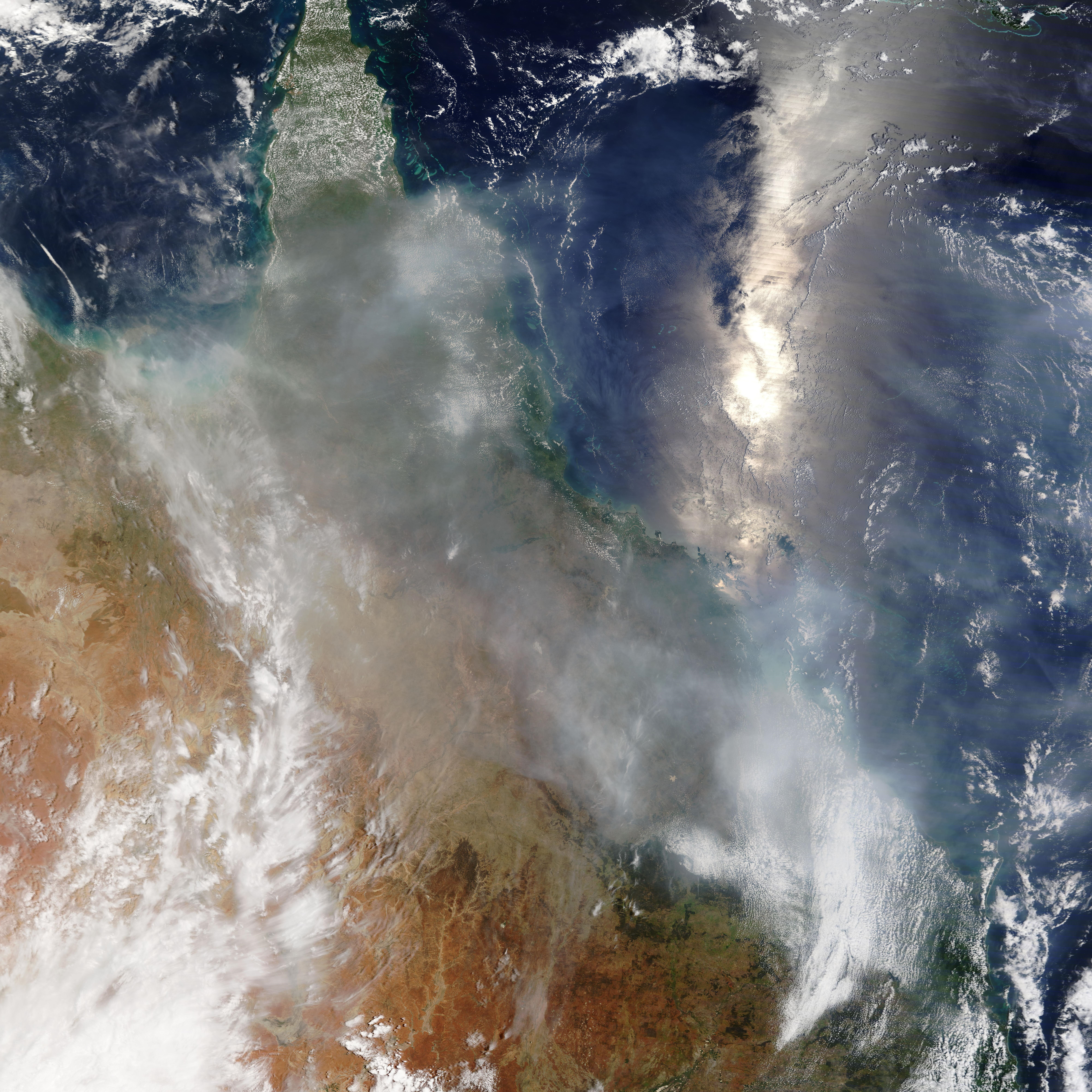
English: Taken from the Terra satellite, this true color image of Queensland, Australia was taken on 17 January 2022 at 00:30 (UTC) (10:30 AM AEST). This image shows the ash distribution from the Hunga Tonga eruption on 15 January continuing to move across the region. |
| Date | Taken on 17 January 2022, 00:30 UTC |
| Source | https://worldview.earthdata.nasa.gov/; direct link to frame: https://go.nasa.gov/3fvdm4w |
| Author | NASA/Terra-MODIS |
Licensing
[edit]
| This file is in the public domain in the United States because it was solely created by NASA. NASA copyright policy states that "NASA material is not protected by copyright unless noted". (See Template:PD-USGov, NASA copyright policy page or JPL Image Use Policy.) | ||
 |
Warnings:
|
File history
Click on a date/time to view the file as it appeared at that time.
| Date/Time | Thumbnail | Dimensions | User | Comment | |
|---|---|---|---|---|---|
| current | 13:08, 17 January 2022 | | 8,000 × 8,000 (15.19 MB) | TheWxResearcher (talk | contribs) | Uploaded a work by NASA/Terra-MODIS from https://worldview.earthdata.nasa.gov/ with UploadWizard |
You cannot overwrite this file.
File usage on Commons
The following page uses this file:
- File:Smoke distribution from Hunga Tonga over Australia.jpg (file redirect)
File usage on other wikis
The following other wikis use this file:
- Usage on en.wikipedia.org
- Usage on es.wikipedia.org
- Usage on fr.wikipedia.org
- Usage on id.wikipedia.org