File:Arundel Station - geograph.org.uk - 1254484.jpg
Jump to navigation
Jump to search
Size of this preview: 450 × 600 pixels. Other resolutions: 180 × 240 pixels | 480 × 640 pixels.
Original file (480 × 640 pixels, file size: 107 KB, MIME type: image/jpeg)
Captions
Captions
Add a one-line explanation of what this file represents
Summary
[edit]
| Description |
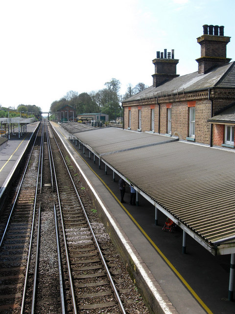
English: Arundel Station Viewed from the footbridge that links the platforms with the former goods building in the distance now a builders merchants. The second station to carry the town's name, the original opened on the West Coastway at Lyminster in the 1840s. The new station opened in 1863 when the Arun valley Line from Hardham Junction to Littlehampton was opened though the then Duke of Norfolk's reluctance to embrace the new railways meant the station was sited a mile away from the town. |
| Date | |
| Source | From geograph.org.uk |
| Author | Simon Carey |
| Attribution (required by the license) | Simon Carey / Arundel Station / |
| Camera location | | View this and other nearby images on: OpenStreetMap |
|---|
_heading:202.00&language=en)
| Object location | | View this and other nearby images on: OpenStreetMap |
|---|
_heading:202.00&language=en)
Licensing
[edit]

|
This image was taken from the Geograph project collection. See this photograph's page on the Geograph website for the photographer's contact details. The copyright on this image is owned by Simon Carey and is licensed for reuse under the Creative Commons Attribution-ShareAlike 2.0 license.
|
This file is licensed under the Creative Commons Attribution-Share Alike 2.0 Generic license.
Attribution: Simon Carey
- You are free:
- to share – to copy, distribute and transmit the work
- to remix – to adapt the work
- Under the following conditions:
- attribution – You must give appropriate credit, provide a link to the license, and indicate if changes were made. You may do so in any reasonable manner, but not in any way that suggests the licensor endorses you or your use.
- share alike – If you remix, transform, or build upon the material, you must distribute your contributions under the same or compatible license as the original.
File history
Click on a date/time to view the file as it appeared at that time.
| Date/Time | Thumbnail | Dimensions | User | Comment | |
|---|---|---|---|---|---|
| current | 19:17, 26 February 2011 | | 480 × 640 (107 KB) | GeographBot (talk | contribs) | == {{int:filedesc}} == {{Information |description={{en|1=Arundel Station Viewed from the footbridge that links the platforms with the former goods building in the distance now a builders merchants. The second station to carry the town's name, the original |
You cannot overwrite this file.
File usage on Commons
There are no pages that use this file.