File:Artzamendi-Mondarrain-Ezcondray-1968.jpg
Jump to navigation
Jump to search
Size of this preview: 800 × 508 pixels. Other resolutions: 320 × 203 pixels | 640 × 407 pixels | 1,024 × 651 pixels | 1,280 × 814 pixels | 3,032 × 1,927 pixels.
Original file (3,032 × 1,927 pixels, file size: 3.98 MB, MIME type: image/jpeg)
Captions
Captions
Add a one-line explanation of what this file represents
Summary
[edit]
| Description |
English: [[:en: |]]
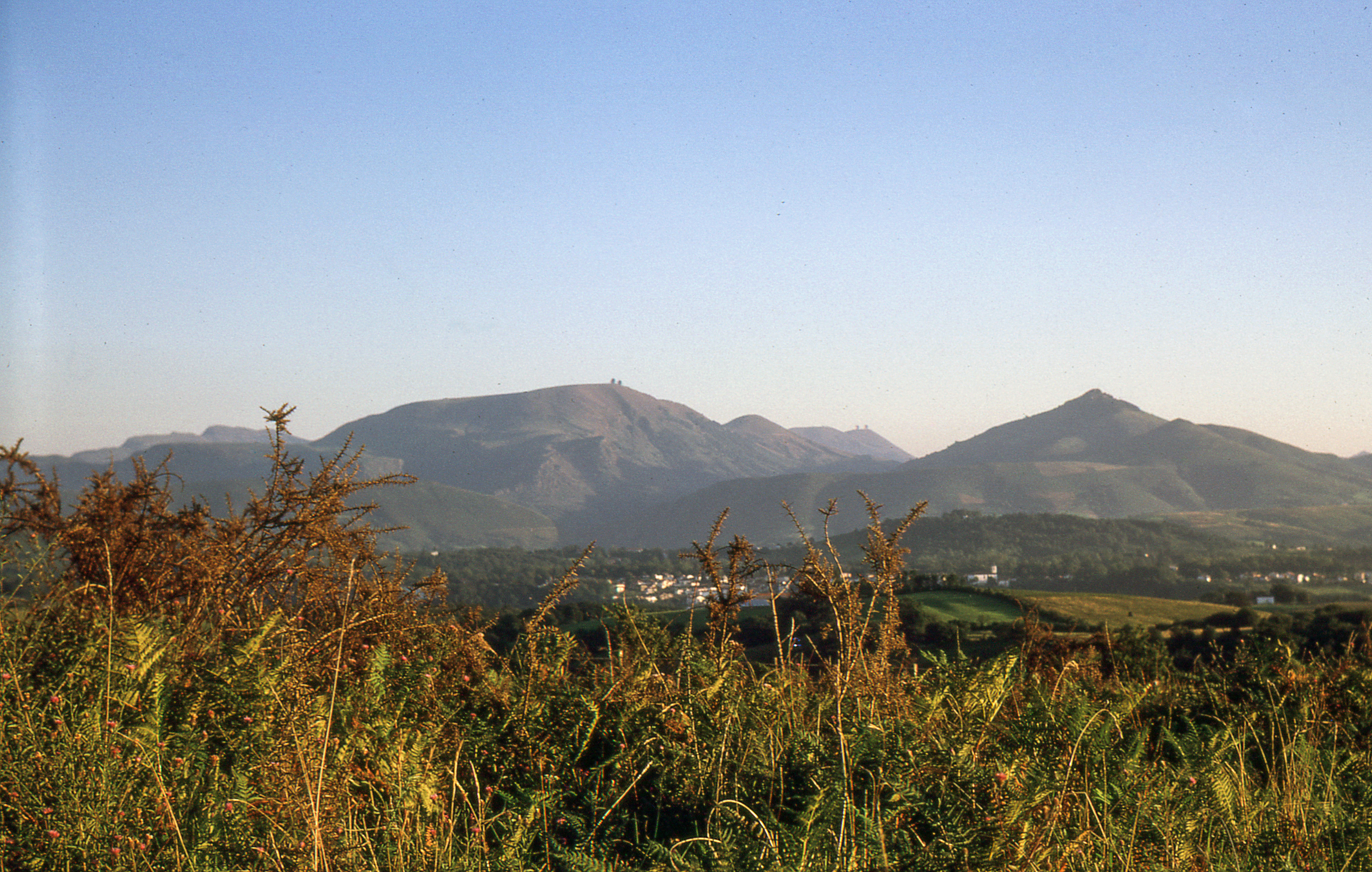
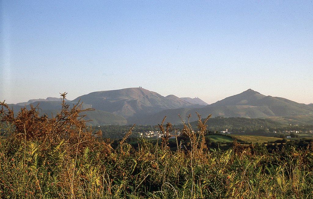
Left the mountain Artzamendi, right the peak of Mondarrain in front of which we find the peak Español: En la izquierda, la montaña de Artzamendi, en la derecha el pico es, frente a la cual se encuentra el pico Ezcondray, en vista de la antigua carretera para Hasparren, tomando a la carretera por Halsou. Se reconoce la Iglesia de Cambo en alineación con el valle del Laxia . Français : À gauche le pic Artzamendi,à droite le pic de Mondarrain en avant duquel se dresse le pic d'Ezcondray, vus de la vieille route d'Hasparren, dite Route des Cîmes, à l'embranchement de la route de Halsou. On reconnaît l'église de Cambo dans l'alignement de la valée du Laxia. |
| Date | Taken on 12 September 1968 |
| Source | Own work. |
| Author | Daniel VILLAFRUELA. |
| Permission (Reusing this file) |
Daniel VILLAFRUELA, the copyright holder of this work, hereby publishes it under the following license: This file is licensed under the Creative Commons Attribution-Share Alike 4.0 International license. Attribution: Daniel VILLAFRUELA
|
| Camera location | | View this and other nearby images on: OpenStreetMap |
|---|
,
File history
Click on a date/time to view the file as it appeared at that time.
| Date/Time | Thumbnail | Dimensions | User | Comment | |
|---|---|---|---|---|---|
| current | 14:59, 28 March 2016 | | 3,032 × 1,927 (3.98 MB) | Daniel VILLAFRUELA (talk | contribs) | =={{int:filedesc}}== {{Information |Description={{mld <!-- LangSwitch /--> |en= {{w| | |en}} Left the mountain {{w | Artzamendi | | en}}, right the peak of {{w | Mondarrain || en}} in front of which we find the peak | {{w | Ezcondray | | Fr}}, all see... |
You cannot overwrite this file.
File usage on Commons
The following page uses this file: