File:Artois.png
Jump to navigation
Jump to search
Size of this preview: 530 × 599 pixels. Other resolutions: 212 × 240 pixels | 424 × 480 pixels | 886 × 1,002 pixels.
Original file (886 × 1,002 pixels, file size: 680 KB, MIME type: image/png)
Captions
Captions
Add a one-line explanation of what this file represents
Summary
[edit]
| Description |
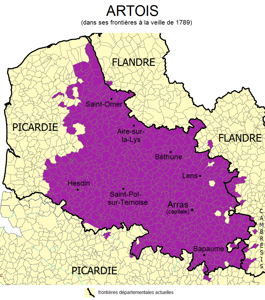
Français : Carte de l'Artois dans ses frontières à la veille de 1789, basée sur l'État par ordre alphabétique des Villes, Bourgs, Villages & hameaux de la Généralité de Flandres & d'Artois publié en 1787. |
| Date | |
| Source | Own work |
| Author | Rosss |
Licensing
[edit]
I, the copyright holder of this work, hereby publish it under the following license:
This file is licensed under the Creative Commons Attribution-Share Alike 3.0 Unported license.
- You are free:
- to share – to copy, distribute and transmit the work
- to remix – to adapt the work
- Under the following conditions:
- attribution – You must give appropriate credit, provide a link to the license, and indicate if changes were made. You may do so in any reasonable manner, but not in any way that suggests the licensor endorses you or your use.
- share alike – If you remix, transform, or build upon the material, you must distribute your contributions under the same or compatible license as the original.
File history
Click on a date/time to view the file as it appeared at that time.
| Date/Time | Thumbnail | Dimensions | User | Comment | |
|---|---|---|---|---|---|
| current | 03:07, 26 August 2011 | | 886 × 1,002 (680 KB) | Rosss (talk | contribs) | Better layout |
| 02:42, 26 August 2011 |  | 887 × 1,063 (686 KB) | Rosss (talk | contribs) | Larger title | |
| 02:38, 26 August 2011 |  | 887 × 1,063 (686 KB) | Rosss (talk | contribs) |
You cannot overwrite this file.
File usage on Commons
The following page uses this file:
File usage on other wikis
The following other wikis use this file:
- Usage on arz.wikipedia.org
- Usage on be.wikipedia.org
- Usage on ca.wikipedia.org
- Usage on eo.wikipedia.org
- Usage on es.wikipedia.org
- Usage on et.wikipedia.org
- Usage on eu.wikipedia.org
- Usage on fy.wikipedia.org
- Usage on he.wikipedia.org
- Usage on ja.wikipedia.org
- Usage on la.wikipedia.org
- Usage on nl.wikipedia.org
- Usage on pl.wiktionary.org
- Usage on ru.wikipedia.org
- Usage on simple.wikipedia.org
- Usage on uk.wikipedia.org
- Usage on www.wikidata.org
- Usage on zh.wikipedia.org