File:Arrasta Kenga 2018.jpg
From Wikimedia Commons, the free media repository
Jump to navigation
Jump to search
Size of this preview: 800 × 600 pixels. Other resolutions: 320 × 240 pixels | 640 × 480 pixels | 1,024 × 768 pixels | 1,280 × 960 pixels | 2,560 × 1,920 pixels | 4,632 × 3,474 pixels.
Original file (4,632 × 3,474 pixels, file size: 7.4 MB, MIME type: image/jpeg)
File information
Structured data
Captions
Summary
[edit]DescriptionArrasta Kenga 2018.jpg |
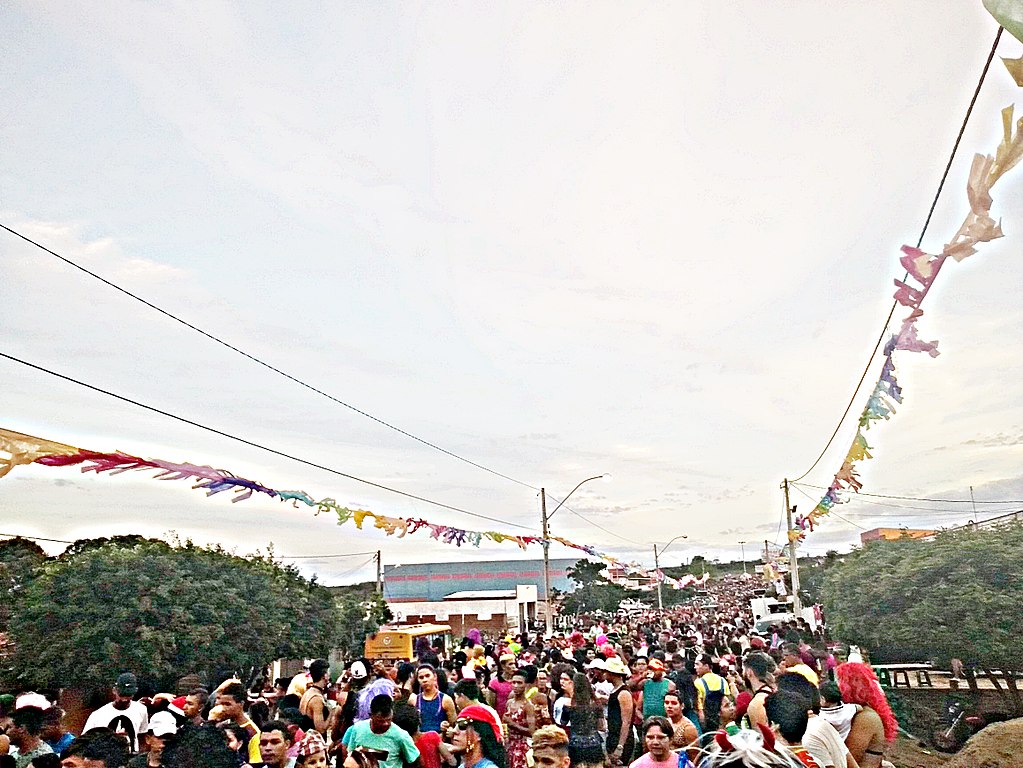
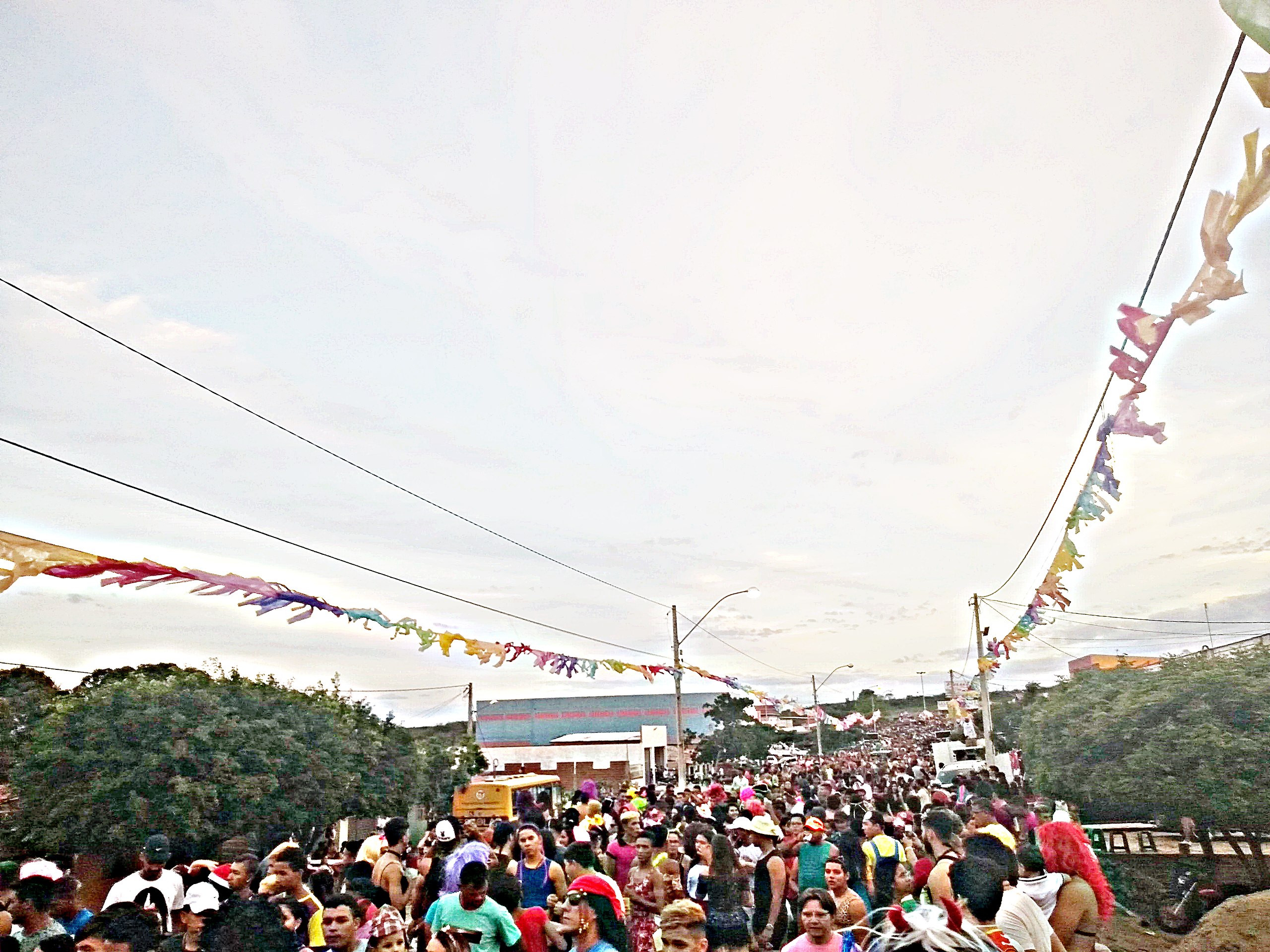
English: The largest Kenga Trail in Rio Grande do Norte.
Português: O maior Arrasta Kenga do Rio Grande do Norte. |
Date | |
Source | Own work |
Author | Eugênio Gouveia |
Licensing
[edit]Public domainPublic domainfalsefalse |
I, the copyright holder of this work, release this work into the public domain. This applies worldwide. In some countries this may not be legally possible; if so: I grant anyone the right to use this work for any purpose, without any conditions, unless such conditions are required by law. |
File history
Click on a date/time to view the file as it appeared at that time.
Date/Time | Thumbnail | Dimensions | User | Comment | |
---|---|---|---|---|---|
current | 17:49, 13 February 2018 | 4,632 × 3,474 (7.4 MB) | Eugênio Gouveia (talk | contribs) | {{Information |Description ={{en|1=The largest Kenga Trail in Rio Grande do Norte.}} {{pt|1=O maior Arrasta Kenga do Rio Grande do Norte.}} |Source ={{own}} |Author =Eugênio Gouveia |Date =12 de f... |
You cannot overwrite this file.
File usage on Commons
There are no pages that use this file.
File usage on other wikis
The following other wikis use this file:
- Usage on pt.wikipedia.org
Metadata
This file contains additional information such as Exif metadata which may have been added by the digital camera, scanner, or software program used to create or digitize it. If the file has been modified from its original state, some details such as the timestamp may not fully reflect those of the original file. The timestamp is only as accurate as the clock in the camera, and it may be completely wrong.
Camera manufacturer | motorola |
---|---|
Camera model | Moto G (5S) |
Exposure time | 1/108 sec (0.0092592592592593) |
F-number | f/2 |
ISO speed rating | 100 |
Date and time of data generation | 17:32, 12 February 2018 |
Lens focal length | 3.59 mm |
Latitude | 5° 54′ 0.26″ S |
Longitude | 35° 45′ 39.99″ W |
Altitude | 64.564 meters above sea level |
Horizontal resolution | 72 dpi |
Vertical resolution | 72 dpi |
Software used | PhotoScape |
File change date and time | 17:32, 12 February 2018 |
Y and C positioning | Centered |
Exposure Program | Normal program |
Exif version | 2.2 |
Date and time of digitizing | 17:32, 12 February 2018 |
Meaning of each component |
|
APEX shutter speed | 6.75 |
APEX aperture | 2 |
APEX brightness | −1 |
APEX exposure bias | 0 |
Maximum land aperture | 2 APEX (f/2) |
Metering mode | Center weighted average |
Flash | Flash fired, compulsory flash firing |
Supported Flashpix version | 1 |
Color space | sRGB |
Scene type | A directly photographed image |
Custom image processing | Normal process |
Exposure mode | Auto exposure |
White balance | Auto white balance |
Digital zoom ratio | 1 |
Scene capture type | Standard |
Contrast | Normal |
Saturation | Low saturation |
Sharpness | Soft |
Unique image ID | 506dd3cf33bb397b0000000000000000 |
GPS time (atomic clock) | 20:32 |
Geodetic survey data used | WGS-84 |
GPS date | 12 February 2018 |
GPS tag version | 2.2.0.0 |