File:Armageddon.jpg
Jump to navigation
Jump to search
Size of this preview: 800 × 532 pixels. Other resolutions: 320 × 213 pixels | 640 × 426 pixels | 1,024 × 681 pixels | 1,280 × 851 pixels | 2,560 × 1,702 pixels | 6,016 × 4,000 pixels.
Original file (6,016 × 4,000 pixels, file size: 6.15 MB, MIME type: image/jpeg)
Captions
Captions
Add a one-line explanation of what this file represents
Summary
[edit]
| Description |
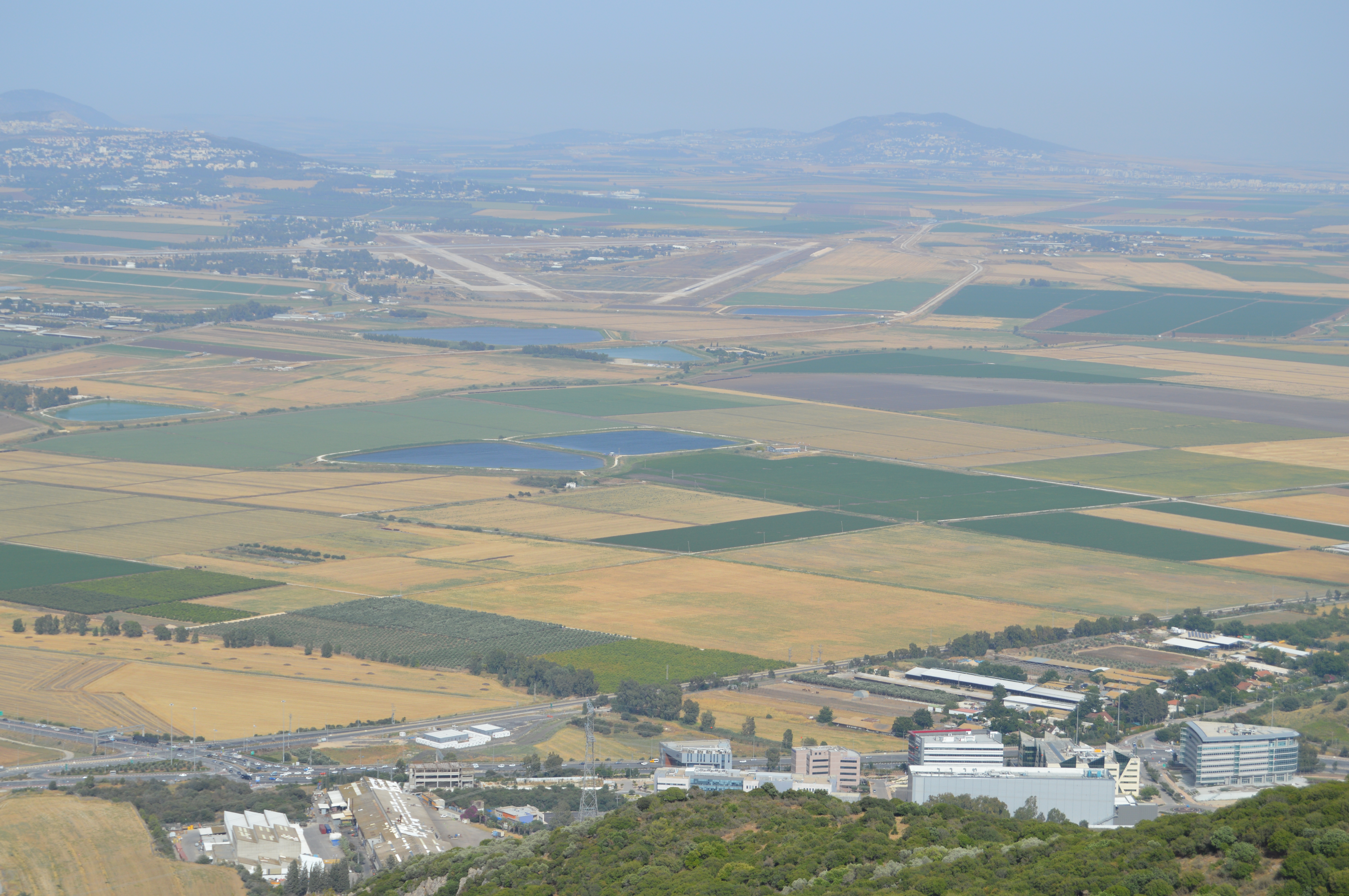
English: According to the Book of Revelation in the New Testament of the Bible, Armageddon (/ˌɑːrməˈɡɛdən/, from Ancient Greek: Ἁρμαγεδών Harmagedōn, Late Latin: Armagedōn, from Hebrew: הר מגידו Har Megiddo) is the prophesied location of a gathering of armies for a battle during the end times, variously interpreted as either a literal or a symbolic location. The term is also used in a generic sense to refer to any end of the world scenario. "Mount" Tel Megiddo is not actually a mountain, but a tell (a hill created by many generations of people living and rebuilding on the same spot) on which ancient forts were built to guard the Via Maris, an ancient trade route linking Egypt with the northern empires of Syria, Anatolia and Mesopotamia. Megiddo was the location of various ancient battles, including one in the 15th century BC and one in 609 BC. Modern Megiddo is a town approximately 25 miles (40 km) west-southwest of the southern tip of the Sea of Galilee in the Kishon River area in Israel.
Deutsch: Laut dem Buch der Offenbarung im Neuen Testament der Bibel ist Armageddon (/ˌɑːrməˈɡɛdən/, aus dem Altgriechischen: Ἁρμαγεδών Harmagedōn, Spätlateinisch: Armagedōn, aus dem Hebräischen: הר מגידו Har Megiddo) der prophezeite Ort einer Versammlung von Armeen für eine Schlacht in der Endzeit, der entweder als wörtlicher oder symbolischer Ort interpretiert wird. Der Begriff wird auch im allgemeinen Sinne verwendet, um sich auf das Szenario des Weltuntergangs zu beziehen. Der „Berg“ Tel Megiddo ist eigentlich kein Berg, sondern ein Tell (ein Hügel, der von vielen Generationen von Menschen geschaffen wurde, die an derselben Stelle lebten und wiederaufbauten) auf dem alte Festungen errichtet wurden, um die Via Maris, eine alte Handelsroute, zu schützen. Sie verband Ägypten mit den nördlichen Reichen Syrien, Anatolien und Mesopotamien. Megiddo war Schauplatz verschiedener antiker Schlachten, darunter eine im 15. Jahrhundert v. Chr. und eine im Jahr 609 v. Chr. Das moderne Megiddo ist eine Stadt etwa 40 km westsüdwestlich der Südspitze des See Genezareth im Gebiet des Flusses Kischon in Israel. |
| Date | |
| Source | Own work |
| Author | Thomasccnawiki |
Licensing
[edit]
I, the copyright holder of this work, hereby publish it under the following license:
This file is licensed under the Creative Commons Attribution-Share Alike 4.0 International license.
- You are free:
- to share – to copy, distribute and transmit the work
- to remix – to adapt the work
- Under the following conditions:
- attribution – You must give appropriate credit, provide a link to the license, and indicate if changes were made. You may do so in any reasonable manner, but not in any way that suggests the licensor endorses you or your use.
- share alike – If you remix, transform, or build upon the material, you must distribute your contributions under the same or compatible license as the original.
File history
Click on a date/time to view the file as it appeared at that time.
| Date/Time | Thumbnail | Dimensions | User | Comment | |
|---|---|---|---|---|---|
| current | 05:21, 28 November 2017 | | 6,016 × 4,000 (6.15 MB) | Embedded Data Bot (talk | contribs) | This file contains embedded data: After 6.1MiB (6446592 bytes, via Ending): Identified type: image/jpeg (JPEG image data, Exif standard: [TIFF image data, big-endian, direntries=1], baseline, precision 8, 1632x1080, frames 3) |
| 05:20, 28 November 2017 |  | 6,016 × 4,000 (6.53 MB) | Thomasccnawiki (talk | contribs) | User created page with UploadWizard |
You cannot overwrite this file.
File usage on Commons
There are no pages that use this file.