File:Arlene 2017-04-20 1512Z (alternate).jpg
Jump to navigation
Jump to search

Size of this preview: 779 × 600 pixels. Other resolutions: 312 × 240 pixels | 624 × 480 pixels | 998 × 768 pixels | 1,280 × 985 pixels | 2,560 × 1,970 pixels | 3,472 × 2,672 pixels.
Original file (3,472 × 2,672 pixels, file size: 3.45 MB, MIME type: image/jpeg)
Captions
Captions
Add a one-line explanation of what this file represents
Summary
[edit].jpg&action=edit§ion=1)
| Description |
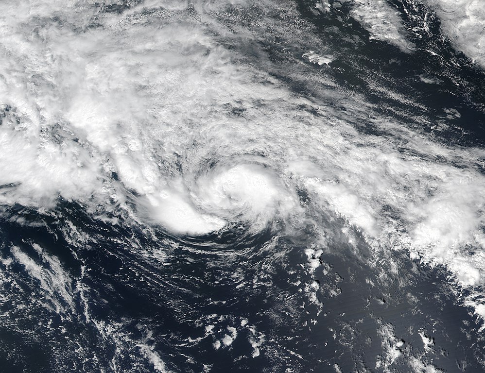
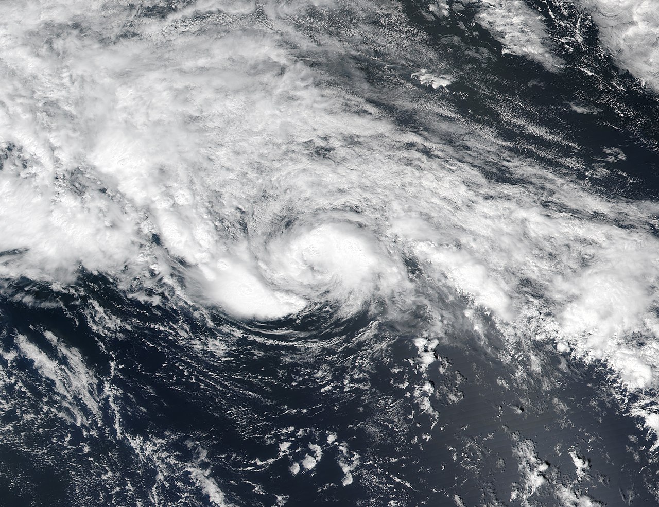
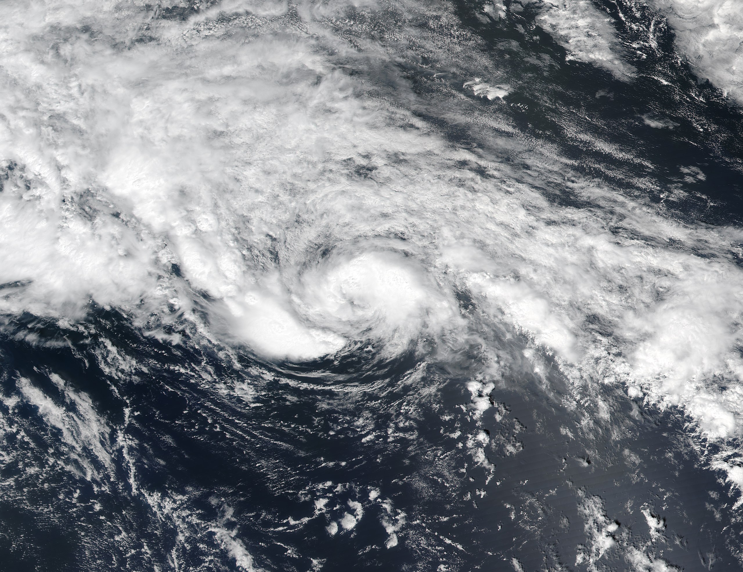
English: When Cyclone Arlene began to build on April 20, 2017, it was an unusual earlybird. Churning in the middle of the ocean, the storm kicked off the 2017 Atlantic hurricane season before promptly winding down on April 21. Hurricane season officially begins on June 1, but meteorologists have noted a fair amount of variability in recent years.
The Visible Infrared Imaging Radiometer Suite (VIIRS) on the Suomi NPP satellite captured this natural-color image around midday on April 20. |
| Date | |
| Source | https://earthobservatory.nasa.gov/images/90089/arlene-early-and-short-lived |
| Author | NASA image by Jeff Schmaltz, LANCE/EOSDIS Rapid Response. Caption by Pola Lem. |
| Camera location | | View this and other nearby images on: OpenStreetMap |
|---|
.jpg¶ms=036.700000_N_-039.600000_E_globe:Earth_type:camera__&language=en)
Licensing
[edit].jpg&action=edit§ion=2)
| This file is in the public domain in the United States because it was solely created by NASA. NASA copyright policy states that "NASA material is not protected by copyright unless noted". (See Template:PD-USGov, NASA copyright policy page or JPL Image Use Policy.) | ||
 |
Warnings:
|
File history
Click on a date/time to view the file as it appeared at that time.
| Date/Time | Thumbnail | Dimensions | User | Comment | |
|---|---|---|---|---|---|
| current | 04:43, 28 December 2018 | | 3,472 × 2,672 (3.45 MB) | Nino Marakot (talk | contribs) | {{Information |description ={{en|1=When Cyclone Arlene began to build on April 20, 2017, it was an unusual earlybird. Churning in the middle of the ocean, the storm kicked off the 2017 Atlantic hurricane season before promptly winding down on April 21. Hurricane season officially begins on June 1, but meteorologists have noted a fair amount of variability in recent years. The Visible Infrared Imaging Radiometer Suite (VIIRS) on the Suomi NPP satellite captured this natural-color image arou... |
You cannot overwrite this file.
File usage on Commons
The following page uses this file:
.jpg&oldid=911553359)