File:Ark 29755 B 596066101 MS 1228 T 14 v0049.jpg
Jump to navigation
Jump to search

Size of this preview: 789 × 599 pixels. Other resolutions: 316 × 240 pixels | 632 × 480 pixels | 1,011 × 768 pixels | 1,240 × 942 pixels.
Original file (1,240 × 942 pixels, file size: 157 KB, MIME type: image/jpeg)
Captions
Captions
Add a one-line explanation of what this file represents
Summary
[edit]
| Description |
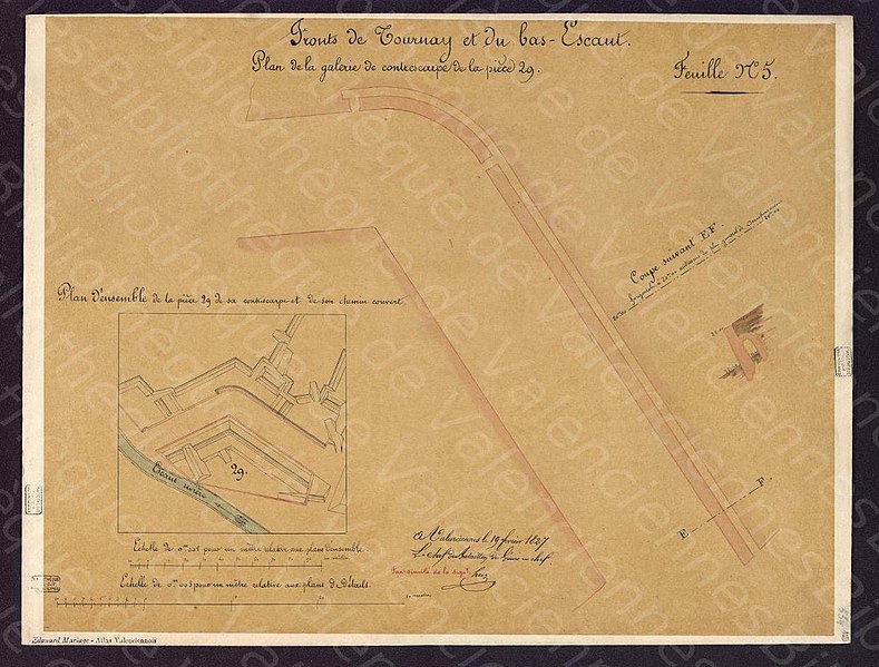
Français : Plan des souterrains de la contrescarpe de la contregarde 29 le 19 février 1827. Ce document a été publié ou reproduit dans l'ouvrage Atlas valenciennois 14 publié par Éouard Mariage entre 1880 et 1893. |
||||
| Date | |||||
| Source | Médiathèque Simone Veil de Valenciennes | ||||
| Creator |
Unknown author |
||||
| Permission (Reusing this file) |
|
||||
| Geotemporal data | |||||
| Date depicted | |||||
| Map location | Valenciennes | ||||
| Georeferencing | If inappropriate please set warp_status = skip to hide. | ||||
Licensing
[edit]
|
This work is in the public domain in its country of origin and other countries and areas where the copyright term is the author's life plus 70 years or fewer. | |
| This file has been identified as being free of known restrictions under copyright law, including all related and neighboring rights. | |
File history
Click on a date/time to view the file as it appeared at that time.
| Date/Time | Thumbnail | Dimensions | User | Comment | |
|---|---|---|---|---|---|
| current | 21:55, 9 September 2021 | | 1,240 × 942 (157 KB) | Arflhn (talk | contribs) |
You cannot overwrite this file.
File usage on Commons
The following page uses this file: