File:Arhipelag Bu Tina.svg
Jump to navigation
Jump to search

Size of this PNG preview of this SVG file: 525 × 600 pixels. Other resolutions: 210 × 240 pixels | 420 × 480 pixels | 672 × 768 pixels | 896 × 1,024 pixels | 1,793 × 2,048 pixels | 744 × 850 pixels.
Original file (SVG file, nominally 744 × 850 pixels, file size: 88 KB)
Captions
Captions
Add a one-line explanation of what this file represents
Summary
[edit]
| Description |
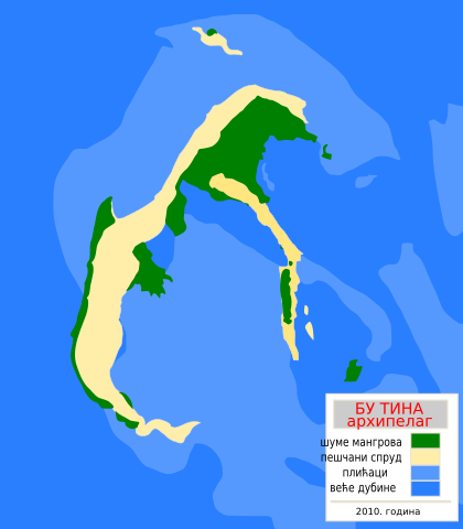
English: Topographic map of Bu Tinah Shoals, UAE
Српски / srpski: Топографска мапа Архипелага Бу Тина, УАЕ
Hrvatski: Topografska mapa Arhipelaga Bu Tinah, UAE
Deutsch: Topographische Karte des Archipels Bu Tinah, VAE |
| Date | |
| Source | Own work |
| Author | User:Ivan25 |
Licensing
[edit]
| I, the copyright holder of this work, release this work into the public domain. This applies worldwide. In some countries this may not be legally possible; if so: I grant anyone the right to use this work for any purpose, without any conditions, unless such conditions are required by law. |
File history
Click on a date/time to view the file as it appeared at that time.
| Date/Time | Thumbnail | Dimensions | User | Comment | |
|---|---|---|---|---|---|
| current | 20:40, 8 April 2010 | | 744 × 850 (88 KB) | Ivan25 (talk | contribs) | {{Information |Description={{en|1=Topographic map of Bu Tinah Shoals, UAE}} {{sr|1=Топографска мапа Архипелага Бу Тина, УАЕ}} {{hr|1=Topografska mapa Arhipelaga Bu Tinah, UAE}} {{de|1=Topographische Karte des Archipels Bu |
You cannot overwrite this file.
File usage on Commons
There are no pages that use this file.