File:ArchipelagoSeaInBalticSea.png
Jump to navigation
Jump to search

Size of this preview: 560 × 599 pixels. Other resolutions: 224 × 240 pixels | 448 × 480 pixels | 718 × 768 pixels | 957 × 1,024 pixels | 1,493 × 1,598 pixels.
Original file (1,493 × 1,598 pixels, file size: 683 KB, MIME type: image/png)
Captions
Captions
Add a one-line explanation of what this file represents

|
This map image could be re-created using vector graphics as an SVG file. This has several advantages; see Commons:Media for cleanup for more information. If an SVG form of this image is available, please upload it and afterwards replace this template with
{{vector version available|new image name}}.
It is recommended to name the SVG file “ArchipelagoSeaInBalticSea.svg”—then the template Vector version available (or Vva) does not need the new image name parameter. |
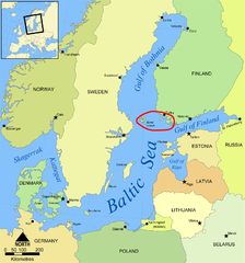
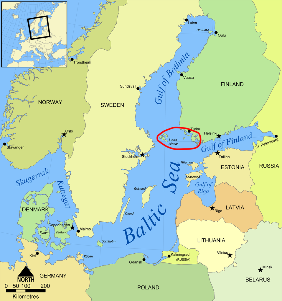
| Description | This is a map of the Baltic Sea with the Archipelago Sea marked. It is a slightly modified version of the file "Baltic Sea map.png". | ||||||||
| Date | |||||||||
| Source | English Wikipedia | ||||||||
| Author | en:User:Chino | ||||||||
| Permission (Reusing this file) |
|
||||||||
| Other versions | Derivative works of this file: Baltic Sea Map-Masry.PNG |

File history
Click on a date/time to view the file as it appeared at that time.
| Date/Time | Thumbnail | Dimensions | User | Comment | |
|---|---|---|---|---|---|
| current | 02:26, 26 April 2013 | | 1,493 × 1,598 (683 KB) | Ras67 (talk | contribs) | cropped |
| 10:17, 14 August 2008 |  | 1,500 × 1,606 (780 KB) | Suncheng125 (talk | contribs) | {{Information |Description=This is a map of the Baltic Sea with the Archipelago Sea marked. It is a slightly modified version of the file "Baltic Sea map.png". |Source=English Wikipedia |Date=August 8th, 2008 |Author=en:User:Chino |Permission |
You cannot overwrite this file.
File usage on Commons
The following page uses this file:
File usage on other wikis
The following other wikis use this file:
- Usage on az.wikipedia.org
- Usage on cs.wikipedia.org
- Usage on da.wikipedia.org
- Usage on en.wikipedia.org
- Usage on fa.wikipedia.org
- Usage on fi.wikipedia.org
- Usage on id.wikipedia.org
- Usage on is.wikipedia.org
- Usage on ja.wikipedia.org
- Usage on jv.wikipedia.org
- Usage on ko.wikipedia.org
- Usage on pa.wikipedia.org
- Usage on pl.wikipedia.org
- Usage on pnb.wikipedia.org
- Usage on pt.wikipedia.org
- Usage on sh.wikipedia.org
- Usage on sr.wikipedia.org
- Usage on tr.wikipedia.org
- Usage on uk.wikipedia.org
- Usage on zh-min-nan.wikipedia.org
- Usage on zh.wikipedia.org