File:Arches Chaponost, 69.jpg
Jump to navigation
Jump to search
Size of this preview: 800 × 600 pixels. Other resolutions: 320 × 240 pixels | 640 × 480 pixels | 1,024 × 768 pixels | 1,136 × 852 pixels.
Original file (1,136 × 852 pixels, file size: 380 KB, MIME type: image/jpeg)
Captions
Captions
Add a one-line explanation of what this file represents
Summary
[edit]
| Description |
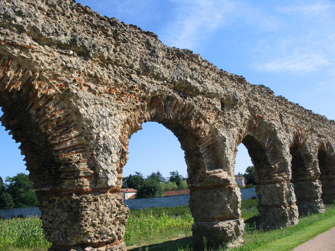
Français : Arches de Chaponost, à l'ouest de l'agglomération lyonnaise.
Elles font partie de l'aqueduc du Gier, acheminant l'eau du Mont Pilat depuis les environs de Saint-Chamond, Loire, au S-O à l'altitude de 405 m, jusqu'à la colline de Fourvière, cote 300. Soit une pente moyenne approximative de 0,8‰, permettant un écoulement très lent. Long de 85 km c'est l'ouvrage le plus important, et aussi le plus sinueux, du système d'alimentation antique de Lyon, qui comportait au nord l'aqueduc du Mont d'Or et à l'ouest, les complexes de la Brévenne et Yzeron. |
| Date | |
| Source | Own work |
| Author | Nanzig |
| Camera location | | View this and other nearby images on: OpenStreetMap |
|---|
Licensing
[edit]
I, the copyright holder of this work, hereby publish it under the following license:
This file is licensed under the Creative Commons Attribution-Share Alike 4.0 International license.
- You are free:
- to share – to copy, distribute and transmit the work
- to remix – to adapt the work
- Under the following conditions:
- attribution – You must give appropriate credit, provide a link to the license, and indicate if changes were made. You may do so in any reasonable manner, but not in any way that suggests the licensor endorses you or your use.
- share alike – If you remix, transform, or build upon the material, you must distribute your contributions under the same or compatible license as the original.
File history
Click on a date/time to view the file as it appeared at that time.
| Date/Time | Thumbnail | Dimensions | User | Comment | |
|---|---|---|---|---|---|
| current | 11:10, 13 July 2018 | | 1,136 × 852 (380 KB) | Nanzig (talk | contribs) | User created page with UploadWizard |
You cannot overwrite this file.
File usage on Commons
There are no pages that use this file.