File:Archaeolacerta bedriagae distribution map.svg
Jump to navigation
Jump to search

Size of this PNG preview of this SVG file: 500 × 400 pixels. Other resolutions: 300 × 240 pixels | 600 × 480 pixels | 960 × 768 pixels | 1,280 × 1,024 pixels | 2,560 × 2,048 pixels.
Original file (SVG file, nominally 500 × 400 pixels, file size: 325 KB)
Captions
Captions
Add a one-line explanation of what this file represents
Summary
[edit]
| Description |
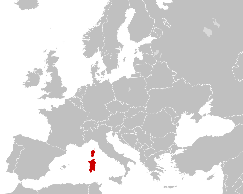
English: Distribution of Archaeolacerta bedriagae |
| Date | |
| Source |
This file was derived from: Blank political map Europe in 2008 (with Kosovo).svg: |
| Author |
|
.svg)
.svg)
| This is a retouched picture, which means that it has been digitally altered from its original version. Modifications: Distribution map of Archaeolacerta bedriagae. The original can be viewed here: Blank political map Europe in 2008 (with Kosovo).svg:
|
Licensing
[edit]
This image is in the public domain because it contains materials that originally came from the United States Central Intelligence Agency's World Factbook.
|
 |
Original upload log
[edit]
This image is a derivative work of the following images:
- File:Blank_political_map_Europe_in_2008_WF_(with_Kosovo).svg licensed with PD-USGov-CIA-WF
- 2011-11-01T13:41:59Z WhiteWriter 680x520 (543089 Bytes)
Uploaded with derivativeFX
File history
Click on a date/time to view the file as it appeared at that time.
| Date/Time | Thumbnail | Dimensions | User | Comment | |
|---|---|---|---|---|---|
| current | 21:23, 10 February 2012 | | 500 × 400 (325 KB) | Totodu74 (talk | contribs) | == {{int:filedesc}} == {{Information |Description={{en|1=Blank map of Europe (with Kosovo) as in year 2008 by [https://www.cia.gov/library/publications/the-world-factbook/graphics/ref_maps/pdf/europe.pdf CIA WF European map.]}} |date=2011-11-01 |Source={{ |
You cannot overwrite this file.
File usage on Commons
The following page uses this file:
- File:Podarcis tiliguerta distribution map.svg (file redirect)
File usage on other wikis
The following other wikis use this file:
- Usage on ceb.wikipedia.org
- Usage on co.wikipedia.org
- Usage on en.wikipedia.org
- Usage on es.wikipedia.org
- Usage on fi.wikipedia.org
- Usage on fr.wikipedia.org
- Usage on it.wikipedia.org
- Usage on nl.wikipedia.org
- Usage on ro.wikipedia.org
- Usage on sv.wikipedia.org
- Usage on vi.wikipedia.org