File:Arable land near Elton - geograph.org.uk - 1324350.jpg
Jump to navigation
Jump to search
No higher resolution available.
Arable_land_near_Elton_-_geograph.org.uk_-_1324350.jpg (640 × 480 pixels, file size: 90 KB, MIME type: image/jpeg)
Captions
Captions
Add a one-line explanation of what this file represents
Summary
[edit]
| Description |
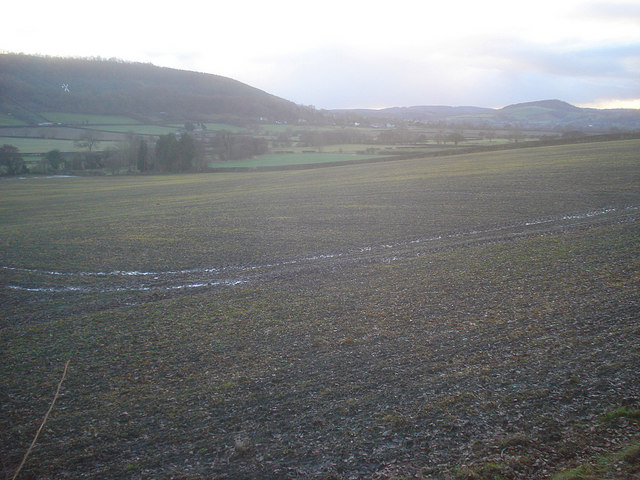
English: Arable land near Elton Looking south-west from the low ridge which separates the Elton valley from Burrington. Gatley Long Coppice on the hill opposite. Halfway up that hill on the left is the white mock windmill near Leinthall Starkes. |
| Date | |
| Source | From geograph.org.uk |
| Author | Trevor Rickard |
| Attribution (required by the license) | Trevor Rickard / Arable land near Elton / |
| Camera location | | View this and other nearby images on: OpenStreetMap |
|---|
_heading:225.00&language=en)
| Object location | | View this and other nearby images on: OpenStreetMap |
|---|
_heading:225.00&language=en)
Licensing
[edit]

|
This image was taken from the Geograph project collection. See this photograph's page on the Geograph website for the photographer's contact details. The copyright on this image is owned by Trevor Rickard and is licensed for reuse under the Creative Commons Attribution-ShareAlike 2.0 license.
|
This file is licensed under the Creative Commons Attribution-Share Alike 2.0 Generic license.
Attribution: Trevor Rickard
- You are free:
- to share – to copy, distribute and transmit the work
- to remix – to adapt the work
- Under the following conditions:
- attribution – You must give appropriate credit, provide a link to the license, and indicate if changes were made. You may do so in any reasonable manner, but not in any way that suggests the licensor endorses you or your use.
- share alike – If you remix, transform, or build upon the material, you must distribute your contributions under the same or compatible license as the original.
File history
Click on a date/time to view the file as it appeared at that time.
| Date/Time | Thumbnail | Dimensions | User | Comment | |
|---|---|---|---|---|---|
| current | 20:02, 27 February 2011 | | 640 × 480 (90 KB) | GeographBot (talk | contribs) | == {{int:filedesc}} == {{Information |description={{en|1=Arable land near Elton Looking south-west from the low ridge which separates the Elton valley from Burrington. Gatley Long Coppice on the hill opposite. Halfway up that hill on the left is the white |
You cannot overwrite this file.
File usage on Commons
There are no pages that use this file.