File:Arabistan-Ottoman-map-1915.jpg
Jump to navigation
Jump to search

Size of this preview: 800 × 583 pixels. Other resolutions: 320 × 233 pixels | 640 × 467 pixels | 1,024 × 746 pixels | 1,280 × 933 pixels | 2,560 × 1,866 pixels.
Original file (2,560 × 1,866 pixels, file size: 693 KB, MIME type: image/jpeg)
Captions
Captions
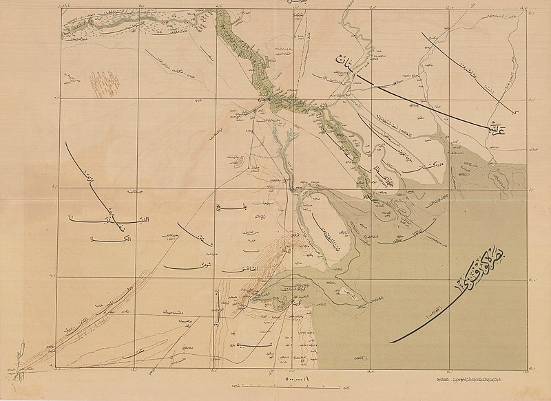
Arabistan (khuzestan) in an Ottoman map from 1915
Summary
[edit]
| Description |
English: An ottoman map from 1915 depicting the Arabistan region عربسـتان (today khuzestan) and the Gulf of Basrah بصرة کورفزي |
| Date | |
| Source | [1] |
| Author | Erkan-ı Harbiye-i Umumiye Matbaası |
Licensing
[edit]
This work first published in the Ottoman Empire is now in the public domain because the Empire's copyright formalities were not met (copyright notice, registration, and deposit), or because the copyright term (30 years after the death of the author, sometimes less) expired before the Empire was dissolved (details).
|
.svg) |
File history
Click on a date/time to view the file as it appeared at that time.
| Date/Time | Thumbnail | Dimensions | User | Comment | |
|---|---|---|---|---|---|
| current | 07:49, 14 February 2023 | | 2,560 × 1,866 (693 KB) | Manuscript01 (talk | contribs) | Uploaded a work by Erkan-ı Harbiye-i Umumiye Matbaası from https://pahor.de/product/kuwait-iraq-basra-wwi-middle-east-important-ottoman-cartography-%d8%a8%d8%b5%d8%b1%d9%87-basrah/ with UploadWizard |
You cannot overwrite this file.
File usage on Commons
The following 2 pages use this file: