File:Arabat arrow.jpg
Jump to navigation
Jump to search
Size of this preview: 800 × 542 pixels. Other resolutions: 320 × 217 pixels | 640 × 434 pixels | 1,024 × 694 pixels | 1,199 × 813 pixels.
Original file (1,199 × 813 pixels, file size: 87 KB, MIME type: image/jpeg)
Captions
Captions
Add a one-line explanation of what this file represents

|
This locator map image could be re-created using vector graphics as an SVG file. This has several advantages; see Commons:Media for cleanup for more information. If an SVG form of this image is available, please upload it and afterwards replace this template with
{{vector version available|new image name}}.
It is recommended to name the SVG file “Arabat arrow.svg”—then the template Vector version available (or Vva) does not need the new image name parameter. |


Summary
[edit]
| Description |
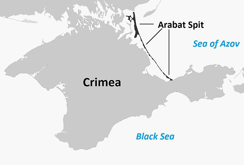
English: Map of the entire Crimea highlighting the Arabat Arrow (or Arabat Spit), the body of land separating the Syvash from the Sea of Azov |
| Date | |
| Source |
This file was derived from: Sevastopol location map.svg |
| Author | User:Herostratus |
Licensing
[edit]
| This work has been released into the public domain by its author, Herostratus at English Wikipedia. This applies worldwide. In some countries this may not be legally possible; if so: Herostratus grants anyone the right to use this work for any purpose, without any conditions, unless such conditions are required by law. |
Original upload log
[edit]
Transferred from en.wikipedia to Commons using For the Common Good.
The original description page was here. All following user names refer to en.wikipedia.
| Date/Time | Dimensions | User | Comment |
|---|---|---|---|
| 16:30, 5 October 2014 | 1,199 × 813 (87,232 bytes) | w:en:Herostratus (talk | contribs) | let's try this one -- improvement? |
| 16:19, 5 October 2014 | 960 × 651 (70,458 bytes) | w:en:Herostratus (talk | contribs) | ==Summary== {{Information |Description = Map of the entire Crimea highlighting the Arabat Arrow (or Arabat Spit), the body of land separating the Syvash from the Sea of Azov |Source = https://commons.wikimedia.org/wiki/File:Sevastopol_location_map.svg... |
File history
Click on a date/time to view the file as it appeared at that time.
| Date/Time | Thumbnail | Dimensions | User | Comment | |
|---|---|---|---|---|---|
| current | 11:39, 17 December 2018 | 1,199 × 813 (87 KB) | Bogomolov.PL (talk | contribs) | according common English naming | |
| 07:22, 21 June 2016 | 1,199 × 813 (85 KB) | Kelly (talk | contribs) | Transferred from en.wikipedia: see original upload log above | ||
| 07:22, 21 June 2016 | 960 × 651 (69 KB) | Kelly (talk | contribs) | Old revision as of 16:19, 5 October 2014: see original upload log above |
You cannot overwrite this file.
File usage on Commons
The following page uses this file:
File usage on other wikis
The following other wikis use this file:
- Usage on ca.wikipedia.org
- Usage on ceb.wikipedia.org
- Usage on cs.wikipedia.org
- Usage on da.wikipedia.org
- Usage on en.wikipedia.org
- Usage on es.wikipedia.org
- Usage on fi.wikipedia.org
- Usage on hr.wikipedia.org
- Usage on ja.wikipedia.org
- Usage on nl.wikipedia.org
- Usage on no.wikipedia.org
- Usage on pt.wikipedia.org
- Usage on sv.wikipedia.org
- Usage on tr.wikipedia.org
- Usage on www.wikidata.org