File:Arab League 1971.svg
Jump to navigation
Jump to search

Size of this PNG preview of this SVG file: 200 × 105 pixels. Other resolutions: 320 × 168 pixels | 640 × 336 pixels | 1,024 × 538 pixels | 1,280 × 672 pixels | 2,560 × 1,344 pixels.
Original file (SVG file, nominally 200 × 105 pixels, file size: 1.25 MB)
Captions
Captions
Add a one-line explanation of what this file represents
Summary
[edit]
| Description |
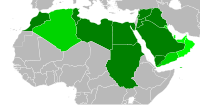
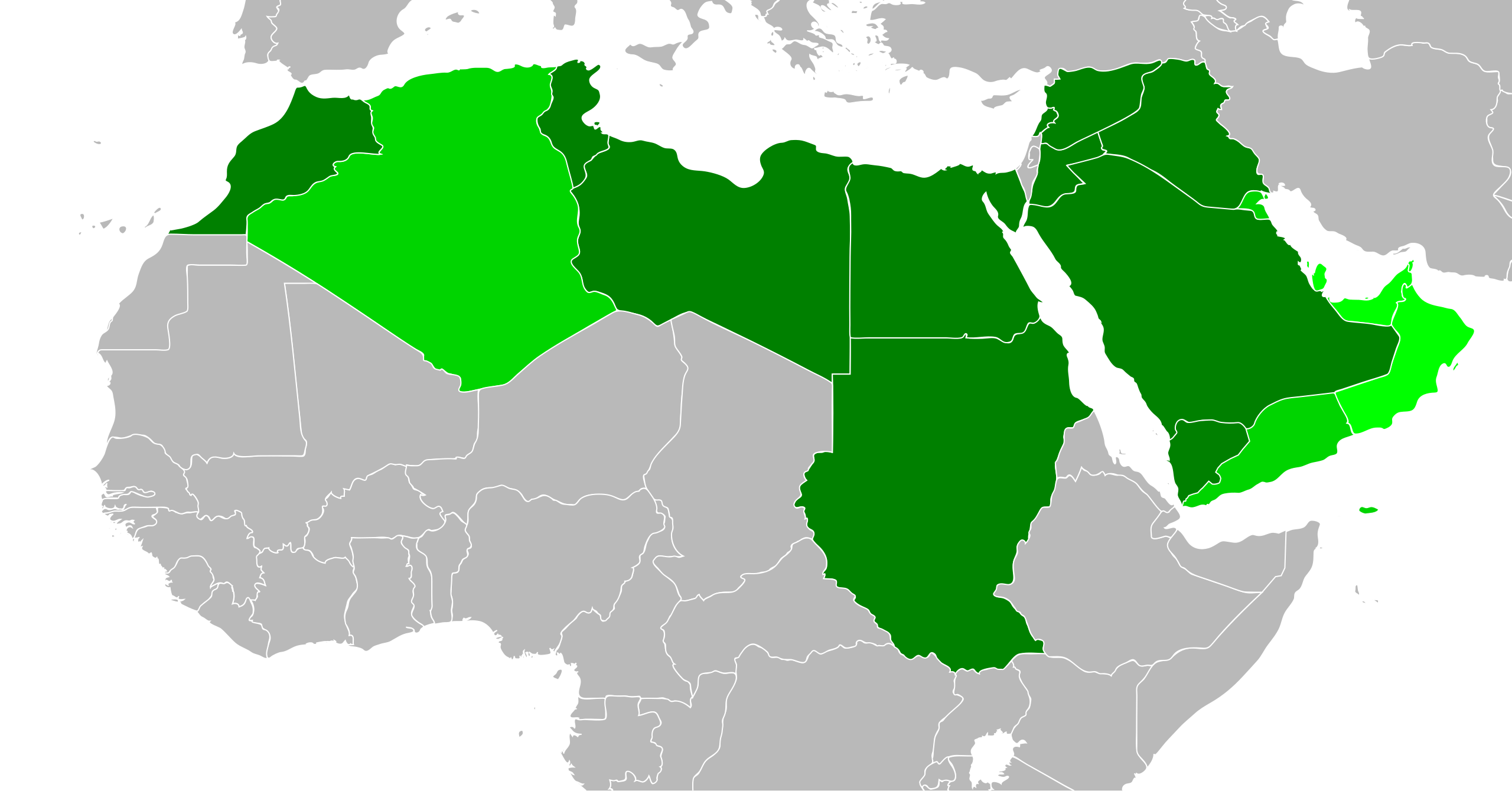
English: Map of the Arab League in 1971. Contemporary borders for states that will join the Arab League, modern borders for other African state. Based on File:BlankMap-World6-Equirectangular.svg, which is released under public domain. SVG file, intended to supersede File:AL1971.PNG. Created with Inkscape. |
| Date | |
| Source | Self, based on CC 1.0 public domain file (see description) |
| Author | User:Quintucket |
| Other versions | File:AL1971.PNG |
Licensing
[edit]
I, the copyright holder of this work, hereby publish it under the following license:
| This file is made available under the Creative Commons CC0 1.0 Universal Public Domain Dedication. | |
| The person who associated a work with this deed has dedicated the work to the public domain by waiving all of their rights to the work worldwide under copyright law, including all related and neighboring rights, to the extent allowed by law. You can copy, modify, distribute and perform the work, even for commercial purposes, all without asking permission.
|
File history
Click on a date/time to view the file as it appeared at that time.
| Date/Time | Thumbnail | Dimensions | User | Comment | |
|---|---|---|---|---|---|
| current | 19:23, 28 December 2011 | | 200 × 105 (1.25 MB) | Quintucket (talk | contribs) | Western Sahara border. You see... I made maps for every expansion, but not in order (Don't know if I should upload them, but I made them, then this set showing multiple expansions to replace the ones used on Wikipedia. Thus, when I created the 1971 expa |
| 08:39, 27 December 2011 |  | 200 × 105 (1.25 MB) | Quintucket (talk | contribs) | {{Information |Description ={{en|1=Map of the Arab League in 1971. Contemporary borders for states that will join the Arab League, modern borders for other African state. Based on File:BlankMap-World6-Equirectangular.svg, which is released under |
You cannot overwrite this file.
File usage on Commons
The following page uses this file:
File usage on other wikis
The following other wikis use this file:
- Usage on ar.wikipedia.org
- Usage on bn.wikipedia.org
- Usage on en.wikipedia.org
- Usage on pt.wikipedia.org
- Usage on zh.wikipedia.org