File:Approaching the Nugget Point Lighthouse.jpg
Jump to navigation
Jump to search

Size of this preview: 800 × 536 pixels. Other resolutions: 320 × 214 pixels | 640 × 429 pixels | 1,024 × 686 pixels | 1,280 × 858 pixels | 2,560 × 1,715 pixels | 3,900 × 2,613 pixels.
Original file (3,900 × 2,613 pixels, file size: 1.71 MB, MIME type: image/jpeg)
Captions
Captions
Add a one-line explanation of what this file represents
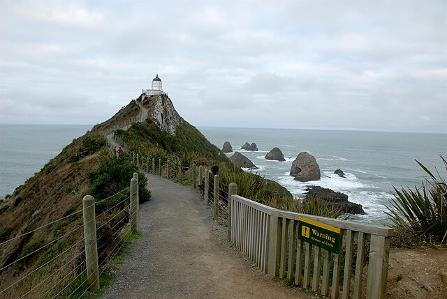
| Description | The path leading to the Nugget Point Lighthouse |
| Date | |
| Source | Own work |
| Author | Karora |
| Camera location | | View this and other nearby images on: OpenStreetMap |
|---|
Licensing
[edit]
| I, the copyright holder of this work, release this work into the public domain. This applies worldwide. In some countries this may not be legally possible; if so: I grant anyone the right to use this work for any purpose, without any conditions, unless such conditions are required by law. |
File history
Click on a date/time to view the file as it appeared at that time.
| Date/Time | Thumbnail | Dimensions | User | Comment | |
|---|---|---|---|---|---|
| current | 05:08, 29 April 2009 | | 3,900 × 2,613 (1.71 MB) | Karora (talk | contribs) | {{Information |Description=The path leading to the Nugget Point Lighthouse |Source=self-made |Date=2008-04-25 |Author=Karora }} {{Location|46|26|50.88|S|169|48|56.54|E|zoom:14_type:landmark_region:NZ_heading:SE}} ==Licensing== {{PD-self}} |
You cannot overwrite this file.
File usage on Commons
There are no pages that use this file.