File:Approaching Empire, Nevada (11128381626).jpg

Original file (4,000 × 3,000 pixels, file size: 2.24 MB, MIME type: image/jpeg)
Captions
Captions
Summary
[edit].jpg&action=edit§ion=1)
| Description |
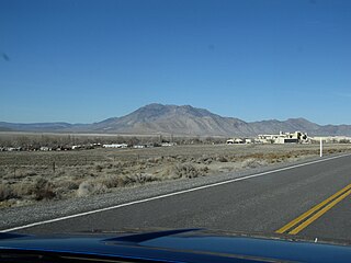
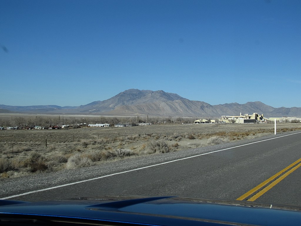
Empire is a census-designated place (CDP) in Washoe County, Nevada, United States. The population was 217 at the 2010 census. A former company town for United States Gypsum Corporation, Empire was once home to more than 750 people. It is part of the Reno–Sparks Metropolitan Statistical Area. Prior to the 2010 census, Empire was part of the Gerlach–Empire census-designated place. The nearest town, Nixon, is 60 miles (97 km) to the south on a reservation owned by the Pyramid Lake Paiute Tribe. The economy of Empire focuses on tourism in the nearby Black Rock Desert, and hunting. Gypsum mining was the historic staple of the local economy until 2011. Empire was the classic company town of the United States Gypsum Corporation (USG). All residents of Empire worked for USG, and USG owns the properties and buildings. The Empire gypsum mine was one of the longest continually operating mines in the US, operating for 88 years from 1923 to 2011. Most mines were shut down during World War II as resources were diverted to the war. It was determined that gypsum was an "essential", resource and the mine was never closed during that period. The town had a church, a public pool, a 9-hole golf course, a post office (89405), and Empire Airport for light planes. There was also a day-care facility for the employees of Empire, and a convenience store with a gas station—the only store for more than 50 miles (80 km). The gypsum plant in Empire closed its doors on January 31, 2011, eliminating 95 jobs. Residents with children were allowed to continue inhabiting their company homes through June 20, 2011, the end of the school year. After that date, Empire effectively became a ghost town. In response, the local ZIP Code, 89405, was also discontinued. Four USG employees remain to maintain the property. Since 1991, Burning Man, a week long countercultural festival with 51,454 participants (as of 2010), has been held nearby. Due to the appearance and actions of many of the participants, local enthusiasm is mixed, but the event is responsible for around 20% of the sales at the few commercial establishments in the area, which include the closest permanent fuel and grocery stops to the event site. The Black Rock Desert is also the site of many other recreational activities, organized and otherwise, throughout the year. en.wikipedia.org/wiki/Empire,_Nevada en.wikipedia.org/wiki/Wikipedia:Text_of_Creative_Commons_... |
| Date | 29 November 2013, 03:06 (according to Exif data) |
| Source | Approaching Empire, Nevada |
| Author | Ken Lund from Reno, Nevada, USA |
| Camera location | | View this and other nearby images on: OpenStreetMap |
|---|
.jpg¶ms=040.549686_N_-119.338753_E_globe:Earth_type:camera_source:Flickr_&language=en)
Licensing
[edit].jpg&action=edit§ion=2)
- You are free:
- to share – to copy, distribute and transmit the work
- to remix – to adapt the work
- Under the following conditions:
- attribution – You must give appropriate credit, provide a link to the license, and indicate if changes were made. You may do so in any reasonable manner, but not in any way that suggests the licensor endorses you or your use.
- share alike – If you remix, transform, or build upon the material, you must distribute your contributions under the same or compatible license as the original.
| This image was originally posted to Flickr by Ken Lund at https://flickr.com/photos/75683070@N00/11128381626. It was reviewed on 5 December 2015 by FlickreviewR and was confirmed to be licensed under the terms of the cc-by-sa-2.0. |
File history
Click on a date/time to view the file as it appeared at that time.
| Date/Time | Thumbnail | Dimensions | User | Comment | |
|---|---|---|---|---|---|
| current | 22:03, 5 December 2015 | | 4,000 × 3,000 (2.24 MB) | INeverCry (talk | contribs) | Transferred from Flickr via Flickr2Commons |
You cannot overwrite this file.
File usage on Commons
There are no pages that use this file.
.jpg&oldid=886467573)