File:Anuradhapura, Sandahiru Seya.jpg
Original file (6,000 × 4,000 pixels, file size: 11.62 MB, MIME type: image/jpeg)
Captions
Captions
Summary
[edit]
| Description |
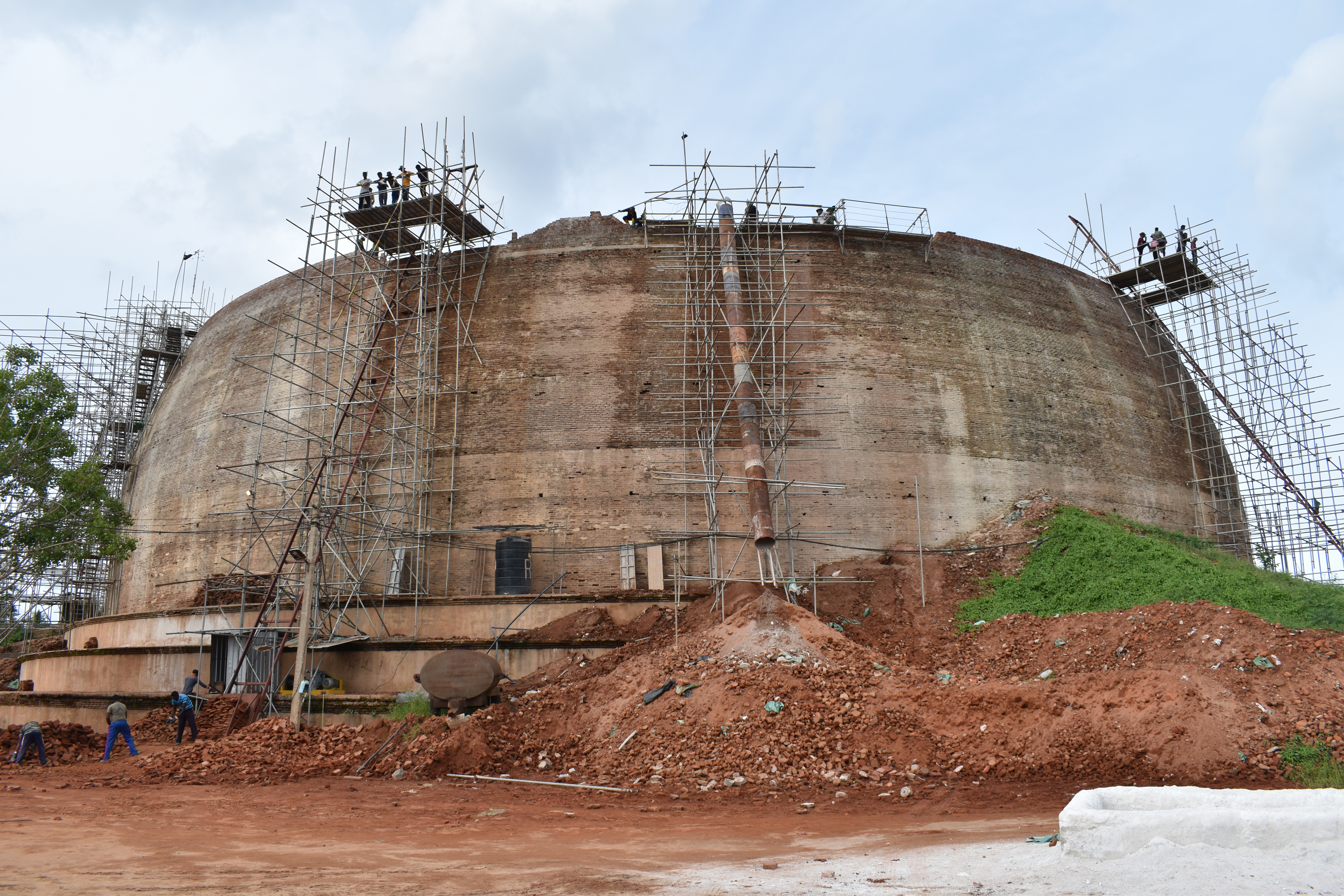
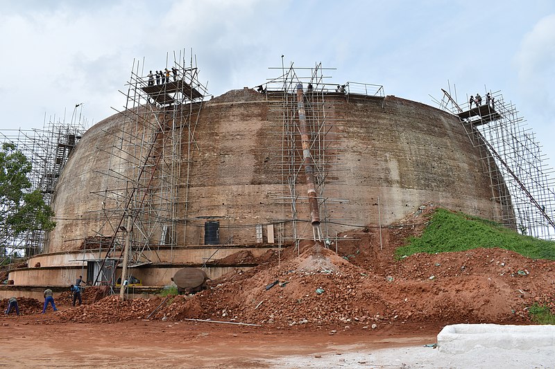
English: Anuradhapura, Sandahiru Seya,
Anuradhapura is the capital city of North Central Province, Sri Lanka, and one of the ancient capitals of Sri Lanka, famous for its well-preserved ruins of ancient Sri Lankan civilization. It was the third capital of the Kingdom of Rajarata after Tambapanni and Upatissa Nuwara. The city, now a UNESCO World Heritage Site, was the center of Theravada Buddhism for many centuries. The city lies on the banks of the historic Malvathu Oya. It is one of the oldest continuously inhabited cities in the world and one of the eight World Heritage Sites of Sri Lanka. It is believed that from the 4th century BC, it was the capital of the Sinhalese until the beginning of the 11th century AD. During this period it remained one of the most stable and durable centers of political power and urban life in South Asia. The ancient city, considered sacred to the Buddhist world, is today surrounded by monasteries covering an area of over 40 km². The Sandahiru Seya ("Triumphant Pagoda") is a huge new stupa rising on the south side of Anuradhapura, two thousand years after the first of the great dagobas was constructed. Designed to reach 85m in height, with a circumference of 244m, it will eventually rise above the ancient dagobas of Jetavanarama and Abhayagiri, but will not surpass their original heights. Sandahiru Seya is being constructed from over 30 million bricks and will be plastered and then whitewashed when finished. The stupa was commissioned by President Rajapaksa in 2010 and is erected as a tribute and appreciation of all fallen War Heroes. This is just one of nine new stupas planned, on orders of the president 'in appreciation of the noble service rendered by the armed forces and police to defeat terrorism and bring lasting peace to the country'. However, some have objected to the principle of dedicating a Buddhist monument to the actions of the Sri Lankan military. The pace of construction and flow of funds has slowed in recent years, so it could be many years before the huge dagoba is finished. (sources: en.wikipedia.org/wiki/Anuradhapura and www.lonelyplanet.com/sri-lanka/the-ancient-cities/anuradh...) |
| Date | |
| Source | https://www.flickr.com/photos/azwegers/49760626291/ |
| Author | Arian Zwegers |
| Camera location | | View this and other nearby images on: OpenStreetMap |
|---|
Licensing
[edit]
- You are free:
- to share – to copy, distribute and transmit the work
- to remix – to adapt the work
- Under the following conditions:
- attribution – You must give appropriate credit, provide a link to the license, and indicate if changes were made. You may do so in any reasonable manner, but not in any way that suggests the licensor endorses you or your use.
| This image was originally posted to Flickr by Arian Zwegers at https://flickr.com/photos/67769030@N07/49760626291. It was reviewed on 13 September 2021 by FlickreviewR 2 and was confirmed to be licensed under the terms of the cc-by-2.0. |
File history
Click on a date/time to view the file as it appeared at that time.
| Date/Time | Thumbnail | Dimensions | User | Comment | |
|---|---|---|---|---|---|
| current | 07:18, 13 September 2021 | | 6,000 × 4,000 (11.62 MB) | Amritsvāraya (talk | contribs) | Uploaded a work by Arian Zwegers from https://www.flickr.com/photos/azwegers/49760626291/ with UploadWizard |
You cannot overwrite this file.
File usage on Commons
There are no pages that use this file.
File usage on other wikis
The following other wikis use this file:
- Usage on en.wikipedia.org